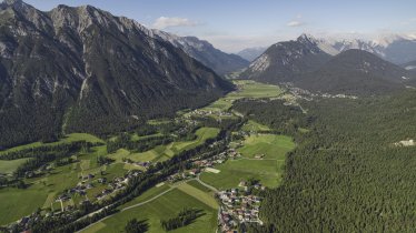
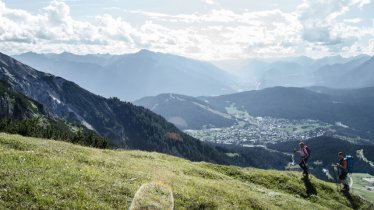
This hike through the Bergleintal Valley (also known as the Bergltal Valley) to the Meilerhütte, a fortress-like hut perched on a mountain ridge at 2,366 metres above sea level, is one of the finest in the Wetterstein Mountains. The valley is bordered to the south by the Öfelekopf mountain (2,478 metres) and to the north by the steep flanks of the Wettersteinwand stretching up to 2,450 metres. From the Meilerhütte, hikers retrace their steps to get back to the starting point. There is also the option of descending to the south via the Söllerpass (2,259 metres) and the Puittal Valley back to the starting point, though this alternative route requires good fitness levels.

Mountain Hike
Starting point
Leutasch-Reindlau
Hike to
Meilerhütte
Finishing point
Leutasch-Reindlau
Mountain chain
Wetterstein Mountains
Length
12.5 km
Total hiking time
8 h 30 min
Features
- Wheelchair-accessible Hiking Route
- Circular hike
Difficulty rating
intermediate (red mountain trails)
Altitude
Elevation uphill 1,372m
Vertical metres downhill 1,372m
Fitness level
Technique
Best time of year
* These are approximate values and recommendations. Please take your personal fitness level, technical ability and the current weather conditions into account. Tirol Werbung cannot guarantee that the information provided is correct and accepts no liability.
Public transport
- Accessible using public transport
Buslinie 431, Haltestelle Leutasch-Reindlau
Parking
Leutasch/Reindlau (via road behind Gasthaus Hubertus)
Places serving food and drink
- Meilerhütte (July until September)
- Gasthaus Hubertushof in Leutasch-Reindlau
Downloads
Trail description
The "Bergleintal" may translate as "Valley of Little Mountains", but there is nothing small about the peaks which await hikers here. One of the highest in the region is the Öfelekopf (2,478 metres) which can be climbed or walked around on this route. The adventure begins at the Gasthaus Hubertushof in Leutasch-Reindlau. From there, a small road leads to the Bergleinbach stream. Follow the left-hand bank and continue for around ten minutes until the trail meets another. Take the left-hand trail through the forest up to a wider path. Here, walk right, turn a steep corner and – of course – enjoy the fabulous view before heading downhill into the Bergleintal Valley. The trail soon becomes steeper and leads through bushy terrain to the foot of the mighty rockfaces. The route then heads west via an area of land known as Schönegg (1,824 metres), past an unnamed hut, up to the Leutascher Platt (2,100 metres). After a short uphill section to the right, head towards the Musterstein mountain (2,478 metres), which together with the Törlspitzen (up to 2,227 metres) is one of the main mountains in the eastern part of the Wetterstein Mountains. The route leads in a westerly direction across rocky terrain to a small ridge, atop which you will find the Meilerhütte perched on the border between Tirol and Bavaria. Up here there are no ski lifts or cable cars up, so anyone who makes it this far has to do so on fot. After a rest, drink and snack at the hut, return the way you came all the way back to the starting point.
Experienced hikers with good fitness levels can descend via the Söllerpass, Söllerrinne and Puittal back to the starting point.


