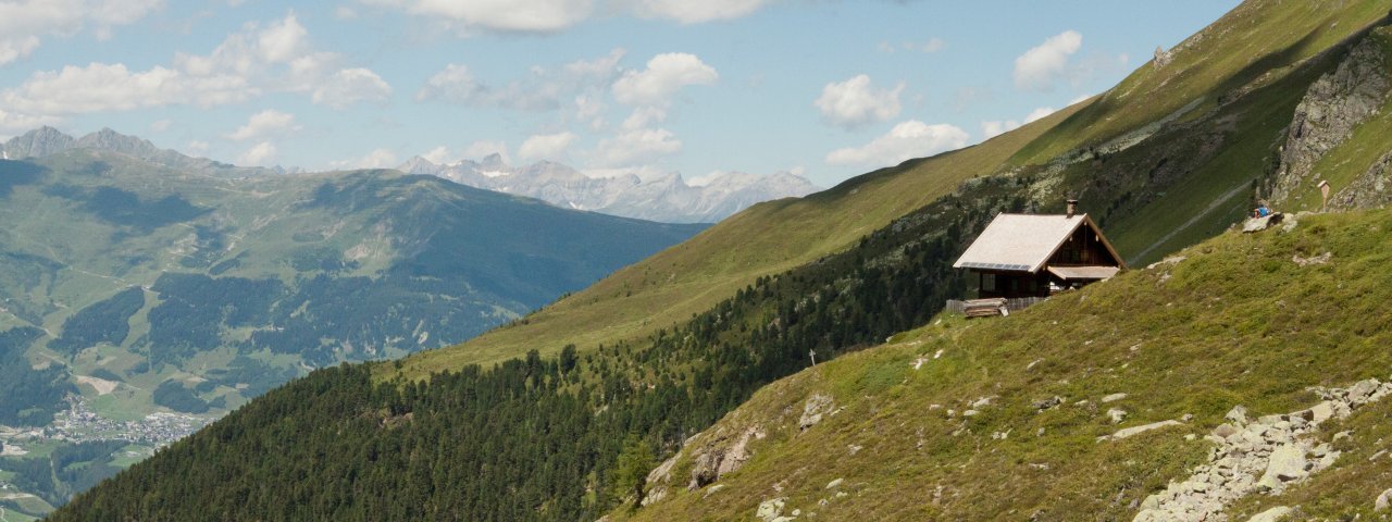
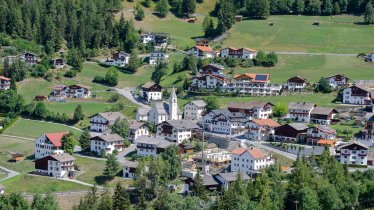
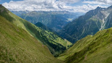
This moderate to difficult four-day trek begins in Fendels, a village in the Upper Inn Valley, and ends in Pfunds. Along the way, hikers will reach altitudes of almost 3,000 metres above sea level and enjoy fabulous views of the Ötztal and Lechtal Alps, including the Hoher Riffler mountain, the Gepatschferner glacier and the Wildspitze, the highest peak in Tirol. The final highlight is the Radurschltal Valley, home to the largest pine forest in the Eastern Alps – as well as to numerous ibex and marmots. This trek requires fitness, stamina, a head for heights and sure footing. Good visibility is also important, since large sections of the trail are sparsely signposted.

Starting point
Top of Bergbahn Fendels cable car (Sattelklause)
Hike to
Anton-Renk-Hütte, Gepatschhaus, Hohenzollernhaus
Finishing point
Pfunds
Mountain chain
Ötztal Alps
Length
52.5 km
Duration
4 day(s)
Features
- Wheelchair-accessible Hiking Route
- Circular hike
Difficulty rating
difficult (black trails)
Altitude
Elevation uphill 2,680m
Vertical metres downhill 3,587m
Fitness level
Technique
Best time of year
* These are approximate values and recommendations. Please take your personal fitness level, technical ability and the current weather conditions into account. Tirol Werbung cannot guarantee that the information provided is correct and accepts no liability.
Parking
Fendels, near the ski lift
Places serving food & drink
- Stage 1: Fendels: Sattelklause, Truyenstube, Fendler Alm (June until September), Anton-Renk-Hütte (self-catering hut, January until December)
- Stage 2: Nassereinalm (mid-June until mid-September), Gepatschhaus (8 June until end of September)
- Stage 3: Hohenzollernhaus (June until September)
- Stage 4: Radurschlalm (mid-June until mid-September), Pfunds: Florians Restaurant, P3 Pizzeria, Hotel Traube
Trail description
Stage 1: Fendels – Fendler Alm – Anton-Renk-Hütte
Uphill: 428 metres, walking time: 2.5 hours, distance: 6.3 kilometres, highest point: 2,252 metres, difficulty level: intermediate (red trails)
In Fendels, take a ride on the chairlift up to Sattelklause. From the top of the Planggerlift walk towards “Zirmesköpfle, Anton-Renk-Hütte” and follow the slightly ascending forest road through the sparse woods. When reaching the fork in a bend to the left, stay on the well-maintained dirt road and head uphill to the Fendler Alm hut. From there, continue on a singletrack trail which passes by the old pasture hut and crosses a meadowy basin, altogether ascending. The leisurely route now takes you through woodlands (larches) and fields of alpine roses along the slope parallel to the Upper Inntal Valley until you reach the foothills of the Zirmesköpfle ridge. The trail climbs a few metres on the ridge. To the right of the ridge, on the slopes above a side valley of the Upper Inntal Valley, stroll along a relatively level and slightly ascending trail into the valley (past numerous stone pines). The final section of the route climbs vigorously to the Anton-Renk-Hütte (2,261 metres) which is located on a small plateau.
Background information: Anton Renk was a 19th century writer whose poems were about love and the high mountains.
Stage 2: Anton-Renk-Hütte – Gepatschhaus
Uphill/downhill: 1,151/1,488 vertical metres, walking time: 9.5 hours, distance: 18.6 kilometres, highest point: 2,880 metres, difficulty rating: difficult (black trails)
From the Anton-Renk-Hütte follow signs for “Aachener Höhenweg” and walk uphill across meadows (also stones, rock piles and ledges) and past the fork to the lakes (continue on the "Aachener Höhenweg"). The route leads you to the basin below the Pfroslkopf, Mitterschragen and Äußere Rifekarspitze peaks and runs upwards along its eastern edge (many rock piles and ledges). A steep climb brings you up to a ridge and to the Rifekarscharte notch. From there, take a steep descent along a jagged trail with fixed cables and continue over earthy ground through scree and talus down into the wide Hüttekar cirque (from this point there are only very narrow and poorly defined footpaths or singletrack trails leading to the Kreuzjöchl col). Pass below an unnamed lake and traverse steep tussock slopes before the route runs down along rugged terrain and into the valley to the brook. Proceed towards “Aachener Höhenweg” and cross the Fissladbach brook right at the signpost. On the valley floor (meadows, scree, rock piles, and ledges) walk gently upwards. The trail takes you to the eastern slopes and narrows into a winding singletrack trail leading up a very steep grassy flank (partly jagged) to the saddle of the Kreuzjöchl col. After the saddle, walk down southeast on a good trail through grass, scree and talus along the slope above the Gepatschsee lake, heading into the valley in open terrain. The trail turns into a dirt road leading further down. When reaching the left bend just above Nassereinalm, take the marked trail on the right which runs down to the pasture hut. From there, continue along the road into the valley and traverse the sparse stone pine forest up to the start of Kaiserbergtal Valley. Follow the signs marked with “Gepatschhaus” and cross the brook before you continue on a dirt road which later turns onto a footpath (route with ups and downs along a slope). A descent now takes you into a meadow and to a fork where you follow a dirt road towards “Gepatschhaus”. At Gepatschalm, cross the Fagge brook and walk left at the next fork and climb the last section to the Gepatschhaus lodge (1,928 metres).
Background information: The delightful Maria im Schnee Chapel, literally ‘Saint Mary of the Snows’, is shingled on the outside and was built in 1894-1895. In the 20th century, the chapel was restored to its full splendour with new shingles applied.
Stage 3: Gepatschhaus – Hohenzollernhaus
Uphill/downhill: 1,101/911 vertical metres, walking time: 7.5 hours, distance: 15 kilometres, highest point: 2,965 metres, difficulty rating: difficult (black trails)
From the Gepatschhaus lodge, walk a few steps on a dirt road into the valley and cross Fagge brook on your way to the Gepatschalm hut. Pass by the hut and follow the road in the meadows leading out of the valley until you reach a fork where you walk in the direction of “Nassereinalm” on an ascending path. The path soon runs along the slope out of the valley and climbs noticeably. Continue above the lake on a route with ups and downs (shrubs, stone pines) which eventually turns onto a dirt road. Cross the brook at the entrance to the Kaiserbergtal Valley and take the dirt road on the left down to the valley (“Rotschragenjoch“, “Hohenzollernhaus”). The relatively level route now leads through open terrain (meadows, stones, talus) and into Kaiserbergtal Valley (passing by the fork to Schwarzsee lake) and turns onto a footpath at about 2,300 metres, continuing at the same altitude for a long time (the path runs parallel to the brook and crosses it several times). Towards the valley end, the path climbs more sharply and up a steep slope before you reach the precipitous flank to the Rotschragenjoch col. The first portion of the ascent follows a winding footpath on earthy ground and scree while the upper part has no trail and, becoming steeper and steeper, leads almost straight up to the col along the right-hand side of a rock outcrop (the last portion resembles a gully; attention: there are no fixed cables). On the other side of the col, follow the signs to “Hohenzollernhaus”. As you traverse a grassy ridge of rugged terrain, there are permanently fixed cables for protection. The path first meanders down along the right edge of the Hüttekar cirque and then zigzags down in the meadows to the Radurschltal Valley and the bridge at the toll hut. Walk a few metres along the right bank of the brook to reach the Hohenzollernhaus lodge (1,924 metres).
Stage 4: Hohenzollernhaus – Pfunds
Downhill: 1,160 vertical metres, walking time: 4.5 hours, distance: 12.5 kilometres, highest point: 2,120 metres, difficulty rating: intermediate (red trails)
Follow the footpath next to the Hohenzollernhaus lodge towards “Radurschlalm” and walk gently down across the sparse stone pine forest. The route passes to the right of a fork leading to a bench and then runs along the right-hand side of the slope through open terrain and into the woods (at the fork keep walking towards Radurschlalm hut). The trail brings you to the Radurschlalm area, where you take a descending dirt road to Pfunds. After crossing the Radurschlbach brook, one can branch off (following the marked winter route uphill) to reach the sculpture park within a few minutes. Otherwise follow the forest road, which runs through alpine meadows and woods along the brook and out of the valley (just slightly downhill, towards Pfunds without leaving the well maintained forest road). Pass by the parking area in Wildmoos (at roughly 1,600m) and continue on the road, now descending a bit more steeply. When reaching a fork, branch off right to the Klammsteig trail and leave the wide forest road. The trail leads down to the Radurschlbach brook and soon crosses it. Proceed on the right bank of the brook (Pfunds via Klammsteig trail) into Pfunds gorge. The route crosses the brook several times, leading out of the gorge. Later, the trail joins a descending dirt road, which you follow on the left bank of the brook directly towards Pfunds and the hamlet of Dorf before continuing to the Inn river.
Background information: The beautiful sculpture park at the Radurschlalm hut is well worth a visit. In this area of awesome natural beauty, renowned Austrian and international artists have demonstrated their skills and displayed their works in the great outdoors. Radurschltal Valley was originally owned by the Tirolean Landesfürst (sovereign) and primarily used as hunting terrain. At the height of salt mining, the valley attracted the interest of the Landesfürst also due to its abundance of wood. Huge amounts of wood (large-scale deforestation) were floated down the Radurschlbach brook to the Inn river and then to the saltworks in Hall.


