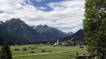
Leaving from the village of Elbigenalp in the middle of the Lechtal Valley, this circular hike leads up to one of the most popular huts in the region: the Hermann-von-Barth-Hütte (2,131 metres). It is the highest mountain refuge in the Allgäu Alps and offers fine views of the Lechtal Valley and the smaller Bernhardstal Valley, including the craggy peaks of the Kreuzkarspitze (2,587 metres) and the Wolfebnerspitze (2,432 metres) as well as the Lechtal Alps to the south. There is plenty of rock-climbing near the hut, with most routes rated intermediate or difficult.

Mountain Hike
Starting point
Elbigenalp
Hike to
Hermann-von-Barth-Hütte
Finishing point
Elbigenalp
Mountain chain
Lechtal Alps
Length
13.6 km
Total hiking time
8 h 45 min
Features
- Wheelchair-accessible Hiking Route
- Circular hike
Difficulty rating
intermediate (red mountain trails)
Altitude
Elevation uphill 1,317m
Vertical metres downhill 1,302m
Fitness level
Technique
Best time of year
* These are approximate values and recommendations. Please take your personal fitness level, technical ability and the current weather conditions into account. Tirol Werbung cannot guarantee that the information provided is correct and accepts no liability.
Public transport
- Accessible using public transport
Bus route 110, get off at the stop Elbigenalp Hotel Alpenrose
Parking
"Geierwally" carpark in the centre of Elbigenalp
Places serving food and drink
- Kasermandlhütte (May until March)
- Hermann-von-Barth-Hütte (July until September; please check for possible opening times in June and October)
- Gibleralm (open all year except November)
- Hotel Stern, Hotel Post, Gasthaus Schwarzer Adler in Elbigenalp
Downloads
Trail description
Leaving from the "Geierwally" carpark in Elbigenalp, take the wide trail along the banks of the Bernhardsbach stream until you reach the final few houses on the mountain slopes. From there, things get steeper. The trail leads up over the Ölberg, where the Ölbergkapelle was erected in 1766, and on to the Kasermandlhütte hut (1,410 metres). It is here that the paths become narrower and more mountainous. Head into the forest, past the Balschtenhütten huts and across the Balschtebach stream onto the left-hand bank. By the time you reach this point you will have completed around half of the total ascent. The adventure continues across rolling terrain dotted with rocks and grassy outcrops, winding its way via a series of switchback corners to a ridge knoen as the Wolfebnerkar. High above you will be able to see the eye-catching peaks of the Ilfen, Plattenspitze and Wolfebnerspitze. The trail heads left, past a mountain spring, to the Hermann-von-Barth-Hütte (2,131 metres). The hut is named after Hermann von Barth, who was one of the first to establish trails and huts in the Karwendel Mountains, Allgäu Alps and Lechtal Alps. Chances are that he stood atop pretty much every single one of the numerous peaks you can see from the hut.
The return leg leads first over to the Birgerkar ridge (2,120 metres), then down through the Birgertal Valley and the idyllic Bernhardstal Valley. Hikers pass the Zargenalm hut (1,430 metres, closed to the public), the Gibleralm hut (1,208 metres, open to the public) and eventually back down to the starting point in Elbigenalp.


