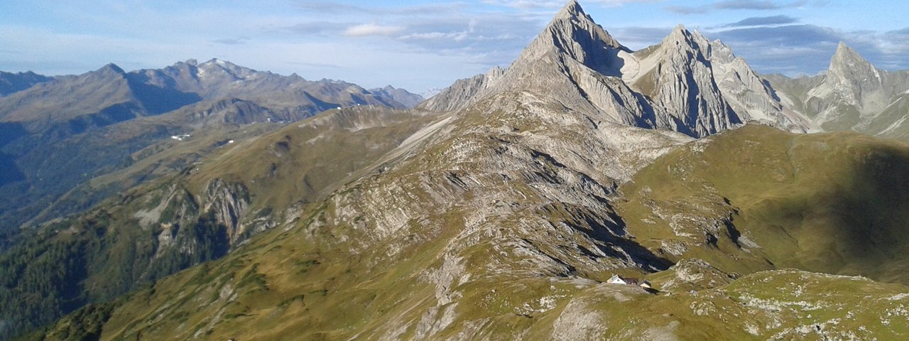
This demanding three-day trek travels the upper ranges of the Lechtal Alps. You’ll reach peaks exceeding 3,000 metres. The rewards for reaching the summits of these giants between Lechtal and Inntal Valleys are some of the most breathtaking uninterrupted panoramic views of Tirol’s mountains and glaciers anywhere in the region. The serious climbs on this tour involve crossing talus and slabs, conquering peaks and climbing on exposed ridges and require technical climbing abilities, mountaineering experience and careful footing.

Starting point
Kaisers
Hike to
Leutkircher Hütte, Kaiserjochhaus, Ansbacher Hütte
Finishing point
Madau
Mountain chain
Lechtal Alps
Length
35 km
Duration
3 day(s)
Features
- Wheelchair-accessible Hiking Route
- Circular hike
Difficulty rating
difficult (black trails)
Altitude
Elevation uphill 2,190m
Vertical metres downhill 2,415m
Fitness level
Technique
Best time of year
* These are approximate values and recommendations. Please take your personal fitness level, technical ability and the current weather conditions into account. Tirol Werbung cannot guarantee that the information provided is correct and accepts no liability.
Parking
Car park at the Alperschonbach river in Bach or in Steeg (e.g. next to the tourist information office)
Places serving food & drink
- Stage 1: Edelweißhaus (early April until early November), Gasthaus Vallugablick (closed on Wednesdays), Bodenalpe (mid-June until mid-September), Leutkircher Hütte (late June until late September), Kaiserjochhaus (late June until late September)
- Stage 2: Ansbacher Hütte (late June until late September)
- Stage 3: Berggasthaus Hermine, Madau (mid-May until early October, closed on Wednesdays)
Downloads
Trail description
Stage 1: Kaisers – Leutkircher Hütte – Kaiserjochhaus
Uphill/downhill: 1,285/515 metres, walking time: 7 hours, distance: 13.8 kilometres, highest point: 2,445 metres, red trails (intermediate)
From Bach, ride a bus to Steeg. Change there to a different bus and continue to the tiny hamlet of Kaisers (get off at the Gasthaus Vallugablick). From the bus stop, head right down through the meadow and over the Kaiserbach river. Take hiking trail 642 in a south-westerly direction into the Almajurtal Valley. After 4.5 kilometres, you will reach an area of meadowland called the "Bodenalpe". Shortly before you get there, trail 642 turns left into the forest. The trail then becomes steep before flattening off. Hikers pass the Almajuralpe and continue through tree-less terrain with just grass and bushes to the Leutkircher Hütte (2,251 metres). This is a good place for a rest. Continue in an easterly direction. Underneath the Hirschpleiskopf mountain, Stanskogel mountain and Schindlesattel ridge, the trail leads along the "Nordalpenweg 01" trail to the Kaiserjochhaus (2,310 metres), your base for the night. The sections of this stage at higher altitude require hikers to be sure-footed.
Stage 2: Kaiserjochhaus – Ansbacher Hütte
Uphill/downhill: 550/470 vertical metres, walking time: 3 hours 50 minutes, distance: 8.3 kilometres, highest point: 2,480 metres, black trails (difficult)
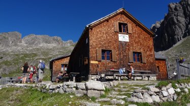
From the Kaiserjochhaus it is a short climb through meadows before the trail heads across rugged terrain to the Kridlonscharte ridge (2,371m) with easy ups and downs. Continue walking along the northern side of Aperriesspitze peak until you get to Hinterseejoch col (2,482m). In the last section, the trail winds its way up towards the col. Beyond the col, the path then plunges down to the Vordersee lake. There, turn left onto the "Haasweg" trail that gently climbs up onto the Alperschonjoch ridge (2,301m). Another gentle climb brings you atop the Flarschjoch ridge (2,464m), before a short and steep descent takes you down to the Ansbacherhütte (2,376m). This lovely mountain shelter is located on a grass-grown ridge with great views high above the Stanzertal Valley. This stage includes sections secured with steel ropes anchored into the rock and requires hikers to be sure-footed and have a head for heights. The route is identical to Stage 23 of the Eagle Walk.
Stage 3: Ansbacher Hütte – Madau
Uphill/downhill: 380/1,450 vertical metres, walking time: 5 hours 45 minutes, distance: 12.8 kilometres, highest point: 2,630 metres, black trail (difficult)
From the Ansbacherhütte, walk until a signed (“Memminger Hütte, Augsburger Hütte”) track heads to the right and climbs atop the Kopfscharte ridge (2,484m). Continue walking along the north-west flank of the Stierkopf mountain for about one kilometre until you reach the Winterjoch col (2,528m). Beyond the notch, another 150 vertical metres have to be gained to get to the pinnacle of the 2,682-metre-high Grießlscharte notch. From there, the route winds down into the valley through the Langkar cirque. It traverses scree slopes in the beginning before winding down to the Parseierbach river in switchbacks. Follow the trail on the left side of the river first and then take a path leading over a footbridge and out of the valley. Keep on this path until you get to the small cable car used to supply food and material to the Memminger Hütte. The route follows a narrow, loamy and in wet conditions slippery singletrack trail. Cross the river again at the small cable car, where the trail merges into a forest road. At the concrete bridge, take the right fork to “Alpengasthof Hermine” in Madau. A ten-minute walk will bring you down to this place of awesome natural beauty. There’s a wonderful charisma about this mountain settlement that makes you want to linger just a little longer. A 7-kilometre minivan transfer service will bring you to Bach in the Lechtal Valley.


