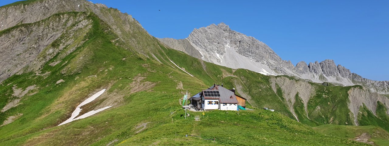


The Kaiserjochhaus (2,310 metres) is a welcoming mountain refuge on the main ridge of the Lechtal Valley between Lechtal and Arlberg, Tirol.
Comfortable mountain refuge hut on the main ridge of the Lechtal Valley
German Alpine Club, Leutkirch Division
The builders of this mountain refuge certainly knew where to find a beautiful spot that countless hikers would feel compelled to visit: the Kaiserjochhaus is located on the main ridge of the Lechtal Valley, nestled amidst the flower-filled alpine meadows of the Kaiserjoch ridge, between the villages of Kaisers in the Lechtal Valley and Pettneu in Stanzertal am Arlberg. Originally built by the Tirolean Tourist Board in 1888, the hut has been in the possession of Leutkirch Division of the German Alpine Club since 1920. The small terrace and wood-panelled dining room with traditional wood burner invite you to linger. The lounge is the perfect place to snuggle up, especially when it gets cold in the evenings or when the clouds roll in over the mountains. There is only one thing to say about the cuisine: the hut's proprietor is passionate about cooking, and you can taste it! The hut is also equipped to the highest environmentally friendly standards. There are 66 sleeping places, most of which are in dormitory-style rooms with matresses next to each other.
How to get to the Kaiserjochhaus
From Pettneu im Stanzertal/Arlberg, ascent via southern slope (3.5 hours); from Kaisers in a side valley of the Lechtal Valley, near Reutte (2,5 Stunden).
Walks and hikes in the area
Grießkopf (2,581 metres), 50 minutes, intermediate
Malatschkopf (2,388 metres), 30 minutes, intermediate
Stanskogel (2,757 metres), 2.75 hours, difficult
Hintersee (2,200 metres), 1 hours, difficult
Further huts in the area, long-distance hiking trails
Ansbacher Hütte, 4,5 hours
Edelweißhaus, 2 hours
Leutkircher Hütte, 2 hours
Frederic-Simms-Hütte, 4.5 hours
The Kaiserjochhaus is the finshing point of Stage 23 and the starting point of Stage 24 of the Eagle Walk, a long-distance hiking trail crossing the region of Tirol in 33 stages.
Comfortable mountain refuge hut on the main ridge of the Lechtal Valley German Alpine Club, Leutkirch Division The builders of this mountain refuge…


