© Tirol Werbung/Michael Walzer

Eagle Walk Stage 24: Kaiserjochhaus - St. Christoph am Arlberg

Blankets of flowers, clean mountain air, wide open views and some scrambling challenges await the eager Eagle Walk hiker in the Arlberg Mountains. Though the hike is hard, it requires no technical expertise as needed on stage 23. You'll be in a true alpine environment with gorgeous scenery, where rolling meadows blanket the slopes of towering mountains. Beyond the Leutkircher Hütte you’ll walk under jagged peaks and past the prominent Valluga Mountain to the Ulmer Hütte, which provides a perfect rest stop for hikers. Once replete and replenished, you’re off for the final descent to St. Christoph am Arlberg. Having tackled some 320 awesome kilometres of hiking, this is where the Eagle Walk comes to an end.

Interesting Facts

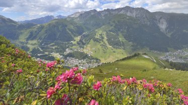
Eagle View ·Admire the beautiful reddish soil on the trail between the Kaiserjochhaus and the Leutkircher Hütte. And don’t forget to turn your focus from the scenery to your feet as you stroll through endless fields of flowers: acres upon acres of slopes bursting with a dazzling array of wildflowers.

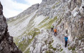
Eagle Kick ·The section from the Leutkircher Hütte to Kapall with some exposed areas can be treacherous in snow or adverse weather conditions and intimidating to unseasoned hikers. In many places there’s considerable exposure, but in such places you will find adequate support provided by cables firmly anchored into the rock. There is a gully beyond Bacheregg that can retain snow until the middle of July.

Open interactive map

Starting point  

Kaiserjochhaus

Finishing point

St. Anton am Arlberg

Mountain chain

Lechtal Alps

Length

17.5 km

Total hiking time

7h

Features

  • Wheelchair-accessible Hiking Route
  • Circular hike

Difficulty rating

difficult (black trails)

Altitude

2,550m 1,790m

Elevation uphill 950m
Vertical metres downhill 1,450m

Fitness level

Technique

Best time of year

Jan
Feb
Mar
Apr
May
Jun

Jul
Aug
Sep
Oct
Nov
Dec

* These are approximate values and recommendations. Please take your personal fitness level, technical ability and the current weather conditions into account. Tirol Werbung cannot guarantee that the information provided is correct and accepts no liability.

Eagle Walk

This is a stage of the Eagle Walk, Tirol's most famous long-distance hiking trail.

Downloads

Trail description

Starting point: Kaiserjochhaus

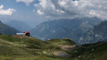
Make your way from the Kaiserjochhaus on a singletrack trail that heads westward to climb a grass-grown peak; many sections are assisted by a fixed anchoring system of cables. Proceed ahead into a basin with lush green meadows. From there, the trail traverses tussock slopes and climbs up to the saddle between the Schindlekopf mountain and Bergleskopf mountain. Descend from the saddle in another green basin and continue westward through a world of wide open meadows and pastures named “Geißwasen”. At the end of Geißwasen, walk across a hilltop and descend to the Leutkircher Hütte, situated on the eastern edge of the wide open and rugged Almajurjoch col (elev. 2,251 m). Up to this point, the track is very loamy, but from here on it is more solid.

Food & drink: Leutkircher Hütte, Ulmer Hütte

From Leutkircher Hütte, walk westward towards Bacheregg, reaching the Almajurjoch col on a singletrack trail. This is where the Upper and Lower High Trails branch off. The Eagle Walk follows the easier Lower High Trail to the east, taking you through steep and rugged terrain to Kapallkopf peak with adequate cable support in places. There is a gully beyond Bacheregg that can retain snow until late in the season. The trail switchbacks upward to the Upper High Trail, gaining 50 vertical metres before heading westward across the "Matun" basin, from where it resumes climbing to gain the Matunjoch ridge and Valfagehrjoch ridge. Beyond the latter, the trail drops down to the Ulmer Hütte. Look to the west to the Swiss border to bask in the glorious views of the Rätikon Mountains with peaks including the Zimba, Schesaplana, Drusenfluh and Sulzfluh. The Ulmer Hütte provides a perfect rest stop for hikers. Once replete and replenished, bear left and walk down verdant alpine pastures towards the Galzig mountain, crossing the Arlberg ski resort to reach the reservoir. The trail passes above the top terminal of Schindlergratbahn lift and joins the Panorama Trail that takes you up to the top lift terminal past the Galzig antenna. From the top, follow the Maienweg trail across dwarf pine fields and pass Maiensee lake to your right. Cross the dirt road at the right side of the bridge and take the footpath to St. Christoph Alm. From that point, a forest road winds down to Arlberg Pass Road, which you cross to get to the Arlberg Hospiz Hotel in St. Christoph, the finishing point of the stage and the Eagle Walk.

Finishing point: St. Anton am Arlberg

Information on place

Arrival date

How to get here by plane, train, bus or car.

Ihr Ziel: Eagle Walk Stage 24: Kaiserjochhaus - St. Christoph am Arlberg (47.173337,10.3258797)

powered by Rome2Rio

Search accommodation

Number of travelers

Hiking trails in this region

show more +

How did you like this article?

Want to receive an answer? If so, please get in touch using the contact form.

Go up

Is your inbox in need of a holiday?

Then subscribe to our weekly newsletter full of exclusive holiday tips from Tirol!