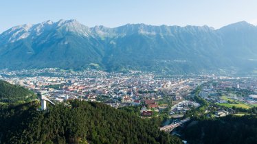
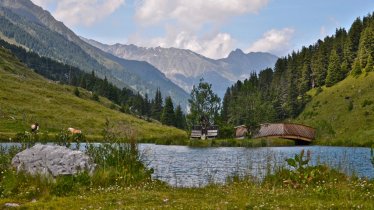
Locals and visitors alike who want to know what Innsbruck looks like from above can embark on this bike & hike to the top of the majestic Vordere Brandjochspitze (2,559 metres) in the Nordkette Mountains overlooking Tirol's regional capital to the north. It is a long way from bottom to top, so the best way to complete the adventure is by riding up from the Hungerburg (826 metres) to the Höttinger Alm (1,487metres) by mountain bike and then continuing up to the top of the Vordere Brandjochspitze. The way to the peak is very steep in places and ends at the "Julius-Pock-Weg" via ferrata, a fixed-rope climbing route rated easy (A/B) leading up to the summit of the mountain. The hiking section from the Höttinger Alm is challenging and requires sure footing. However, the view from the top is magnificent and takes in the Karwendel Mountains, Stubai Alps, Tux Alps, Ötztal Alps and Pitztal Alps.

Bike & Hike Adventure
Starting point
Innsbruck Hungerburg, public car park at Höhenstraße
Hike to
Vordere Brandjochspitze (2,559 metres)
Finishing point
Innsbruck Hungerburg, public car park at Höhenstraße
Mountain chain
Karwendel Mountains
Length
23 km
Features
- Wheelchair-accessible Hiking Route
- Circular hike
Difficulty rating
difficult (black trails)
Altitude
Elevation uphill 2,031m
Vertical metres downhill 2,031m
Best time of year
* These are approximate values and recommendations. Please take your personal fitness level, technical ability and the current weather conditions into account. Tirol Werbung cannot guarantee that the information provided is correct and accepts no liability.
Parking
Hungerburg, public car park at Höhenstraße
Places serving food & drink
- Höttinger Alm (late April until mid-November)
- Arzler Alm (open all year except December, closed Mondays)
- Bistro/bar "Hitt und Söhne", Hungerburg
- Gasthof Alpina, Hungerburg
Downloads
Trail description
Bike (intermediate)
Riding time: 2 h 30 min
Distance: 15.8 km
Vertical ascent: 971 vertical metres
Hike (difficult)
Hiking time: 6 h 15 min
Distance: 7.2 km
Vertical ascent: 1,060 vertical metres
This bike & hike adventure begins at the large car park in the Hungerburg district of Innsbruck. Ride along the "Höhenstraße" for a section before turning off right and heading uphill, then right onto the Rosnerweg leading to the Arzler Alm hut. Most of the first section of the bike ride is in the forest. From the Arzler Alm hut, take the trail in a westerly direction uphill as far as the crossroads and follow the signs to the Höttinger Alm. After around four kilometres you will reach the Höttinger Alm (1,487 metres). The last section of the bike section is not too steep but is slightly exposed and offers great views of the Stubai and Zillertal Alps.
Lock up your bike at the Höttinger Alm hut and pull on your hiking boots ready for the challenging second section of this adventure. You will already be able to see the Vordere Brandjochspitze (2,559 metres) from behind the hut, to the left of the iconic Frau Hitt (2,267 metres). From here the trail becomes significantly steeper. The section just below the Frau-Hitt-Sattel ridge is particularly difficult due to the loose rocks and stones. At the top of the ridge, hikers are rewarded for their effort with fine views of Innsbruck to the south and the Karwendel Mountains to the north. Turn left for the final push up to the top of the Vordere Brandjochspitze, where the trail becomes steeper and more challenging. The very last section leads along the "Julius-Pock-Weg" via ferrata, a fixed-rope climbing route rated easy (A/B). Up at the top you can enjoy a fantastic 360° panorama.
Return along the way you came.


