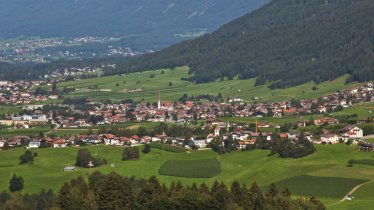
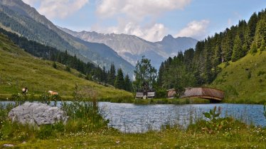
This hike leads through the Kalkkögel, a collection of craggy mountains known as the "Dolomites of North Tirol", located in the Stubai Alps near Innsbruck. Long before sport climbing became as popular as it is today, the Adolf-Pichler-Hütte hut was a popular basecamp used by early alpine pioneers such as Hermann Buhl to complete first ascents of these imposing rock faces. This hike begins in Grinzens (945 metres) near Innsbruck and leads to the Adolf-Pichler-Hütte hut (1,977 metres).

Mountain Hike
Starting point
Grinzens
Hike to
Adolf-Pichler-Hütte
Finishing point
Grinzens
Mountain chain
Stubai Alps
Length
15.8 km
Total hiking time
7h
Features
- Wheelchair-accessible Hiking Route
- Circular hike
Difficulty rating
intermediate (red mountain trails)
Altitude
Elevation uphill 1,016m
Vertical metres downhill 1,016m
Fitness level
Technique
Best time of year
* These are approximate values and recommendations. Please take your personal fitness level, technical ability and the current weather conditions into account. Tirol Werbung cannot guarantee that the information provided is correct and accepts no liability.
Public transport
- Accessible using public transport
Parking
Grinzens
Places serving food & drink:
- Kemater Alm (May until March)
- Adolf-Pichler-Hütte (June until September)
- Sportcafé in Grinzens
- Gasthöfe in Innsbruck
Downloads
Trail description
Opposite the bus stop, follow the trail to “Kemater Alm” and “Adolf-Pichler-Hütte” and walk around 200 metres uphill along the tarmac road. The road flattens and turns onto a forest road (toll road) that runs into the Senderstal Valley, straight as an arrow and gently uphill through meadows and pastures. The toll road ends at the Kemater Alm hut. Here, hikers leave the Senderstal Valley along the dirt road that runs above the alpine hut and follow the sign for “Adolf-Pichler-Hütte”. Continue on this dirt road, which runs parallel to the Griesbach stream and gradually climbs up to the Adolf-Pichler-Hütte hut (the last section via a series of switchbacks). The hut is located opposite the peaks of the Kalkkögel. There is also the option of continuing the hike up to the top of the Sonntagsköpfl mountain (2,096 metres). The way back to Grinzens is along the same route.
Tip! It is also possible to drive to the Kemater Alm along the toll road and then start the hike there.


