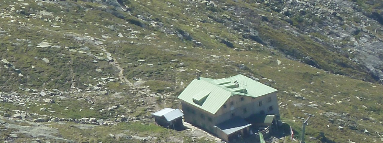
The Greizer Hütte (2,227 metres) is a mountain hut in the Zillertal Alps is a good destination for a day hike and a good basecamp for exploring the surrounding mountains.
Beautiful mountain hut near the Floitenkees glacier
German Alpine Club, Greiz Division
Situated at the end of the long Trogtal Valley, a side valley which itself is located at the end of the Zillertal Valley, the Greizer Hütte offers fine views of the Floitenkees glacier and the surrounding Zillertal Alps. It lies on the Berlin High Trail and is an important stop on this popular long-distance trek. In the months when it is open to visitors (mid-June until early October) the hut sleeps around 100 guests in a mixture of private rooms and dormitories with matresses next to each other. There is also a separate winter room. Most of the climbing around the hut is for experts only and requires glacier equipment and experience. There is a rock-climbing area near the hut.
How to get to the hut
From Ginzling 4 hours, from the Tristenbachalm hut 3.25 hours.
Walks and hikes in the area (walking time to summit)
Schwarzenstein (3,369 metres), 5 hours, difficult
Zsigmondyspitze (3,087 metres), 5.5 hours, difficult
Großer Löffler (3,379 metres), 3.75 hours, difficult
Gigalitz (3,002 metres), 2.5 hours, difficult
Further huts in the area, long-distance hiking trails
Berliner Hütte, 6 hours
Kasseler Hütte, 5,5 hours
Grüne-Wand-Hütte, 3 hours
Schwarzensteinhütte, 3,5 hours
The Greizer Hütte is located on the Berlin High Trail (Stage 4/5), a challenging high-alpine trek.
Beautiful mountain hut near the Floitenkees glacier German Alpine Club, Greiz Division Situated at the end of the long Trogtal Valley, a side valley…


