
Opening hours:Open today
Place:Sölden
:Restaurant
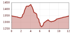
A top after-work round! From Sölden, you go up about 130 m elevation on the Kaiserwald Route and return to the village via the red Kaiser Trail.
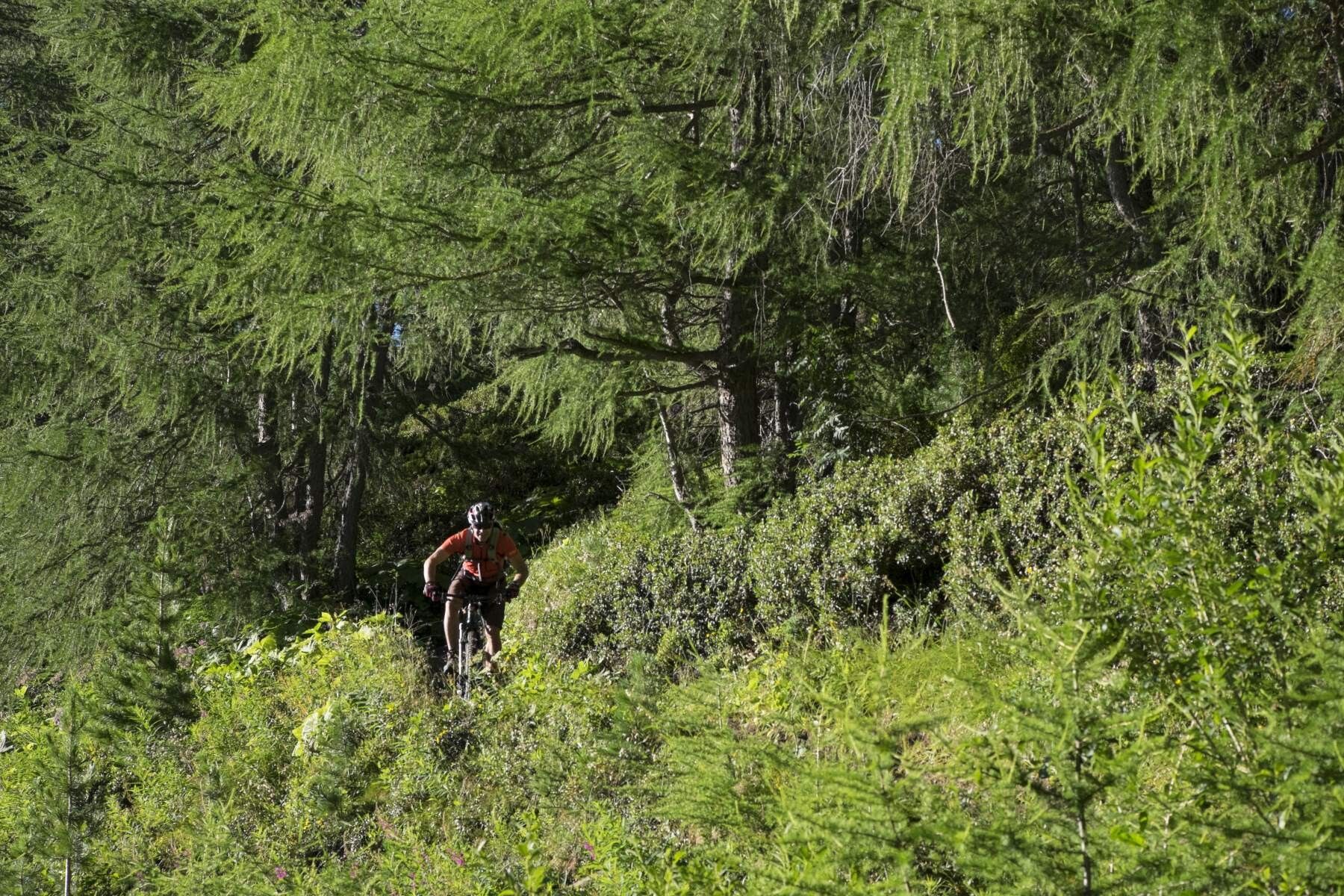
The red Kaiser Trail is relatively flowing, but can become really slippery when wet and also offers some more challenging sections.
At the BIKE REPUBLIC SÖLDEN, it's all about shared fun in bike sports – no matter what riding level you have. Be considerate of each other and support each other. And behave respectfully towards all other people on the mountain and in the valley – and the nature.
-> Stay on the paved and signposted paths. Do not ride over open meadows!
-> Avoid locking the rear wheel and thus help preserve the paths.
-> Pay attention to animals and close the pasture gates. There can always be cows on the trails and lines. Ride cautiously and keep your distance!
-> Please note: Hikers are also on the nature trails of the BIKE REPUBLIC SÖLDEN. Ride carefully, stop, give way considerately, and greet politely.
Well-equipped rules! We recommend wearing MTB protective gear (helmet, protectors for knees, elbows, back, ...) on all lines, trails, enduro tracks, and mountain bike routes of the BIKE REPUBLIC SÖLDEN. All routes are exclusively designated for use with mountain bikes that meet today's quality standards.The route leads downstream on the Ötztal Cycle Path and along the mountain bike Kaiserwald Route. At the end of Sölden in Kaisers, turn right towards Höfle. The 130 meters of elevation gain are tackled in one stretch, first on an asphalt road to Höfle and then on a gravel road through the forest. The route then continues on the red Kaiser Trail, which begins at the end of the gravel road. The Kaiser Trail offers some excitement through short root sections and partly steep terrain. When wet, the rich ground takes time to dry again. After about 500 m, the trail joins the Ötztal Cycle Path, which you follow up to the junction towards Brand. In Aschbach, cross the street and follow the Ötztal Cycle Path again downstream back to Sölden.
Please watch out for hikers!
Arrival by train
Take the train easily to Ötztal train station at the valley entrance. A local bus departs directly from the station square towards Obergurgl. The bus ride to Sölden takes about 1 to 1.5 hours. On the designated bike line buses, bike transport (including EMTBs) is free with a valid bus ticket.
All important information about bus schedules, connections, and taxi companies can be found here.
At the valley stations of the Gaislachkoglbahn and the Giggijochbahn, sufficient parking spaces are available; parking garages are also provided.The parking spaces are subject to charges.
Paid overnight car parking is possible in the Gaislachkogl parking garage:
more information about overnight parking
Please respect that wild camping is prohibited!


.jpg")


Andi Frank (247).jpg")

")

-min.jpg")

Erwin Haiden, bikeboard.at.jpg")


.jpg")

