Bikepacking Tour Tirol - Etappe 3 Variante B Bikepacking Tour Tirol - Gesamtverlauf Bikepacking Tour Tirol - Etappe 1 Bikepacking Tour Tirol - Etappe 2 Bikepacking Tour Tirol - Etappe 3 Variante A Bikepacking Tour Tirol - Etappe 3 Variante B Bikepacking Tour Tirol - Etappe 4 Bikepacking Tour Tirol - Etappe 5
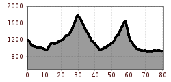
Open interactive mapOpen this POI on the interactive mapElevation profileBikepacking Tour Tirol - Etappe 3 Variante B .gpx
Leutascher Ache im Herbst - Drohnenaufnahme mit Weg neben dem Fluss.jpg © Region Seefeld Wheelchair Circular Hike Kirchplatzl-AchwegDifficulty: easy Length: 1.8 km Duration: 0:30 h Elevation uphill: 10 m See trailSee trail: Wheelchair Circular Hike Kirchplatzl-Achweg
_JCK4681.jpg © JACKSCORNER Wheelchair Circular Hike in the Möserer ValleyDifficulty: medium Length: 4.6 km Duration: 1:10 h Elevation uphill: 10 m See trailSee trail: Wheelchair Circular Hike in the Möserer Valley
Weitwandern Etappe 1 Teilnehmer bei Bach (1).jpg © Region Seefeld, Johannes Geyer Stage 1: From Schanz to Weidach – Tyrol’s 1. Winter Multi-day HikeOpening hours: open Difficulty: medium Length: 14.2 km Duration: 3:30 h Elevation uphill: 140 m Go to winter hikeGo to winter hike: Stage 1: From Schanz to Weidach – Tyrol’s 1. Winter Multi-day Hike
_JCK4571.jpg © JACKSCORNER Wheelchair Circular Hike Seekirchl–Ski JumpDifficulty: easy Length: 3.2 km Duration: 1:10 h See trailSee trail: Wheelchair Circular Hike Seekirchl–Ski Jump
Urlaub mit Rollstuhl in der Region Seefeld (18).jpg © JACKSCORNER Wheelchair Hike Scharnitz–GießenbachDifficulty: easy Length: 7.0 km Duration: 1:50 h Elevation uphill: 40 m See trailSee trail: Wheelchair Hike Scharnitz–Gießenbach
Höhenweg Leutasch_Aussichtsplattform Höhenweg_Pfarrkirche St. Magdalena und Ganghofermuseum.jpg © Region Seefeld Wheelchair Circular Hike Runst-AchwegDifficulty: easy Length: 6.3 km Duration: 2:00 h Elevation uphill: 40 m See trailSee trail: Wheelchair Circular Hike Runst-Achweg
Urlaub mit Rollstuhl in der Region Seefeld (67).jpg © JACKSCORNER Wheelchair Circular Hike around the WildseeDifficulty: easy Length: 3.4 km Duration: 1:00 h See trailSee trail: Wheelchair Circular Hike around the Wildsee
Weitwandern Etappe 2 Teilnehmer am Weg bei Huette © Region Seefeld, Johannes Geyer Stage 2: From Leutasch to Mösern – Tyrol’s 1. Winter Multi-day HikeOpening hours: open Difficulty: medium Length: 16.9 km Duration: 5:00 h Elevation uphill: 402 m Go to winter hikeGo to winter hike: Stage 2: From Leutasch to Mösern – Tyrol’s 1. Winter Multi-day Hike
Nördlinger Hütte - Wanderer kurz vor der Hütte (2).jpg © Region Seefeld, newcreatings Hike via Nördlinger Hütte to Reither SpitzeDifficulty: difficult Length: 9.9 km Duration: 7:30 h Elevation uphill: 1,191 m See trailSee trail: Hike via Nördlinger Hütte to Reither Spitze
Leutascher Geisterklamm - Wasserfallsteig (2).jpg © Region Seefeld Hike through the Leutasch Spirit Gorge and to the Waterfall TrailOpening hours: closed Difficulty: medium Length: 5.0 km Duration: 2:30 h Elevation uphill: 225 m See trailSee trail: Hike through the Leutasch Spirit Gorge and to the Waterfall Trail
Falkenhütte neu © Falkenhütte Karwendelmarsch 52 kmDifficulty: difficult Length: 52.0 km Duration: 19:00 h Elevation uphill: 2,281 m See trailSee trail: Karwendelmarsch 52 km
Familien-Weitwanderung im Gaistal - Familie vor Hohe Munde - Alle lächeln.jpg © Region Seefeld Complete Route for the Leutasch 3-Day Hut Hike for FamiliesDifficulty: medium Length: 16.2 km Duration: 3 days Elevation uphill: 960 m See trailSee trail: Complete Route for the Leutasch 3-Day Hut Hike for Families
Leutasch Farm Shop Circular HikeDifficulty: easy Length: 11.5 km Duration: 3:10 h Elevation uphill: 111 m See trailSee trail: Leutasch Farm Shop Circular Hike
Katzenkopfhütte Winter © Region Seefeld - Tessa Mellinger Complete Route for the Tyrol’s 1. Winter Multi-day HikeOpening hours: open Difficulty: medium Length: 48.0 km Duration: 4 days Elevation uphill: 1,000 m Go to winter hikeGo to winter hike: Complete Route for the Tyrol’s 1. Winter Multi-day Hike
Langlaufen in Seefeld - Langläufer auf der A1 beim Seekirchl in Seefeld - Tirols Hochplateau (1).jpg © Region Seefeld, Moritz Klee A1 - Seekirchl LoipeOpening hours: open Difficulty: easy Length: 3.0 km Elevation uphill: 19 m : Style: Skating, Classic Go to Cross-country skiing trailGo to Cross-country skiing trail: A1 - Seekirchl Loipe
Seekirchl mit Neuschnee - 29.11.2023 - Querformat.jpg © Region Seefeld Complete Route for the Seefeld High Plateau Winter Multi-day HikeOpening hours: open Difficulty: medium Length: 65.2 km Duration: 5 days Elevation uphill: 1,157 m Go to winter hikeGo to winter hike: Complete Route for the Seefeld High Plateau Winter Multi-day Hike
Ski tour in Seefeld © TVB Seefeld Seefelder Joch Difficulty: medium Length: 6 m Duration: 2:30 h Elevation uphill: 866 m Go to skitourGo to skitour: Seefelder Joch
Leutascher Ache im Sommer - Drohnenaufnahme Kurve im Fluss (1).jpg © Region Seefeld Biketour - Adventure RideDifficulty: medium Length: 48.5 km Duration: 5:00 h Elevation uphill: 1,071 m Go to biketourGo to biketour: Biketour - Adventure Ride
Bikepark Katzenkopf - Grüner Trail © Jenny Haimerl Photography Bikepark Katzenkopf - Green Pangea TrailDifficulty: easy Length: 600 m Go to biketourGo to biketour: Bikepark Katzenkopf - Green Pangea Trail
Familie in der Region Seefeld - Spielen am Fluss - Leutascher Ache.jpg © Region Seefeld, David Hennerbichler Hike to UnterleutaschDifficulty: easy Length: 9.1 km Duration: 2:30 h Elevation uphill: 3 m See trailSee trail: Hike to Unterleutasch
Bikepark Katzenkopf - Roter Trail © Jenny Haimerl Photography Bikepark Katzenkopf - Dirty Dancer TrailDifficulty: medium Length: 2.1 km Go to biketourGo to biketour: Bikepark Katzenkopf - Dirty Dancer Trail
Oberer Wiesenweg im Frühwinter_Paar läuft auf Wanderweg_Blick auf Stadl und Hohe Munde.jpg © Region Seefeld W17: Winter circular hike on the WiesenwegOpening hours: open Difficulty: easy Length: 6.2 km Duration: 1:45 h Elevation uphill: 61 m Go to winter hikeGo to winter hike: W17: Winter circular hike on the Wiesenweg
KatzenkopfLeutasch - Blauer Trail © Jenny Haimerl Photography Bikepark Katzenkopf - Kitty Twister TrailDifficulty: easy Length: 2.1 km Duration: 0:15 h Go to biketourGo to biketour: Bikepark Katzenkopf - Kitty Twister Trail
Schlossbachklamm mit Bahnstrecke - Reith.jpg © Region Seefeld Hike through the SchlossbachklammDifficulty: medium Length: 12.2 km Duration: 4:30 h Elevation uphill: 488 m See trailSee trail: Hike through the Schlossbachklamm
Snowfarming Loipe Leutasch © Region Seefeld A2 - Snowfarming track LeutaschOpening hours: open Difficulty: easy Length: 2.8 km Elevation uphill: 20 m : Style: Skating, Classic Go to Cross-country skiing trailGo to Cross-country skiing trail: A2 - Snowfarming track Leutasch
Give feedback for a chance to win a special holiday experience!Click here for the surveyClick here for the survey


.jpg")

.jpg")

.jpg")

.jpg")
.jpg")


.jpg")


.jpg")


