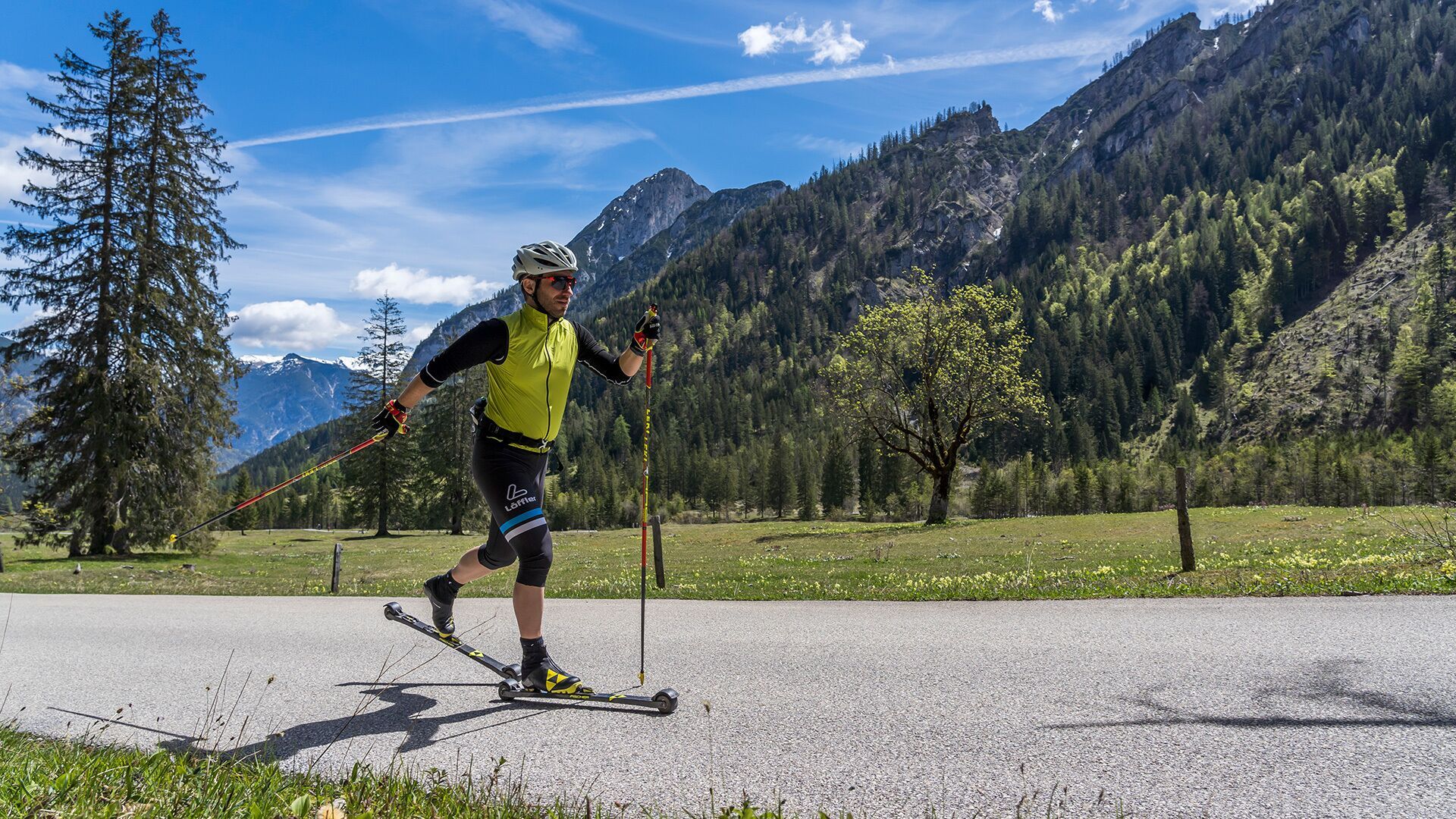
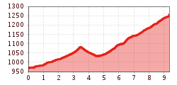
Open interactive mapOpen this POI on the interactive mapElevation profileFalzthurnalm - Gramai Alm.gpx
Der Murmliweg in Serfaus © © Serfaus-Fiss-Ladis Marketing GmbH Marmot TrailOpening hours:closedDifficulty:easyLength:573 mDuration:0:20 hElevation uphill:12 mSee trailSee trail: Marmot Trail
Kasseler Hütte © Reinhard Weber Stage Berliner Höhenweg (Zillertal Runde): Kasseler Hütte - EdelhütteDifficulty:difficultLength:13.0 kmDuration:9:00 hElevation uphill:800 mSee trailSee trail: Stage Berliner Höhenweg (Zillertal Runde): Kasseler Hütte - Edelhütte
Stage of the Berliner Höhenweg (Zillertal Runde): Greizer Hütte - Kasseler HütteDifficulty:difficultLength:9.8 kmDuration:6:00 hElevation uphill:650 mSee trailSee trail: Stage of the Berliner Höhenweg (Zillertal Runde): Greizer Hütte - Kasseler Hütte
Mountain hut tour: Birgitzköpfl - Muttereralm - Götzner Alm - Birgitzer AlmDifficulty:mediumLength:11.4 kmDuration:3:30 hElevation uphill:894 mSee trailSee trail: Mountain hut tour: Birgitzköpfl - Muttereralm - Götzner Alm - Birgitzer Alm
wanderung-grosser-zunig-wokenmeer-c-bernhard-assmair.jpg © Bernhard Aßmair Lasörling altitude trailDifficulty:mediumLength:57.0 kmDuration:25:00 hElevation uphill:3,740 mSee trailSee trail: Lasörling altitude trail
wandern2-neuepragerhuette-c-dezordo-desiree.jpg © Desirèe De Zordo Venediger altitude trailDifficulty:difficultLength:55.5 kmDuration:27:00 hElevation uphill:3,915 mSee trailSee trail: Venediger altitude trail
Nature park house_with hiker.JPG © TVB Pitztal Kaunergrat Circular Route - 7 DaysDifficulty:difficultLength:66.4 kmDuration:7 daysElevation uphill:5,496 mSee trailSee trail: Kaunergrat Circular Route - 7 Days
495 - Singletrail Isskogel (495 Iss-Tough 1-2)Opening hours:closedDifficulty:mediumLength:300 mDuration:0:06 hElevation uphill:9 mGo to biketourGo to biketour: 495 - Singletrail Isskogel (495 Iss-Tough 1-2)
Nördlinger Hütte - Wanderer kurz vor der Hütte (2).jpg © Region Seefeld, newcreatings Hike via Nördlinger Hütte to Reither SpitzeDifficulty:difficultLength:9.9 kmDuration:7:30 hElevation uphill:1,190 mSee trailSee trail: Hike via Nördlinger Hütte to Reither Spitze
Kaunergrathütte © TVB Pitztal/Roman Huber Kaunergrat Circular Route - 3 DaysDifficulty:difficultLength:22.8 kmDuration:3 daysElevation uphill:2,650 mSee trailSee trail: Kaunergrat Circular Route - 3 Days
The sunny plateau circuitDifficulty:easyLength:38.0 kmDuration:8:00 hElevation uphill:740 mSee trailSee trail: The sunny plateau circuit
Abstieg in Richtung Oberstalleralm © edifilm75 Herz-Ass VillgratentalDifficulty:mediumLength:75.6 kmDuration:34:00 hElevation uphill:5,703 mSee trailSee trail: Herz-Ass Villgratental
Bergdoktor-Winter Hiking TrailDifficulty:easyLength:2.1 kmDuration:0:45 hElevation uphill:40 mGo to winter hikeGo to winter hike: Bergdoktor-Winter Hiking Trail
St. Sigmund - Pforzheimer Hütte mountain hut (145)Difficulty:mediumLength:14.1 kmDuration:5:00 hElevation uphill:781 mSee trailSee trail: St. Sigmund - Pforzheimer Hütte mountain hut (145)
Along the Goetheweg trail to thePfeishütte mountain hutDifficulty:difficultLength:5.2 kmDuration:5:00 hElevation uphill:769 mSee trailSee trail: Along the Goetheweg trail to thePfeishütte mountain hut
Through the Forest from Praxmar to LüsensDifficulty:mediumLength:5.0 kmDuration:0:47 hElevation uphill:54 m:Style: ClassicGo to Cross-country skiing trailGo to Cross-country skiing trail: Through the Forest from Praxmar to Lüsens
sommer-steinbockmarsch-foto-dominic-ebenbichler © Archiv TVB Mayrhofen Stage of the Berliner Höhenweg (Zillertal Runde): Berliner Hütte - Greizer HütteDifficulty:difficultLength:10.2 kmDuration:6:30 hElevation uphill:1,200 mSee trailSee trail: Stage of the Berliner Höhenweg (Zillertal Runde): Berliner Hütte - Greizer Hütte
Axamer Lizum to Halsl and then on to Saile/NockspitzeDifficulty:mediumLength:9.4 kmDuration:5:00 hElevation uphill:886 mSee trailSee trail: Axamer Lizum to Halsl and then on to Saile/Nockspitze
Winter- und Schneeschuhwandern (c) Mirja Geh (26).jpg © Mirja Geh At the foot of Fleischbank and TotenkirchlDifficulty:easyLength:9.3 kmDuration:3:00 hElevation uphill:250 mGo to winter hikeGo to winter hike: At the foot of Fleischbank and Totenkirchl
The Zirbenweg trailDifficulty:easyLength:7.0 kmDuration:2:30 hElevation uphill:200 mSee trailSee trail: The Zirbenweg trail
491/492- Singletrail Isskogel (Iss-Flow 1-3)Opening hours:closedDifficulty:easyLength:400 mDuration:0:08 hElevation uphill:1 mGo to biketourGo to biketour: 491/492- Singletrail Isskogel (Iss-Flow 1-3)
Figerhorn - Goßglockner_TVB Osttirol_Elias Bachmann_Kals am Großglockner (1) © TVB Osttirol | Elias Bachmann FigerhornDifficulty:difficultLength:6.5 kmDuration:6:00 hElevation uphill:807 mSee trailSee trail: Figerhorn
Carnic altitude trail. Stage 4: Porzehütte – HochweißsteinhausMore InformationMore Information: Carnic altitude trail. Stage 4: Porzehütte – Hochweißsteinhaus
Suspension bridge to Maria Locherboden pilgrimage churchDifficulty:mediumLength:8.5 kmDuration:3:00 hElevation uphill:370 mSee trailSee trail: Suspension bridge to Maria Locherboden pilgrimage church
img_9853.jpg © @ualm.at 3-hut hikeDifficulty:mediumLength:13.2 kmDuration:6:00 hElevation uphill:1,120 mSee trailSee trail: 3-hut hike
Give feedback for a chance to win a special holiday experience!Click here for the surveyClick here for the survey


.jpg")


")


 Mirja Geh (26).jpg")


")


