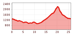
High and sacred – Stage 08 from Obermauern to Kals
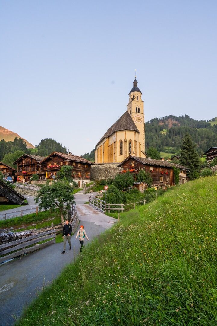
From Obermauern follow the Calvary path in the direction of Göriach and Virgen. This romantic field path, which connects the pilgrimage site Maria Schnee with Virgen, is probably the most traveled pilgrim path in Tyrol. It continues along the "Weg der Sinne" (start at the Joast bakery) through the hedgerow fields of Virgen and along the "Iselweg" to the footbridge over the Isel river below Mitteldorf. From here you hike along the downstream right bank of the Isel along path no. 91 in the direction of Ganz and from there on a detour up to the Romanesque church of St. Nikolaus. After a visit and a break, you will leave this culturally and historically important place and reach the town centre of Matrei through Bichl.
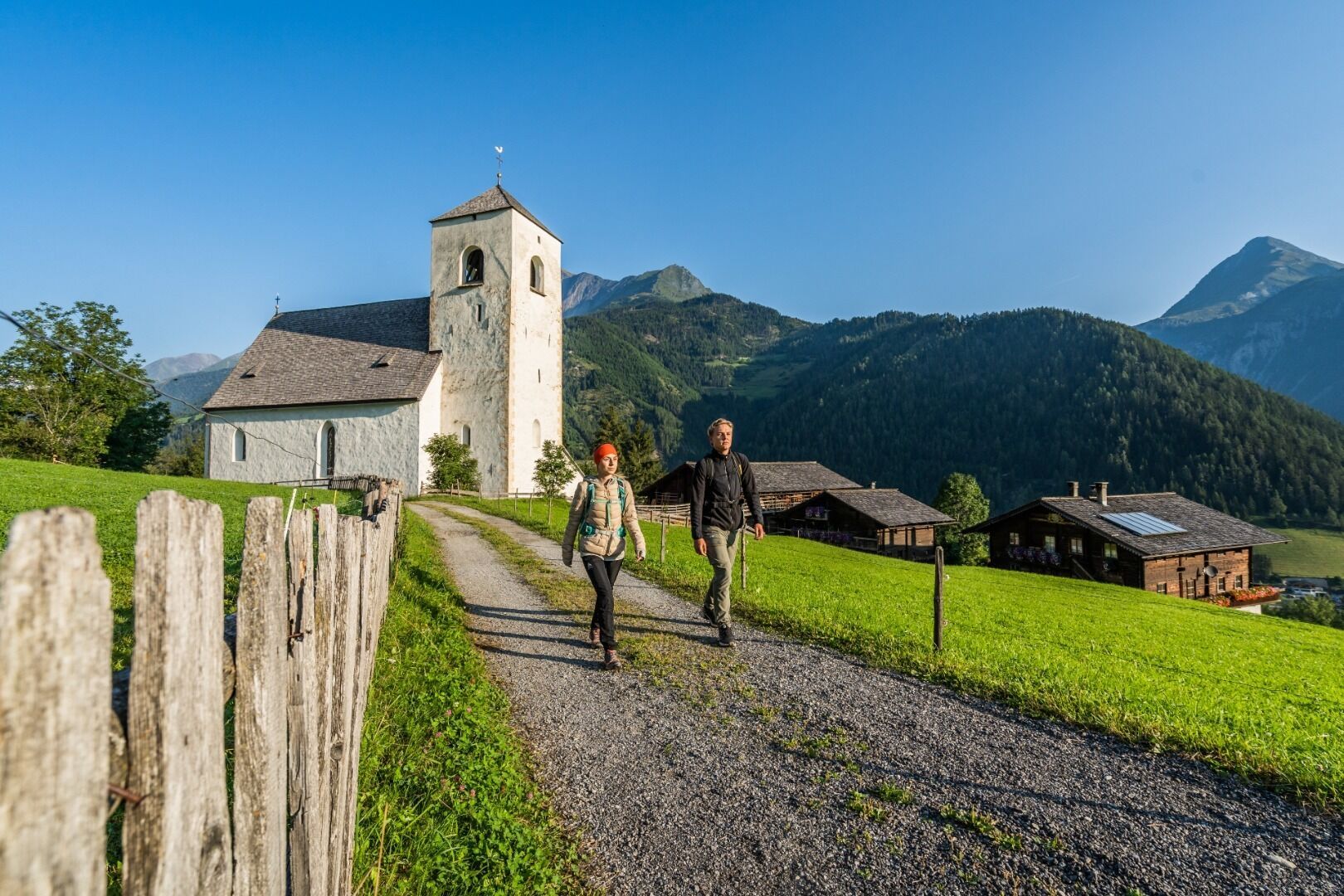
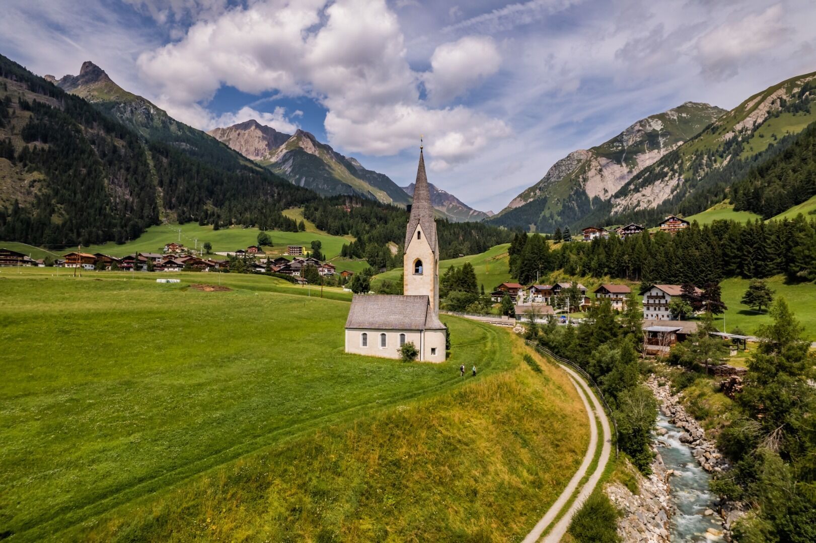
You cross the village with its large dome St. Alban, take some refreshments in the local shop "Talladen" and start the ascent along the Bretterwandbach to the Klaunzer Berg via path no. 515, where you also pass the St. Veit Stöckl. Finally you reach the highest point of the stage with the Kals-Matreier-Törl (2.207 m). The shelter of the same name at the crossing of the pass offers rest, good food and a wonderful view of the many surrounding three thousand meter peaks. For the descent to Kals you choose the more direct, steeper path no. 502B to Gasthof Tembler. From here your way leads over the village fields to the bottom station of the gondola lift. Nowon we go along the sidwalk from Großdorf to Unterburg. At Unterburg you are going to pass the famous Romanesque church of St. Georg which stands freely on the pasture. After the bridge, turn right onto path no. 31 and walk downstream left from the stream to Ködnitz. Via path no. 39 you will directly reach the church of St. Rupert.

")


www.bergpixel.de")


