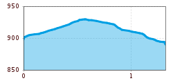
Open interactive mapOpen this POI on the interactive mapElevation profileChristmas Trail | Grüble Weihnacht.gpx
DescriptionChristmas trail in Ried im Oberinntalthrough a mysterious door from station to stationfor children, families & adults with Christmas in their heartsSurprises to take homeopen daily from 29.11. to 06.01. and freely accessibleDon't forget your headlamp in the evening!Opening on 29.11.2025Advent on the Christmas trailFestive opening of the trailmulled wine & punchsmall tasting from 17:00
Wallfahrtsweg Kauns (1.050 m) - Kaltenbrunn (1.287 m)Difficulty: easy Length: 9.2 km Duration: 3:30 h Elevation uphill: 290 m See trailSee trail: Wallfahrtsweg Kauns (1.050 m) - Kaltenbrunn (1.287 m)
Brandenburgerhaus © Katharina Nösig Ötztal Trek Stage 15Difficulty: difficult Length: 6.5 km Duration: 2:30 h Elevation uphill: 332 m See trailSee trail: Ötztal Trek Stage 15
Nauders mountain trailDifficulty: medium Length: 18.0 km Duration: 7:00 h Elevation uphill: 407 m See trailSee trail: Nauders mountain trail
©-TVB-Tiroler-Oberland-Daniel-Zangerl-Winterwandern-Kobl-2019 (51).jpg © Daniel Zangerl Winter hike Pfunds | Wild animal enclosure "FeichtiOpening hours: closed Difficulty: easy Length: 900 m Duration: 0:40 h Elevation uphill: 105 m See trailSee trail: Winter hike Pfunds | Wild animal enclosure "Feichti
Schwarzer and Grüner SeeDifficulty: easy Length: 8.3 km Duration: 4:30 h Elevation uphill: 368 m See trailSee trail: Schwarzer and Grüner See
©-TVB-Tiroler-Oberland-Kaunertal-Michael-Veit-Klima-Führer-2018-Talwanderweg-Vergötschen-Platz-2018 © Michael Veit Talwanderweg KaunertalDifficulty: easy Duration: 2:30 h Elevation uphill: 295 m See trailSee trail: Talwanderweg Kaunertal
Großer MutzkopfDifficulty: easy Length: 10.3 km Duration: 4:00 h Elevation uphill: 507 m See trailSee trail: Großer Mutzkopf
Winter walk Schwarzer See, NaudersDifficulty: easy Length: 10.5 km Duration: 3:30 h Elevation uphill: 255 m See trailSee trail: Winter walk Schwarzer See, Nauders
Evening winter hike Kleinmutzkopf, NaudersDifficulty: easy Length: 6.0 km Duration: 2:00 h Elevation uphill: 70 m See trailSee trail: Evening winter hike Kleinmutzkopf, Nauders
©-TVB-Tiroler-Oberland-Kaunertal-Martin-Lugger-2019-Winterwandern-Rodeln-Familie-LUG0758.jpg © Martin Lugger Winterwanderweg Aussichtsplattform Adlerblick (Kaunertal)Opening hours: closed Difficulty: easy Length: 3.2 km Duration: 2:30 h Elevation uphill: 372 m See trailSee trail: Winterwanderweg Aussichtsplattform Adlerblick (Kaunertal)
©-TVB-Tiroler-Oberland-Kurt-Kirschner-Tschey-Herbst-2017 (4).jpg © Kurt Kirschner Rundwanderung FrudigerDifficulty: medium Length: 13.5 km Duration: 5:00 h Elevation uphill: 588 m See trailSee trail: Rundwanderung Frudiger
Kapelle Maria SchneeDifficulty: easy Length: 1.7 km Duration: 0:30 h Elevation uphill: 90 m See trailSee trail: Kapelle Maria Schnee
Klammsteig - GreitOpening hours: closed Difficulty: medium Length: 8.8 km Duration: 3:00 h Elevation uphill: 469 m See trailSee trail: Klammsteig - Greit
©-TVB-Tiroler-Oberland-Kaunertal-Teammedia-Michael-Obex-2021-Verpeilschlucht-_A025725.jpg © Teammedia, Michael Obex VerpeilschluchtOpening hours: closed Difficulty: medium Duration: 3:00 h Elevation uphill: 386 m See trailSee trail: Verpeilschlucht
Give feedback for a chance to win a special holiday experience!Click here for the surveyClick here for the survey
.jpg")


.jpg")
.jpg")
.jpg")

.jpg")
.jpg")
.jpg")

.jpg")
")
.jpg")

