
Opening hours:Open today
Place:Zams
:Restaurant, Alpine pasture / hut / mountain restaurant:Breakfast, vegetarian
From Zams via the Wiesensteig trail up to the Zammer Alm and Zams ski hut. From there up to the Venetbahn mountain station, then on via the Glanderspitze (2,505m), Wannejöchl (2,495m) and Larcher Alm to Wenns in Pitztal.
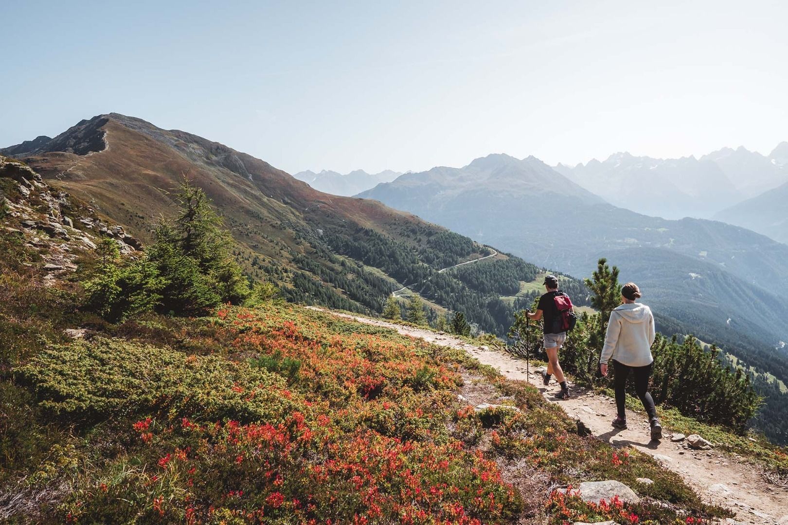
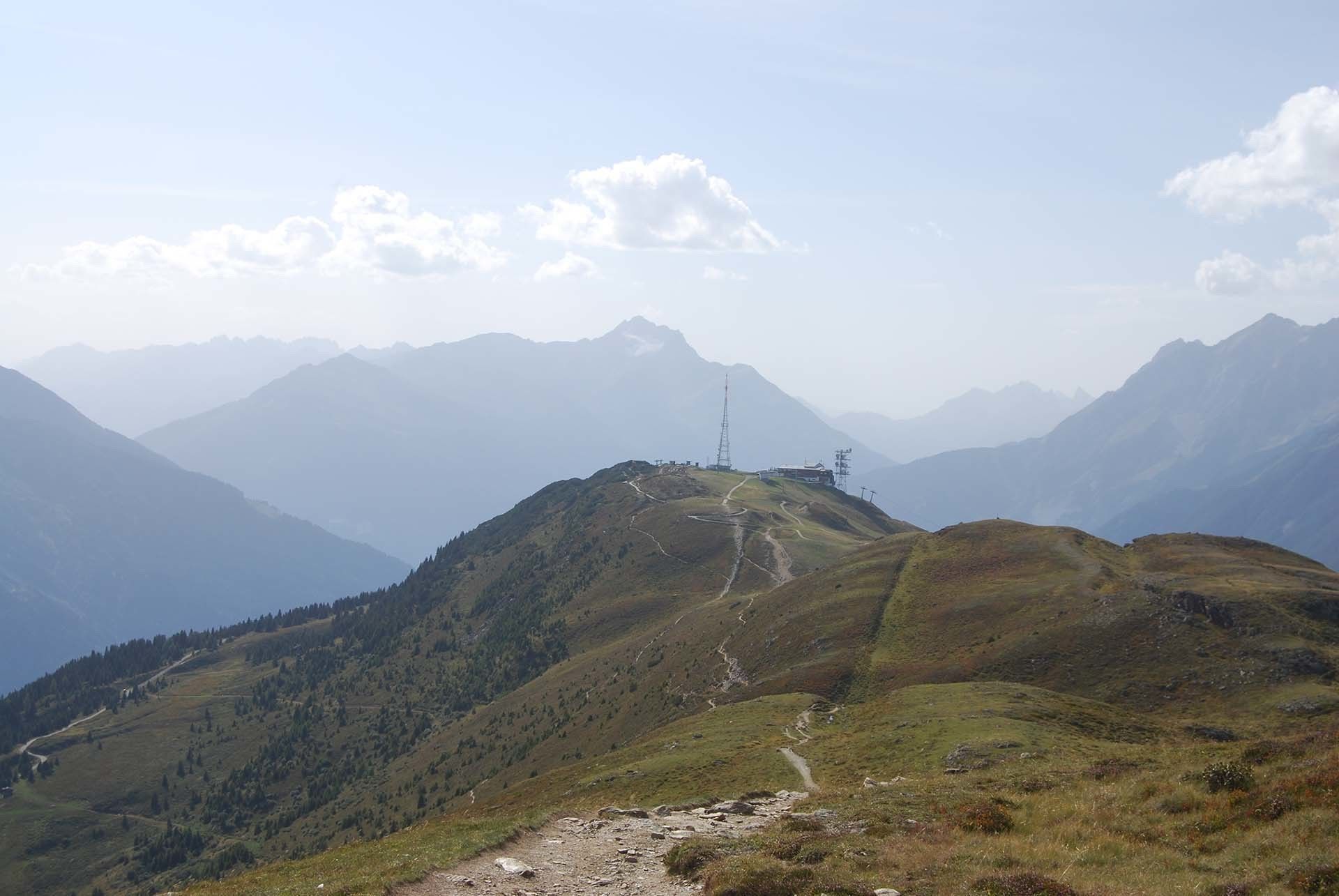
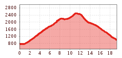
The E5 leads from the Venetbahn valley station via the Wiesensteig trail (2a) up to the Zammer Alm and Zams ski hut. From there it continues up to the Venetbahn mountain station with the panorama restaurant and the summit hut. From the Venetbahn mountain station, a path leads up to the Glanderspitze (2,505m), then over the Wannjöchl (2,495m) to the Larcher Alm and down to Wenns.
Mehrtagesparkplatz der Gemeinde Landeck


.jpg")


.jpg")
