

Öffnungszeiten:Heute geöffnet
Ort:Finkenberg
:Alpine pasture / hut / mountain restaurant, Bar / Pub
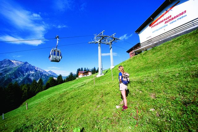
Varied ascent on old paths through woods and meadows to the middle station of the Finkenberger Almbahnen.

Correct footwear (sole with a tread, firm hiking shoes)
Clothing (quickly drying, protection against wind, rain and cold)
Sunscreen – ATTENTION: strong sunlight in the mountains! Sunglasses, head protection, sunscreen with a high sun protection factor
First aid kit (gauze bandage, plaster)
Charged mobile phone
Drinks and food (drink plenty of fluid on hikes – but avoid alcohol!)
Folllow the cart track (path no. 28) from house no. 510 in the hamlet of Stein towards the head of the valley. After approx. 300 m the footpath branches off, leading via Altenstall alpine pasture to the middle station of the Finkenberg Almbahnen.
Linienbus
4104
Bus stop Finkenberg-GH Persal
Day parking lot Finkenberg Teufelsbrücke


")


")

