
Opening hours:Open today
Place:Finkenberg
:Alpine pasture / hut / mountain restaurant
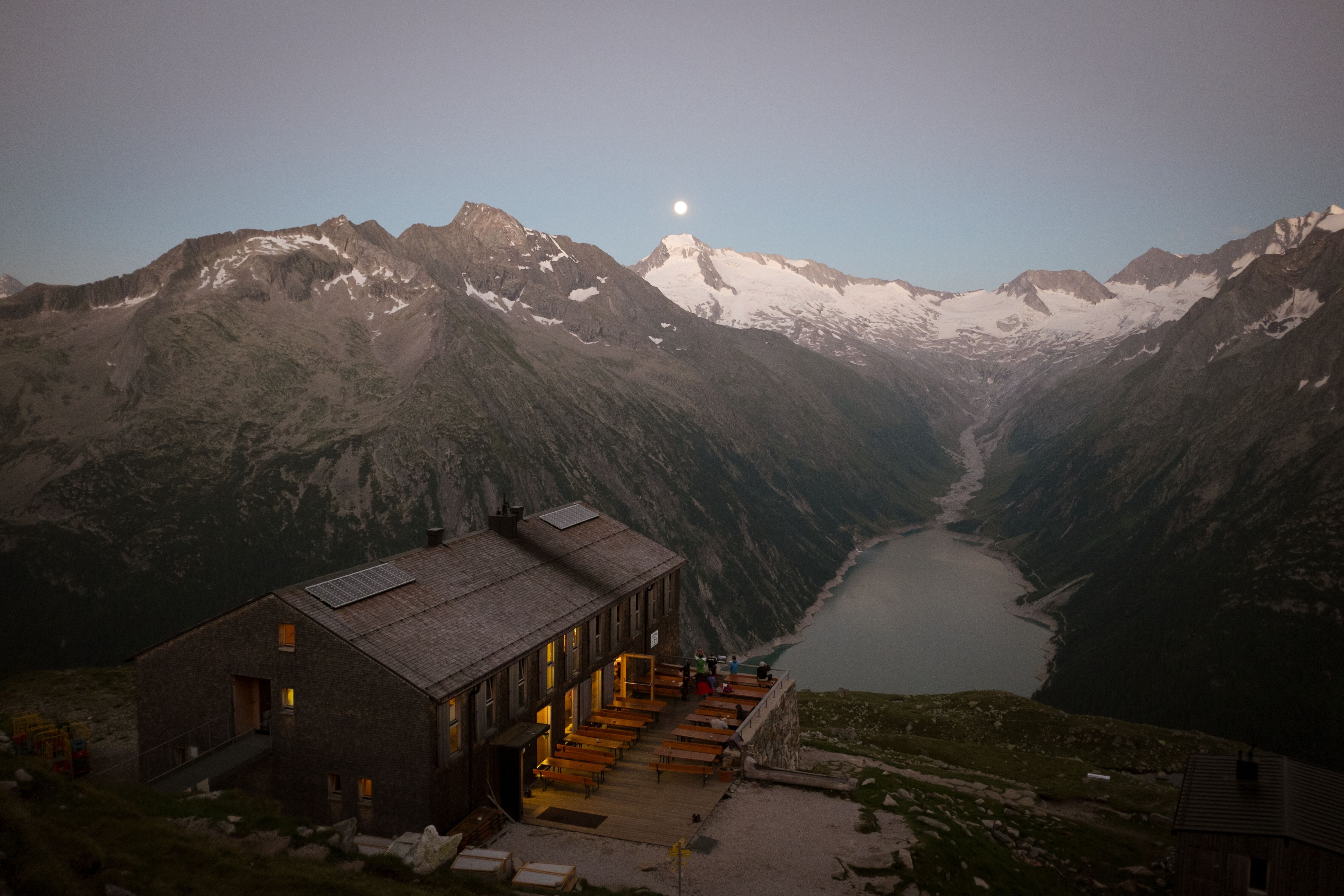
We have never tired of the view of the Schlegeis reservoir with the glaciated Zillertal Alps behind it. The Olperer bridge is best passed quickly. Nevertheless, we recommend searching the internet afterwards - the beautiful but small bridge is the best example of a worthwhile reality check.
Demanding but rewarding mountain tour to the modern Olperer Hütte in the Zillertal. The starting point is the Schlegeisspeicher reservoir near Ginzling; from there, the trail leads through forest, mountain pines and grassy slopes to the hut, which offers magnificent views of the reservoir and the Zillertal Alps. For the descent, we recommend the Neumarkt loop via the panoramic high trail with views of the Zillertal Alps High Mountain Nature Park, past the Unterschrammachkar and Zamser Grund back to the Schlegeisspeicher.
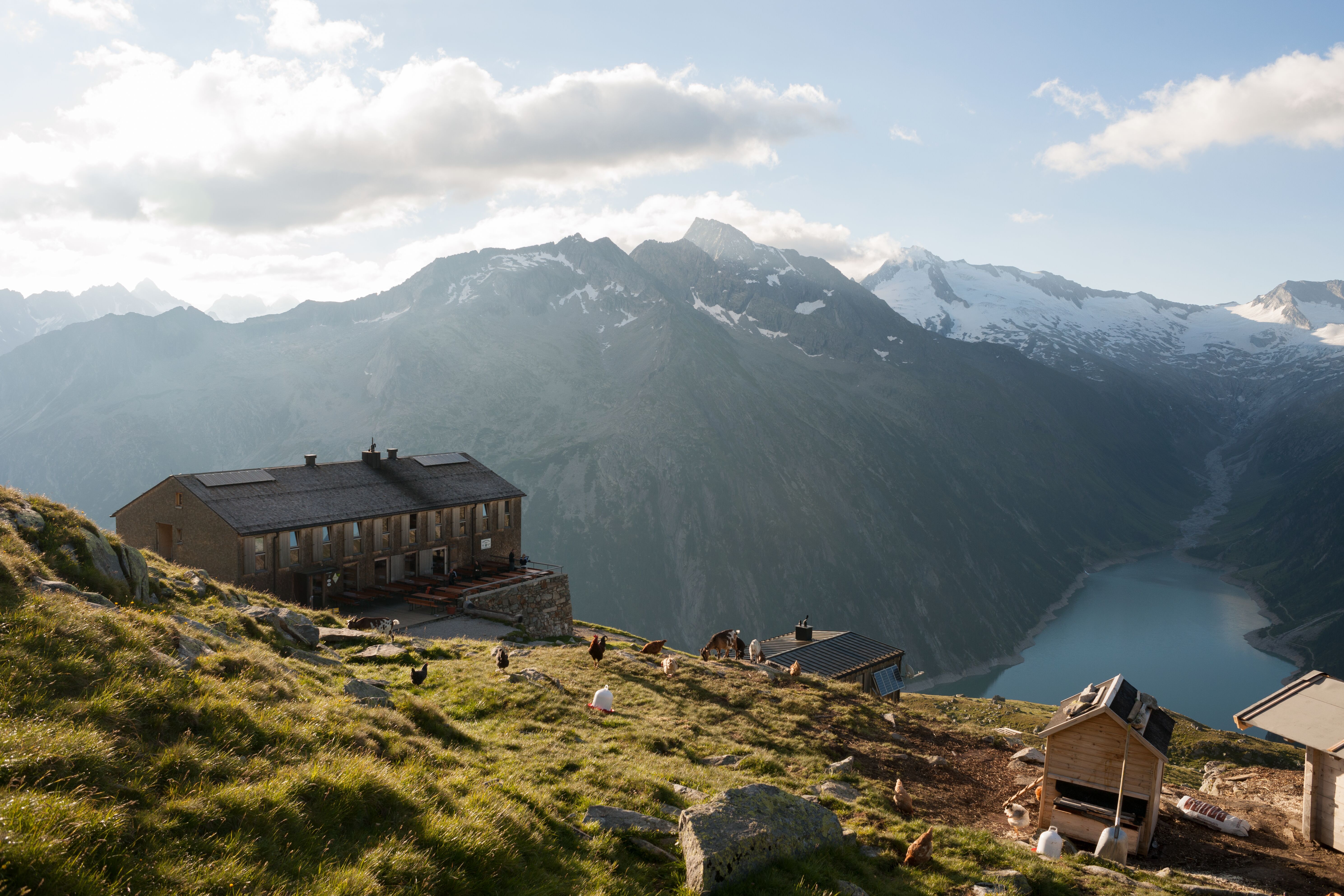
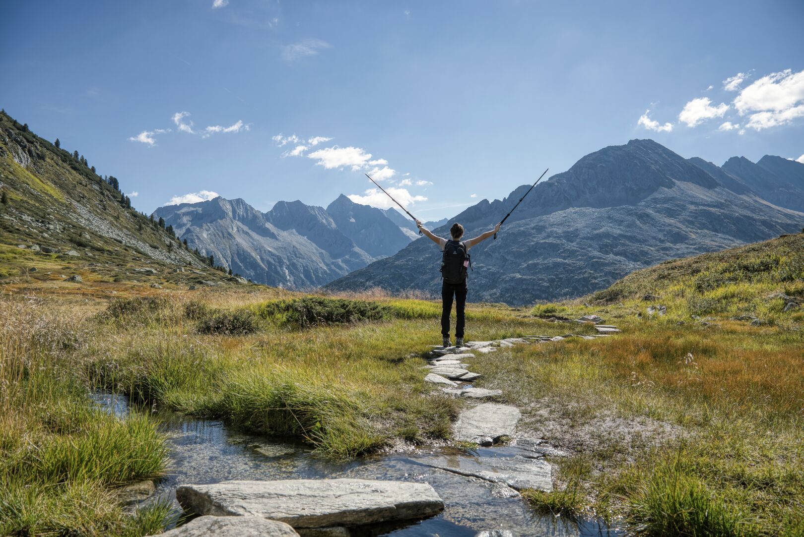
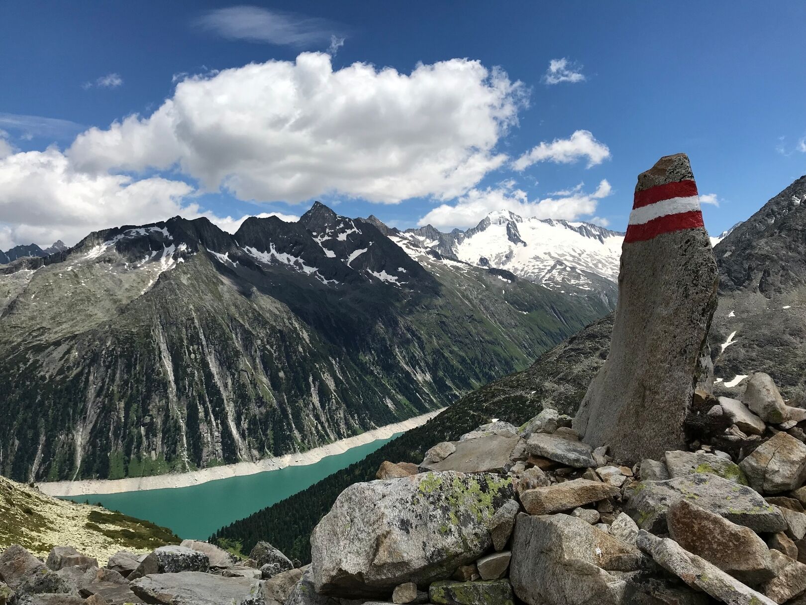
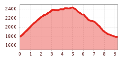
This circular hike starts at the parking lot at the Schlegeis reservoir, nähe Jausenstation Zamsgatterl, 1.785 m. You'll follow trail No. 502 towards Olpererhütte, 2.389 m, initially through the forest and then across fields of Latschen, always keeping the Schlegeis reservoir in sight. About halfway, the terrain becomes more rugged and rocky. After approximately 2 hours, you'll reach Olpererhütte, 2.389 m. Continuing on trail No. 502 towards the south, you'll come to the foothills of Riepengrat, marked by a large cairn. From here, it's a gentle descent into the Unterschrammachkar to a fork in the trail. Follow trail No. 535 downhill along the Unterschrammach stream and cross it at the end of the flat ground via a small bridge. Then, traverse through fields of Latschen until you reach Zamsgatterl,1.785 m, before returning to the starting point. This tour can also be completed in reverse.
Bus line: 4102, Stop: Schlegeis Stausee
www.mayrhofen.at/timetables


 © Bergbahn Pillersee.jpg")


 Sportalpen (21).jpg")


