
Opening hours:Open today
Place:
Fließ
:
Restaurant, Tavern, Alpine pasture / hut / mountain restaurant
Wonderful hike from the nature park community of Fliess via the forest pond and the Gogles Alm 2,017m to the Glanderspitze 2,505m.
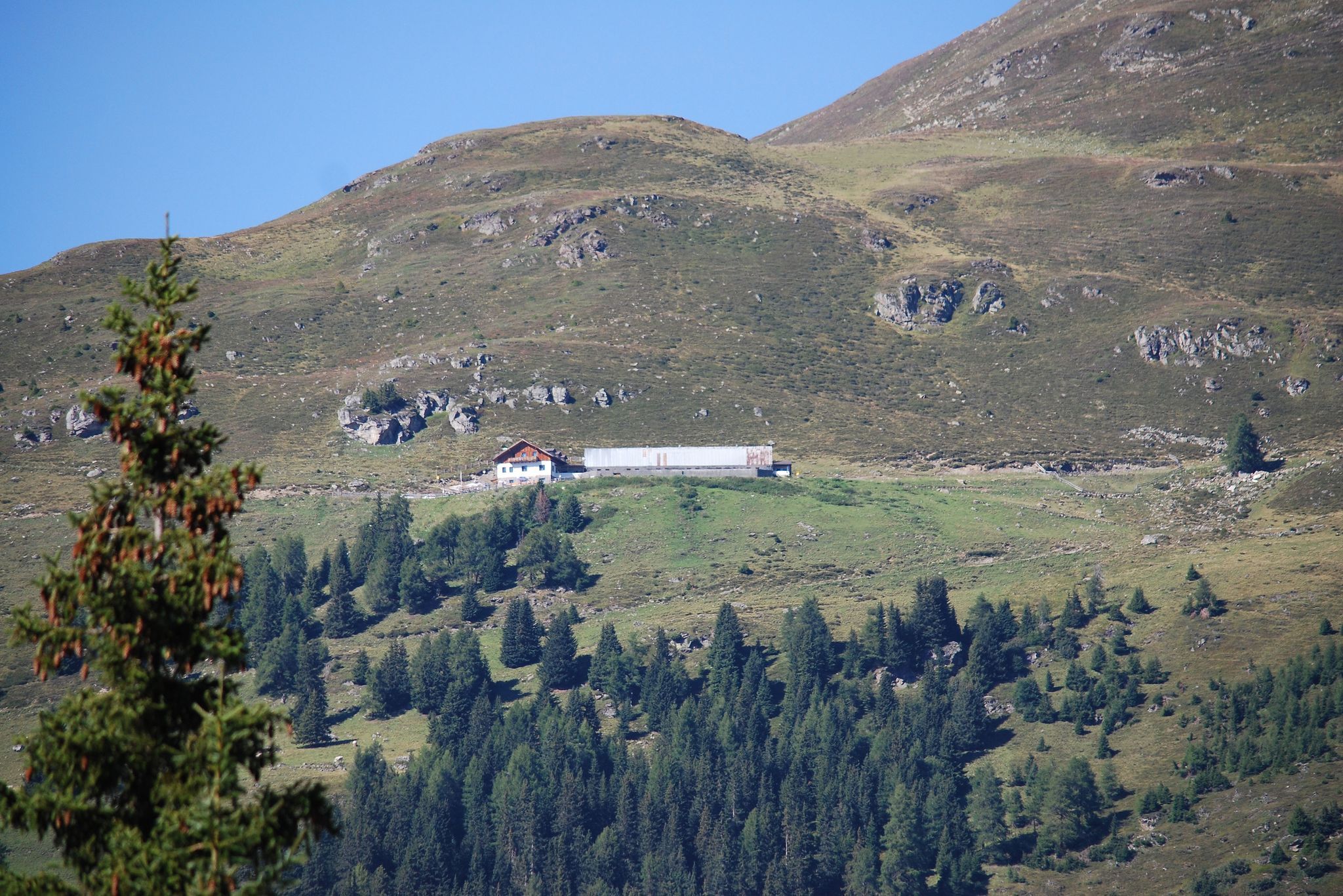
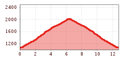
From the parish church in Fliess, head in the direction of Biedenegg Castle. After the castle, take a steep right-hand bend uphill towards Kälgergatter. From there, follow the path up to the forest pond. The trail continues uphill through the Gogleswald forest until you finally reach the Goglesalm (2,017 m, walking time approx. 4 hours). Here you can fortify yourself and enjoy the marvellous view of the mountains of the Kaunergrat Nature Park.
From the hut, first follow the E5 towards Wenns and then keep left following the signs up to the Glanderspitze. The path winds its way in pleasant hairpin bends over grassy hills towards the summit. On the Glanderspitze (2,505 m) you can enjoy a marvellous panoramic view of the breathtaking mountain world.


.jpg")
.jpg")


