
Difficulty:medium
Length:10.1 kmDuration:11:20 hElevation uphill:1,554 m
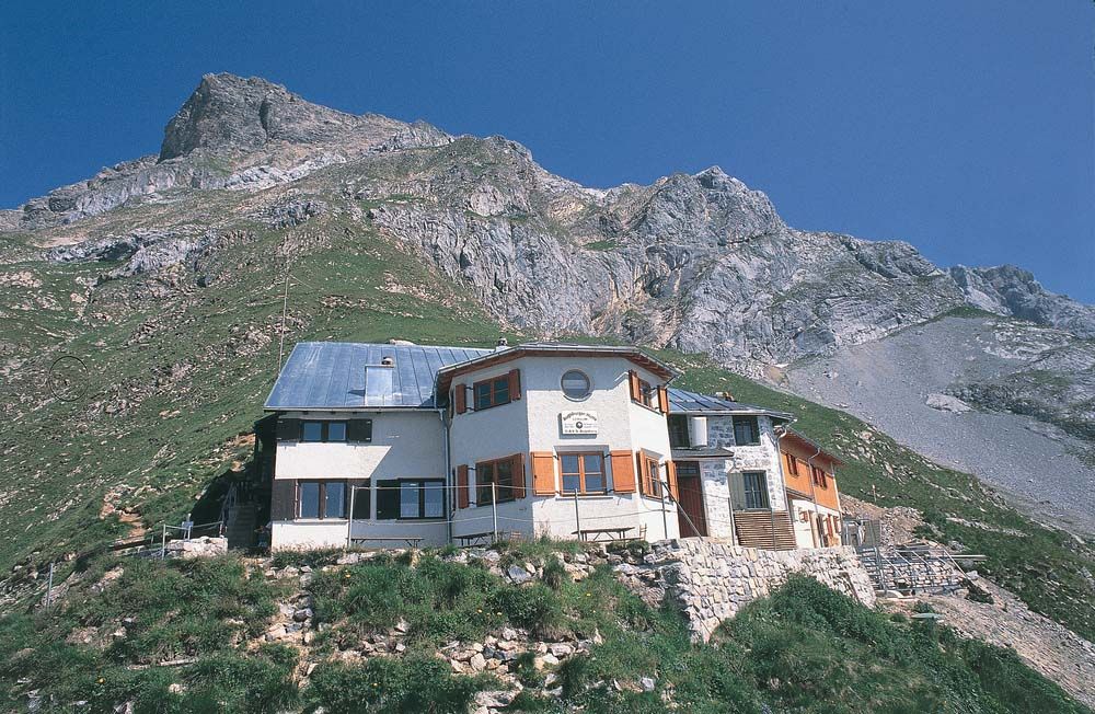
The hut stands on a rocky outcrop from which you can enjoy a magnificent view. It is also the base of the Lechtaler Höhenweg and the starting point for the Parseierspitze, the highest peak in the Lechtal Alps.
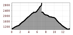
Day 1 - 5.5 km; 1225 metres difference in altitude; ascent 4:45 h:
At the swimming pool, a moderately steep footpath branches off to the right. With the destination constantly in sight, you hike across beautiful pastures until the path narrows to a climb. The path winds its way steeply through the mountain pines up to Gasillboden (1,597 m). It takes about 2 hours to reach this point and you have covered 600 metres in altitude, but still have 600 metres to go. The trail leads over the Gasillbach stream and climbs steeply in many hairpin bends up to the spring at the ‘Muesmannsruhe’, the only spring in the entire area. At around 2,100 metres, the Gasillbach stream is crossed again. After a few hairpin bends, the narrow trail turns off to the right and climbs only slightly up to the hut.
Day 2 - 1.9 km; 719 metres of ascent; ascent 2:30 h:
From the hut, take the narrow path back to the Gasilltal valley and turn right there. Climb over scree up to the Fernerwand. From here, the path winds over stone slabs and narrow ledges (secured by a wire rope) and continues over a scree-covered slope up to the trough edge of the Grinner Ferner. Keep to the numerous footprints in the snow and climb straight ahead to the signposted entrance to the Parseierspitze. At first, the path leads over rock steps to the right, from the centre of the wall you turn left. From here you reach the summit of the Parseierspitze 3,036 m in a few minutes after approx. 3.8 km and 800 metres of ascent.
The descent to the Augsburger Hütte is via the same route.
TIP:
From the Augsburger Hütte down into the valley, you can also take the route via the Ochsenalm


.jpg")


.jpg")
