
Difficulty:
difficult
Length:
66.4 km
Duration:
7 days
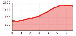
Elevation uphill:
5,496 m
Beautiful hike from Grins via the Grinner Schihütte and Dawin to the Strenger Schihütte and Dawin Alm.
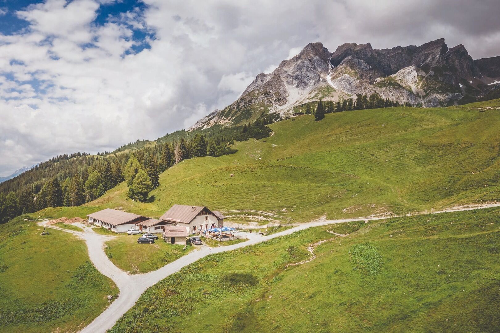
From the Grins municipal office, the hike leads along the Lattenbach Tobl stream up to Gmar and on to Grist. There, the path branches off to the right and leads along a path through woods and meadows up to the Grinner ski hut. Passing the Grinner ski hut, you reach the highest point of the hike and then continue left to the Strenger ski hut and the Dawin Alm at 1,819 metres.
The way back to Grins follows the same route.


.jpg")


.jpg")


