Mountain hikes Kitzbüheler Horn

closed
Kirchdorf in Tirol / Kitzbüheler Alpen
Difficulty ratings: medium
Route length: 20.0 km
Duration: 10:00 h

THE Vista Mountain in the Kitzbühel Alps!

Tour information

  • Requirement: medium
  • Length: 20.0 km
  • Duration: 10:00 h
  • Elevation uphill:1,342 hm
  • Elevation downhill:1,340 hm
Highest point1,962 m

Starting point

Oberndorf in Tirol - Wiesenschwang

Finishing point

Oberndorf in Tirol - Wiesenschwang
  • Fitness level 4 / 6
  • Technique 3 / 6

Best time of year

  • January
  • February
  • March
  • April
  • May
  • June
  • July
  • August
  • September
  • October
  • November
  • December

Trail condition

forest and meadow paths, partially exposed mountain trails

Equipment

- outdoor clothing
- sturdy shoes
- Sufficient food and drinks
- First aid kit
- Mobile phone with full battery & charger
- Hiking map & guide literature
- GPS device or download the GPS data to your mobile phone if necessary
- Sun protection (sunglasses, sun cream, cap)
- Rain protection
- Cash

Description

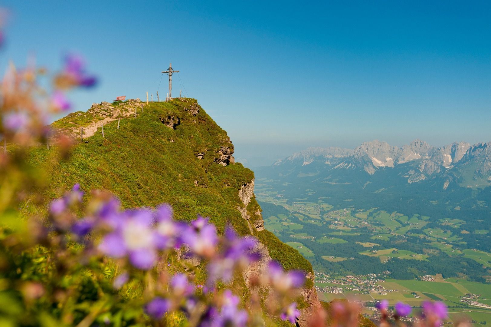
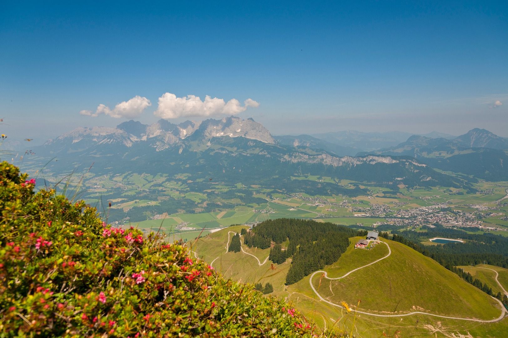
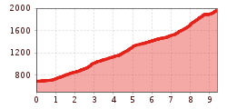
Start this hike in the hamlet of Wiesenschwang in Oberndorf where you follow the signs to Bassgeiger Alm and Müllneralm. Just after Müllneralm pick up the narrow path through forest and meadows to Stanglalm. From Stanglalm the trail climbs gently to Harschbichl where you follow Ludwig-Scheiber-Steig trail to the cross on Kitzbüheler Horn. This part of the hike is especially scenic with plenty of great vista points. The last, short, stretch to the summit is along an asphalt road. Take the gondola down to the valley to Kitzbühel and hop on the train to get back to your starting point.
 

Getting here

  • Arrival by public transport

    Giselabahn 201Getting out at station: Oberndorf in Tirol train station
    Postbus 4000 or 4012: Getting out at station: Oberndorf i. T. Ort

  • Parking

    Oberndorf Penzing free car park

More tours in the surrounding area

Newsletter

The mountain is calling? So does our newsletter!

In our monthly newsletter we reveal the best holiday tips for Tyrol.