Mountain hikes Kleiner Panoramaweg

Kirchbichl / Kitzbühel Alps
Difficulty ratings: easy
Route length: 4.3 km
Duration: 1:30 h

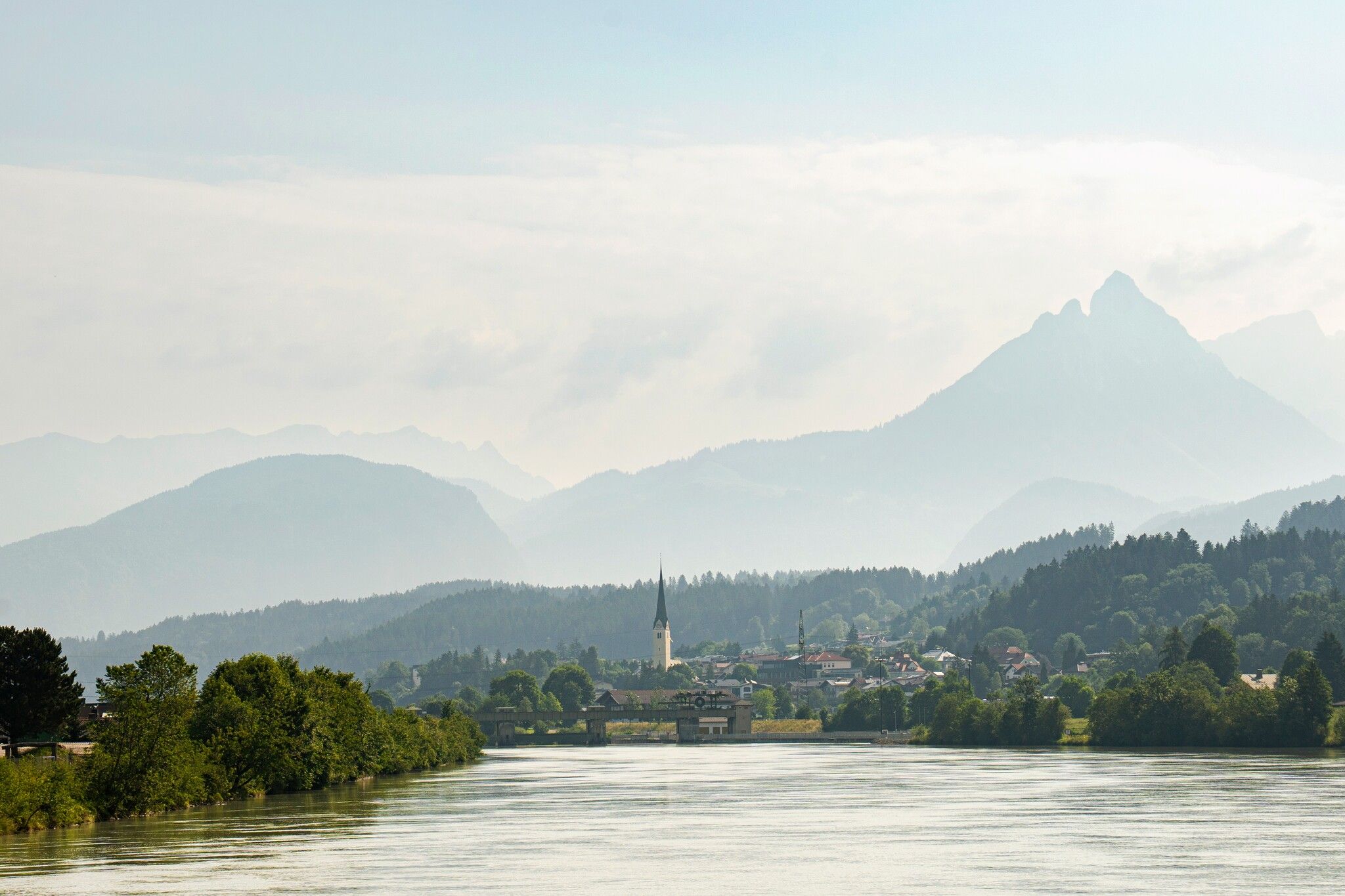
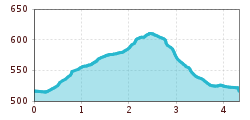
A varied hike with beautiful views and a forest playground

Tour information

  • Requirement: easy
  • Length: 4.3 km
  • Duration: 1:30 h
  • Elevation uphill:100 hm
  • Elevation downhill:100 hm
Highest point610 m

Starting point

Tourist information office Kirchbichl

Finishing point

Tourist information office Kirchbichl
  • Fitness level 1 / 6
  • Technique 1 / 6

Features

  • Circular route
  • Suitable for families
  • suitable for pushchairs

Best time of year

  • January
  • February
  • March
  • April
  • May
  • June
  • July
  • August
  • September
  • October
  • November
  • December

Trail condition

Asphalt, gravel

Equipment

Outdoor clothing, sturdy shoes 
Source: Kitzbüheler Alpen Management GmbH

Description

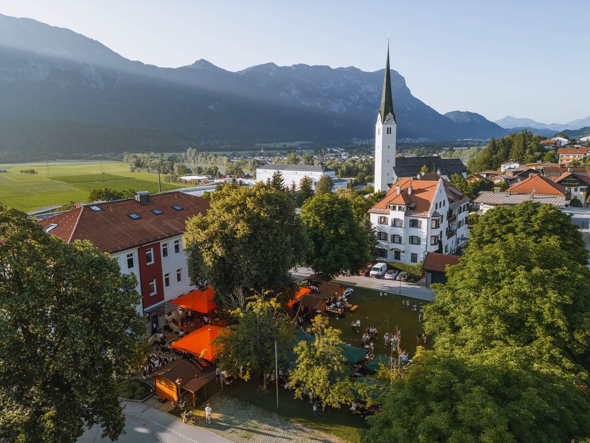
The starting point of the tour is the information office in Kirchbichl. From here, walk left along Ulricusstraße until you reach the cemetery. There you turn right into Tiroler Straße and follow the path on the other side of the road. Through a small section of forest, past the Großkinkhof farm, you reach the Kirchbichl forest playground on a panoramic hill with a wonderful view of the Inn valley. After the playground, continue along the path until you reach Häringer Straße. Follow this road for about 30 m in the direction of Bad Häring and then turn right again.
Now follow the signs to Kirchstieglstraße. At the next junction turn left towards the lido. At the lido, turn right in the direction of "Plattnbichl" and follow the road in the direction of the town centre.

Nearby huts and mountain restaurants

Getting here

  • Arrival by public transport

    Bus: bus stop Kirchbichl primary schools

    Guest card of the region = train ticket from Kirchbichl to Hochfilzen + bus ticket from Mariastein to Kitzbühel included! 
    Valid on ÖBB local trains (S, REX) and InterRegio trains (IR) between Kirchbichl - Wörgl and Hochfilzen.
    Not valid on RJ, RJX, EC, IC, ICE, D and NJ/EN trains.


    More detailed information: www.hohe-salve.com/mobility
     

  • Parking

    Parking garage Kirchbichl
    Parking place Pfarrgasse
    Parking place Strandbad

More tours in the surrounding area

  • Kaunerberger Wasserweg

    Difficulty:medium
    Length:15.2 kmDuration:6:00 hElevation uphill:935 m
  • Rolli-Wanderung Aifner Alm

    Difficulty:medium
    Length:6.0 kmDuration:2:30 hElevation uphill:460 m
  • Möslalmkogel via Wörgl

    Difficulty:medium
    Length:10.3 kmDuration:3:30 hElevation uphill:580 m
  • Hohe Aifnerspitze (2.779 m)

    Difficulty:medium
    Length:7.2 kmDuration:5:15 hElevation uphill:815 m
Newsletter

The mountain is calling? So does our newsletter!

In our monthly newsletter we reveal the best holiday tips for Tyrol.