Mountain hikes Memminger Hütte - Augsburger Hütte

Zams / Lechtaler Alpen
Difficulty ratings: difficult
Route length: 6.2 km

Demanding alpine hike.

Tour information

  • Requirement: difficult
  • Length: 6.2 km
  • Elevation uphill:767 hm
Highest point2,892 m

Starting point

Memminger Hütte

Finishing point

Augsburger Hütte
  • Fitness level 3 / 6
  • Technique 3 / 6

Best time of year

  • January
  • February
  • March
  • April
  • May
  • June
  • July
  • August
  • September
  • October
  • November
  • December

Trail condition

Mountain path

Equipment

Good equipment is essential for your hike. The following items should definitely be in your rucksack: - Food and drink - Functional clothing for rain, wind and cold - A change of clothes - Sun protection - First aid kit - Mobile phone with a full battery (Euro emergency number 112) - Hiking map or GPS - Hiking poles Nevertheless, the following applies: light luggage is also easier to carry, so you should not weigh down your rucksack with unnecessary ballast. In addition, your hiking equipment should of course also be adapted to your particular hiking tour.
Source: Tirol West

Description

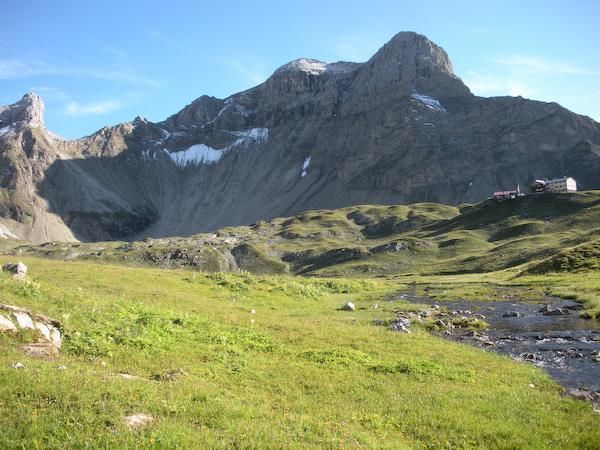
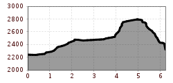
Mountain tour via the Spiehlerweg (Patrolscharte, Parseierjoch, Wegscharte)  

Getting here

  • Arrival by public transport

    Regiobus stop Bach-Dorf Madautaltaxi from mid-June to the end of September

More tours in the surrounding area

Newsletter

The mountain is calling? So does our newsletter!

In our monthly newsletter we reveal the best holiday tips for Tyrol.