
Opening hours:Today closed
Place:Kössen
:Alpine pasture / hut / mountain restaurant
Trail Nr.: 22; 21
Hiking trail, forest road
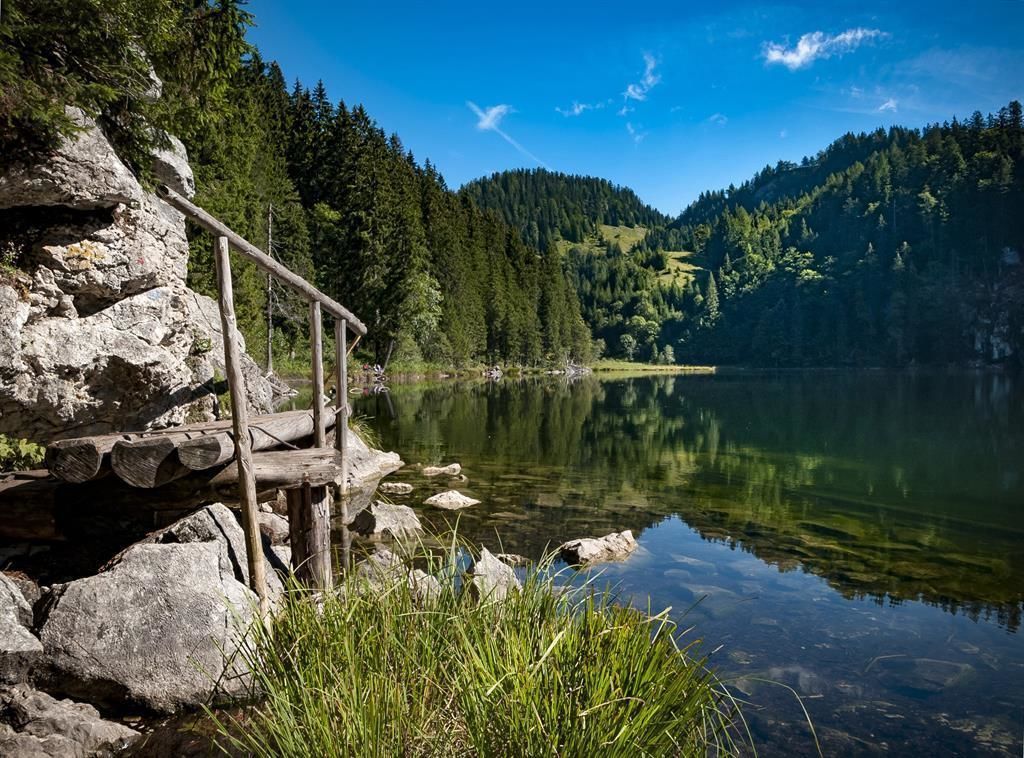
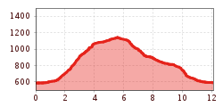
The starting point is at the Kössen Information Office. Shortly after the turnoff to the Kössen Forest Adventure Pool, take the second right turn toward the Kalkpoint farm. Keep left through the Black Forest until you reach the fork leading to the Moosen-Alm. From here, keep left across beautiful alpine meadows to the Taubensee Hut and on to Lake Taubensee. Descend via the steep forest road to the Hirzeggalm and from there back to the Ast zu Moosen-Alm. From here, take Trail No. 21 to the Schaffler parking lot or past the Mühlberghof (which serves food and drinks) back to the starting point.
Take the bus to the stop VZ Kaiserwinkl
(or to the stop Erlebnis-Waldschwimmbad - is a bit closer to the starting point of the hike)
In front of the Tourist office Kössen


.jpg")


.jpg")


