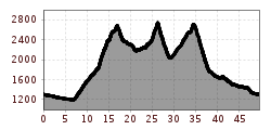
Mountain hikes St. Anton - Edmund Graf Hütte - Niederelbe Hütte - Darmstädter Hütte - Konstanzer Hütte - St. Anton
Open interactive mapOpen this POI on the interactive mapElevation profileSt. Anton - Edmund Graf Hütte - Niederelbe Hütte - Darmstädter Hütte - Konstanzer Hütte - St. Anton.gpx
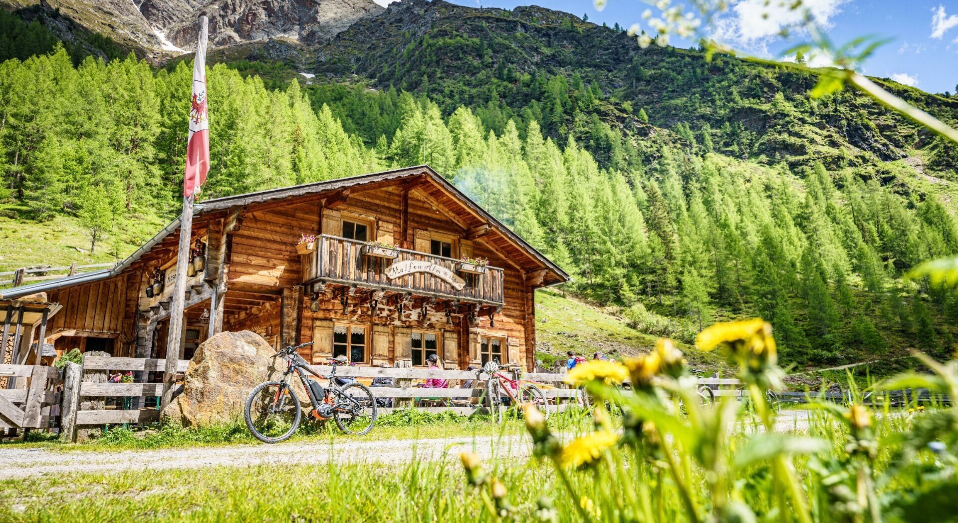
Malfon Alm © TVB St. Anton am Arlberg Patrick Bätz Malfon Alm - 1.687mOpening hours:Open todayPlace:Pettneu am Arlberg:Alpine pasture / hut / mountain restaurantsee restaurant detailssee restaurant details: Malfon Alm - 1.687m
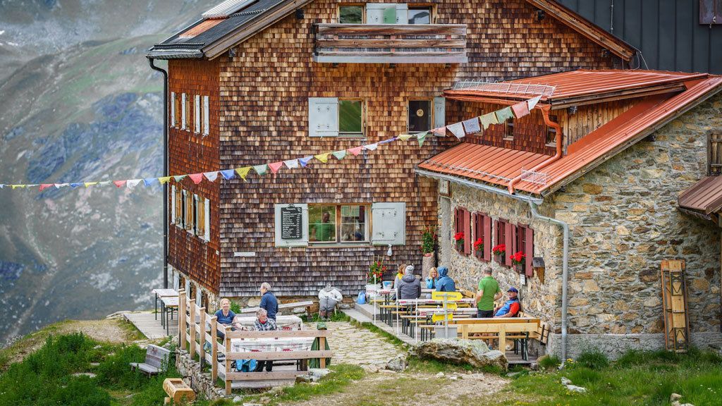
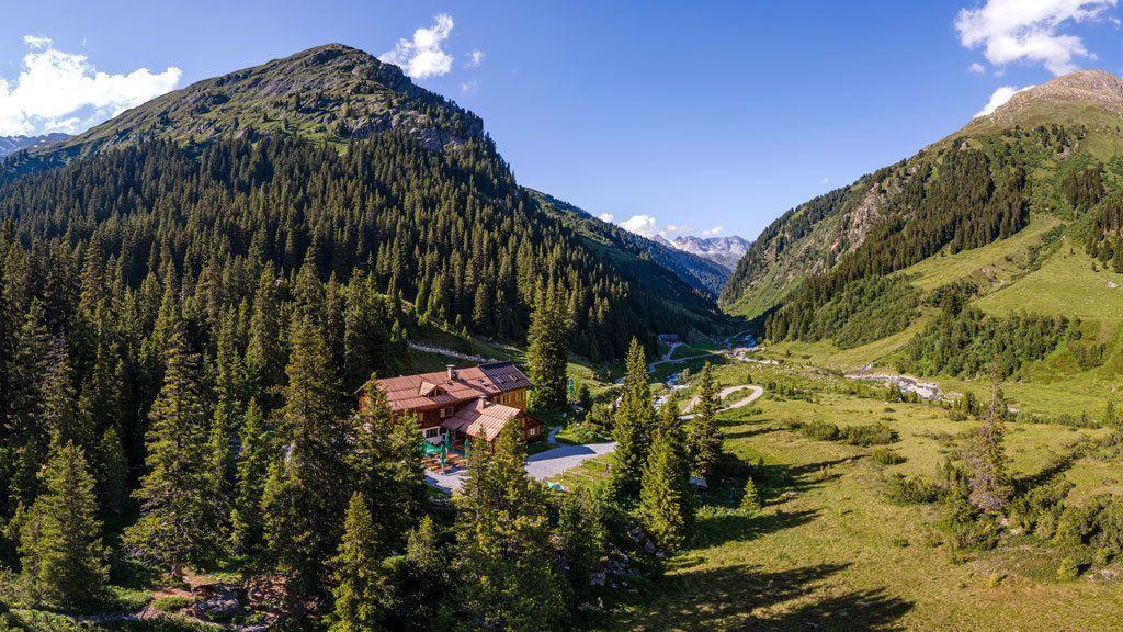
Niederelbe Hütte © Boris Dukanovic Niederelbe Hütte - 2.310mOpening hours:Open todayPlace:Kappl:Alpine pasture / hut / mountain restaurantsee restaurant detailssee restaurant details: Niederelbe Hütte - 2.310m
Edmund-Graf-Hütte © TVB St. Anton am Arlberg Patrick Bätz Edmund Graf Hütte - 2375mOpening hours:Open todayPlace:Pettneu am Arlberg:Alpine pasture / hut / mountain restaurantsee restaurant detailssee restaurant details: Edmund Graf Hütte - 2375m
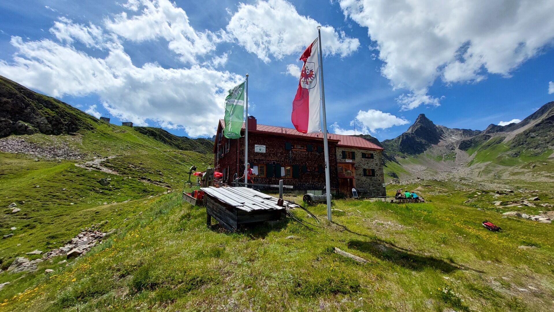
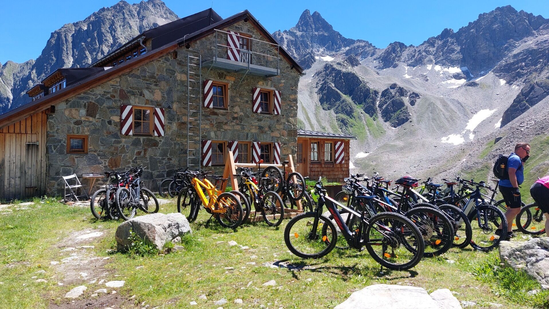
Darmstädter Hütte © TVB St. Anton am Arlberg Patrick Bätz Darmstädter Hütte - 2385mOpening hours:Open todayPlace:St. Anton am Arlberg:Alpine pasture / hut / mountain restaurantsee restaurant detailssee restaurant details: Darmstädter Hütte - 2385m
Konstanzer Hütte © TVB St. Anton am Arlberg Patrick Bätz Konstanzer Hütte - 1.688mOpening hours:Open todayPlace:St. Leonhard i. P.:Alpine pasture / hut / mountain restaurantsee restaurant detailssee restaurant details: Konstanzer Hütte - 1.688m
Putzen-Alm © TVB St. Anton am Arlberg Patrick Bätz St. Anton - PutzenalpeDifficulty:mediumLength:10.8 kmDuration:4:00 hElevation uphill:605 mSee trailSee trail: St. Anton - Putzenalpe
Kaiserjochhaus © Lechtal Tourismus Lechtaler Höhenweg: 3. Etappe Kasierjochhaus-Ansbacher HütteDifficulty:difficultLength:11.2 kmDuration:6:45 hElevation uphill:1,037 mSee trailSee trail: Lechtaler Höhenweg: 3. Etappe Kasierjochhaus-Ansbacher Hütte
Adlerweg © Lechtal Tourismus Ansbacher Hütte - Memminger HütteDifficulty:difficultLength:10.0 kmDuration:6:00 hElevation uphill:861 mSee trailSee trail: Ansbacher Hütte - Memminger Hütte
Schnanner Klamm © TVB St. Anton am Arlberg Yannick Rumler Schnann - Schnanner KlammDifficulty:mediumLength:900 mElevation uphill:180 mSee trailSee trail: Schnann - Schnanner Klamm
Arlberg_Marketing_Arlbergtrail_WEST © West Werbeagentur GmbH Arlberg TrailDifficulty:difficultLength:52.1 kmElevation uphill:4,730 mSee trailSee trail: Arlberg Trail
Arlbergtrail © Boris Dukanovic Arlberg Trail Etappe St. Anton - StubenDifficulty:mediumLength:17.4 kmElevation uphill:1,430 mSee trailSee trail: Arlberg Trail Etappe St. Anton - Stuben
Moostal © TVB St. Anton am Arlberg Patrick Bätz Darmstädter HütteDifficulty:mediumLength:12.2 kmDuration:5:00 hElevation uphill:1,100 mSee trailSee trail: Darmstädter Hütte
Eagle trail stage 24 © Tirol Werbung/Christian Klingler Eagle Walk Stage 24: Kaiserjochhaus - St. Christoph am ArlbergDifficulty:difficultLength:17.5 kmDuration:8:20 hElevation uphill:1,225 mSee trailSee trail: Eagle Walk Stage 24: Kaiserjochhaus - St. Christoph am Arlberg
Eagle trail stage 23 © Tirol Werbung/Dominik Gigler Eagle Walk Stage 23: Ansbacher Hütte - KaiserjochhausDifficulty:difficultLength:8.5 kmDuration:5:00 hElevation uphill:700 mSee trailSee trail: Eagle Walk Stage 23: Ansbacher Hütte - Kaiserjochhaus
hp-entrance-miracle-trail_1 © Sennhütte Senn's WunderWanderWegDifficulty:easyLength:1.0 kmDuration:0:30 hElevation uphill:81 mSee trailSee trail: Senn's WunderWanderWeg
Give feedback for a chance to win a special holiday experience!Click here for the surveyClick here for the survey