
Opening hours:Today closed
Place:Ebbs
:Alpine pasture / hut / mountain restaurant
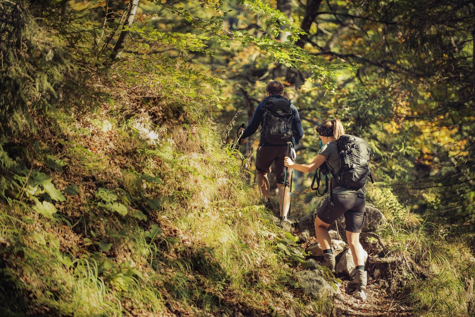
Hike through the mountain valley Kaisertal and learn about it.
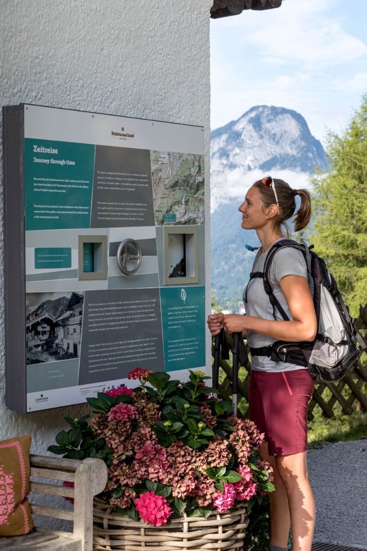
The mountain valley Kaisertal is under nature conservation and was only accessable by foot until 2008. In that year a tunnel was built and the inhibitant got a connection to public traffic that only they may use.
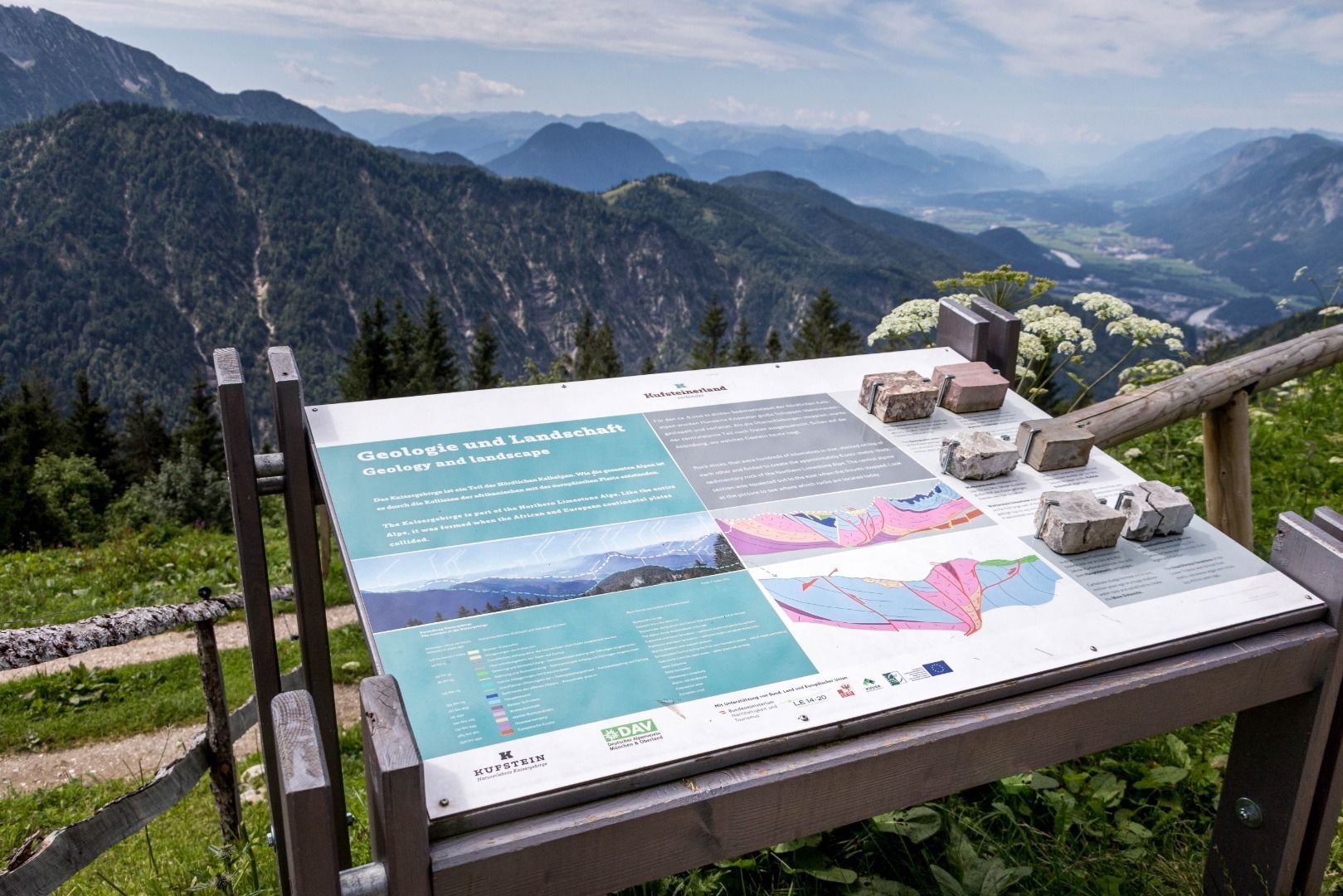
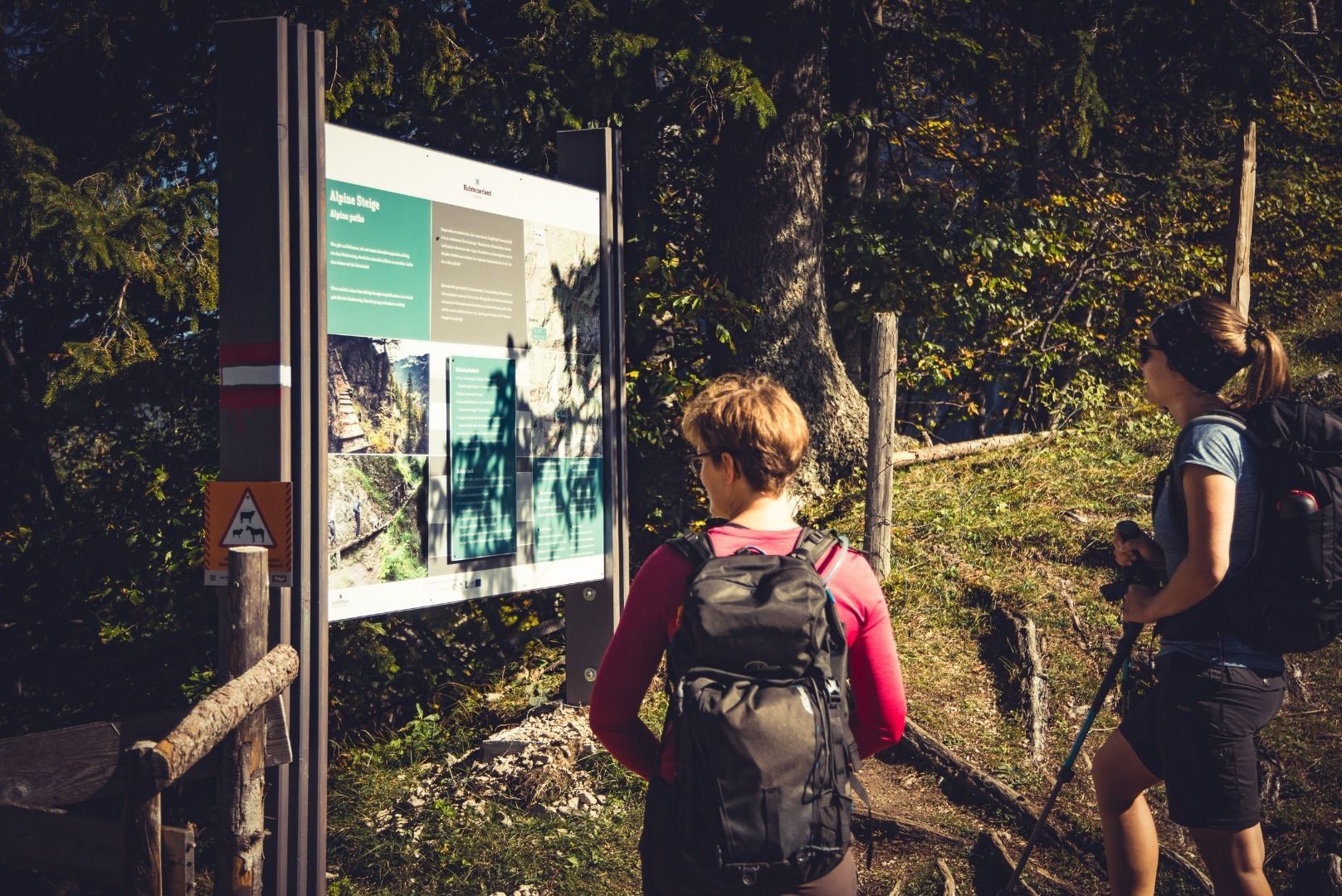
Since 2019 there are 11 interactive information boards that inform for example about the history of the valley, the geology in the Kaiser mountains and the regional meals.
On the suggested route you can see the information boards on your way thorugh the Kaiser mountains. The hike can be split up in 2 or 3 stages.
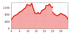
Stage 1: Kaiseraufstieg - Vorderkaiserfeldenhütte
Starting point is at the "Kaiseraufstieg" where you hike up the 300 stairs until the valley opens up in front of you. Always following the forest road we come to a fork in the road and go left in the direction of Ritzau Alm. Remaining on the same path, we pass the Ritzau Alm and ascend the last 200 meters to the Vorderkaiserfeldenhütte.
Distance: 5 kilometers
Difference in altitude: 900 metres ascent
Stage 2: Vorderkaiserfeldenhütte - Hans-Berger-Haus
From the Vorderkaiserfeldenhütte start east, first a few metres downhill, until on the first bend of the forest path the "Höhenweg" Nr. 811 branches off. We follow the path for a short while until a fork appears again. Here we turn right towards Anton-Karg-Haus/Hans-Berger-Haus/Stripsenjoch. We follow the path for a long time up to the stone field "Öchselweidkar", shortly after the field the path forks again and we turn right again towards Anton-Karg-Haus/Hans-Berger-Haus. Now it goes into the long descent until one has arrived below at the stream Bärentalbach. Now cross the forest path and go over the wooded ridge for approx. 100 metres in altitude in the direction of the hut Anton-Karg-Haus. From Anton-Karg-Haus follow the signs to Hans-Berger-Haus. After another short ascent the destination is reached.
Distance: 7 kilometers
Difference in altitude: 300 metres ascent / 750 metres descent
Stage 3 / Variante 1: Hans-Berger-Haus - Brentenjoch
The more demanding variant for the way back leads over the Bettlersteig to the Brentenjoch. First we descend in the direction of Anton-Karg-Haus. Before we pass the hut, a path branches left towards Brentenjoch/Gamskogel. We follow the trail for about 500 metres until we reach the open area of the Steinbergalmen at the top. Here we keep to the right and climb to the top of Gamskogel. We descend in western direction from Gamskogel. Now you can see the top station of the Kaiserlift. Only a short ascent to the top station, then we descend 800 meters with the Einsersessellift. From the car park of the Kaiserlift we take a wide field path to the right in the direction of Kaiserbach and back to the car park at the Kaiser ascent.
Route: 8.2 kilometres
Difference in altitude: 700 metres ascent / 250 metres descent
Stage 3 / Variante 2: Hans-Berger-Haus - Kaiseraufstieg
Version 2 of the third stage leads from the Hans-Berger-Haus back to the Kaiserstieg with a few metres of altitude difference. We first hike downhill to the Anton-Karg-Haus and then always follow the forest path in a westerly direction outwards along the valley.
Distance: 8.5 kilometres
Difference in altitude: 150 metres ascent / 500 metres descent
Vom Bahnhof Kufstein mit dem Regionalbus Linie 4030 oder dem Stadtbus Linie 2 zur Haltestelle Kaisertal.
Kaiseraufstieg (gebührenpflichtig)


.jpg")


.jpg")


.jpg")


