©-TVB-Tiroler-Oberland-Kaunertal-Michael-Veit-Klima-Führer-2018-Talwanderweg-Vergötschen-Platz-2018 © Michael Veit Talwanderweg KaunertalDifficulty: easy Duration: 2:30 h Elevation uphill: 295 m See trailSee trail: Talwanderweg Kaunertal
©-TVB-Tiroler-Oberland-Kaunertal-Teammedia-Michael-Obex-2021-Verpeilschlucht-_A025725.jpg © Teammedia, Michael Obex VerpeilschluchtOpening hours: closed Difficulty: medium Duration: 3:00 h Elevation uphill: 386 m See trailSee trail: Verpeilschlucht
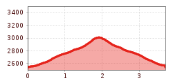
Brandenburgerhaus © Katharina Nösig Ötztal Trek Stage 15Difficulty: difficult Length: 6.5 km Duration: 2:30 h Elevation uphill: 332 m See trailSee trail: Ötztal Trek Stage 15
Evening winter hike Kleinmutzkopf, NaudersDifficulty: easy Length: 6.0 km Duration: 2:00 h Elevation uphill: 70 m Go to winter hikeGo to winter hike: Evening winter hike Kleinmutzkopf, Nauders
Winter walk Schwarzer See, NaudersDifficulty: easy Length: 10.5 km Duration: 3:30 h Elevation uphill: 255 m Go to winter hikeGo to winter hike: Winter walk Schwarzer See, Nauders
Großer MutzkopfDifficulty: easy Length: 10.3 km Duration: 4:00 h Elevation uphill: 507 m See trailSee trail: Großer Mutzkopf
Nauders mountain trailDifficulty: medium Length: 18.0 km Duration: 7:00 h Elevation uphill: 407 m See trailSee trail: Nauders mountain trail
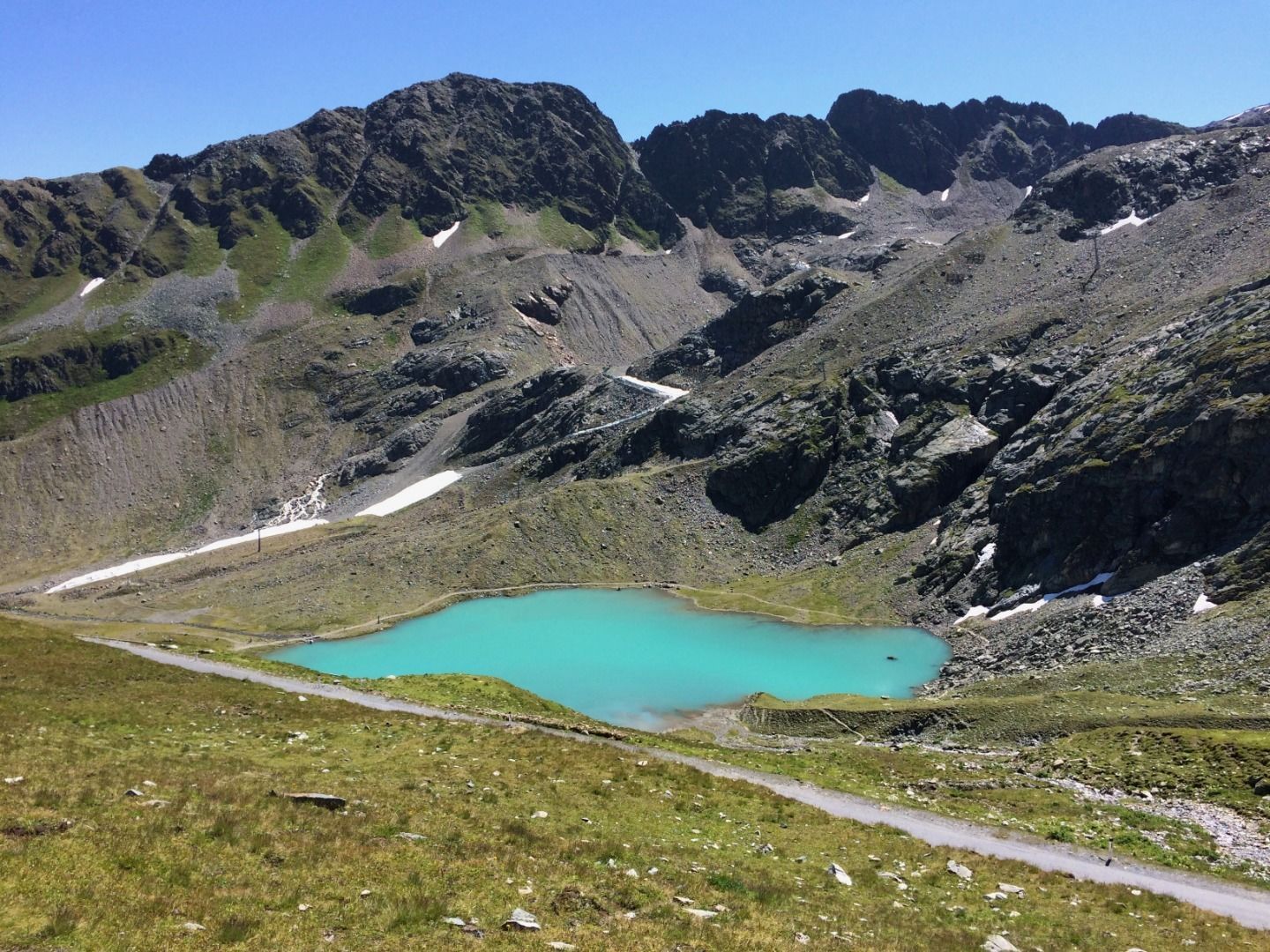
Schwarzer and Grüner SeeDifficulty: easy Length: 8.3 km Duration: 4:30 h Elevation uphill: 368 m See trailSee trail: Schwarzer and Grüner See
Wallfahrtsweg Kauns (1.050 m) - Kaltenbrunn (1.287 m)Difficulty: easy Length: 9.2 km Duration: 3:30 h Elevation uphill: 290 m See trailSee trail: Wallfahrtsweg Kauns (1.050 m) - Kaltenbrunn (1.287 m)
©-TVB-Tiroler-Oberland-Kaunertal-Martin-Lugger-2019-Winterwandern-Rodeln-Familie-LUG0758.jpg © Martin Lugger Winterwanderweg Aussichtsplattform Adlerblick (Kaunertal)Opening hours: closed Difficulty: easy Length: 3.2 km Duration: 2:30 h Elevation uphill: 372 m Go to winter hikeGo to winter hike: Winterwanderweg Aussichtsplattform Adlerblick (Kaunertal)
©-TVB-Tiroler-Oberland-Kurt-Kirschner-Tschey-Herbst-2017 (4).jpg © Kurt Kirschner Rundwanderung FrudigerDifficulty: medium Length: 13.5 km Duration: 5:00 h Elevation uphill: 588 m See trailSee trail: Rundwanderung Frudiger
Kapelle Maria SchneeDifficulty: easy Length: 1.7 km Duration: 0:30 h Elevation uphill: 90 m See trailSee trail: Kapelle Maria Schnee
Klammsteig - GreitOpening hours: closed Difficulty: medium Length: 8.8 km Duration: 3:00 h Elevation uphill: 469 m See trailSee trail: Klammsteig - Greit
©-TVB-Tiroler-Oberland-Daniel-Zangerl-Winterwandern-Kobl-2019 (51).jpg © Daniel Zangerl Winter hike Pfunds | Wild animal enclosure "FeichtiOpening hours: open Difficulty: easy Length: 900 m Duration: 0:40 h Elevation uphill: 105 m Go to winter hikeGo to winter hike: Winter hike Pfunds | Wild animal enclosure "Feichti
Give feedback for a chance to win a special holiday experience!Click here for the surveyClick here for the survey


.jpg")
.jpg")
.jpg")
.jpg")
.jpg")
.jpg")

.jpg")
")
.jpg")
.jpg")
