Walter Mair Trail Lienzer Talboden - Stage 3
Nikolsdorf /
Difficulty ratings: easy
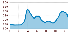
Route length: 14.0 km
Duration: 4:20 h

Walter Mair Trail Lienzer Talboden - Stage 3

Tour information

  • Requirement: easy
  • Length: 14.0 km
  • Duration: 4:20 h
  • Elevation uphill:330 hm
  • Elevation downhill:260 hm

Starting point

Talstation Hochsteinbahn

Finishing point

Talstation Hochsteinbahn
  • Fitness level 3 / 6
  • Technique 2 / 6

Features

  • Circular route

Best time of year

  • January
  • February
  • March
  • April
  • May
  • June
  • July
  • August
  • September
  • October
  • November
  • December

Trail condition

Asphalt, Forstweg, Waldweg, Steig, Schotter
Source: Lienzer Dolomiten

Description

The trail from Chrysanthen near Nikolsdorf, to the Zettersfeldbahn (cable car) station, passes through the four municipal areas of Nikolsdorf, Dölsach, Nußdorf-Debant and Gaimberg. From always a low elevation, you have a view of the large Lienzer Talboden.

More tours in the surrounding area

Newsletter

The mountain is calling? So does our newsletter!

In our monthly newsletter we reveal the best holiday tips for Tyrol.