Description
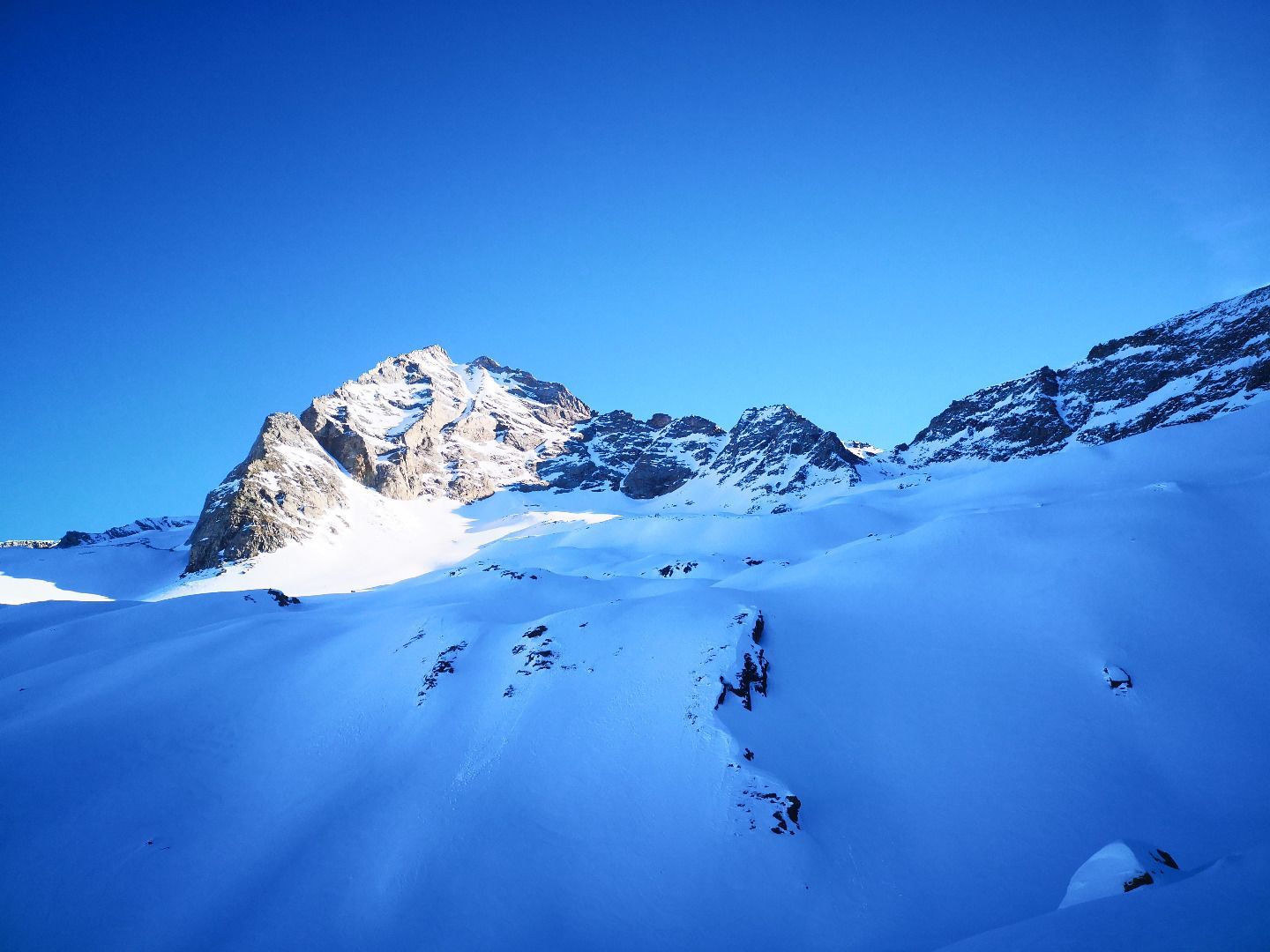
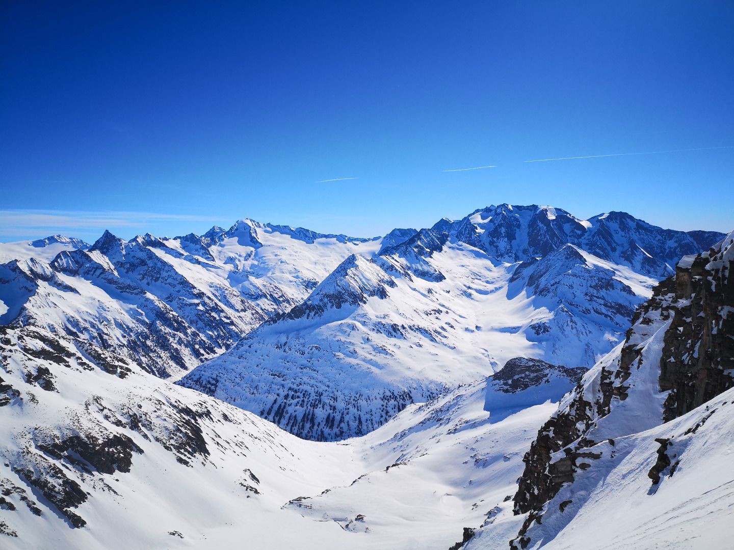
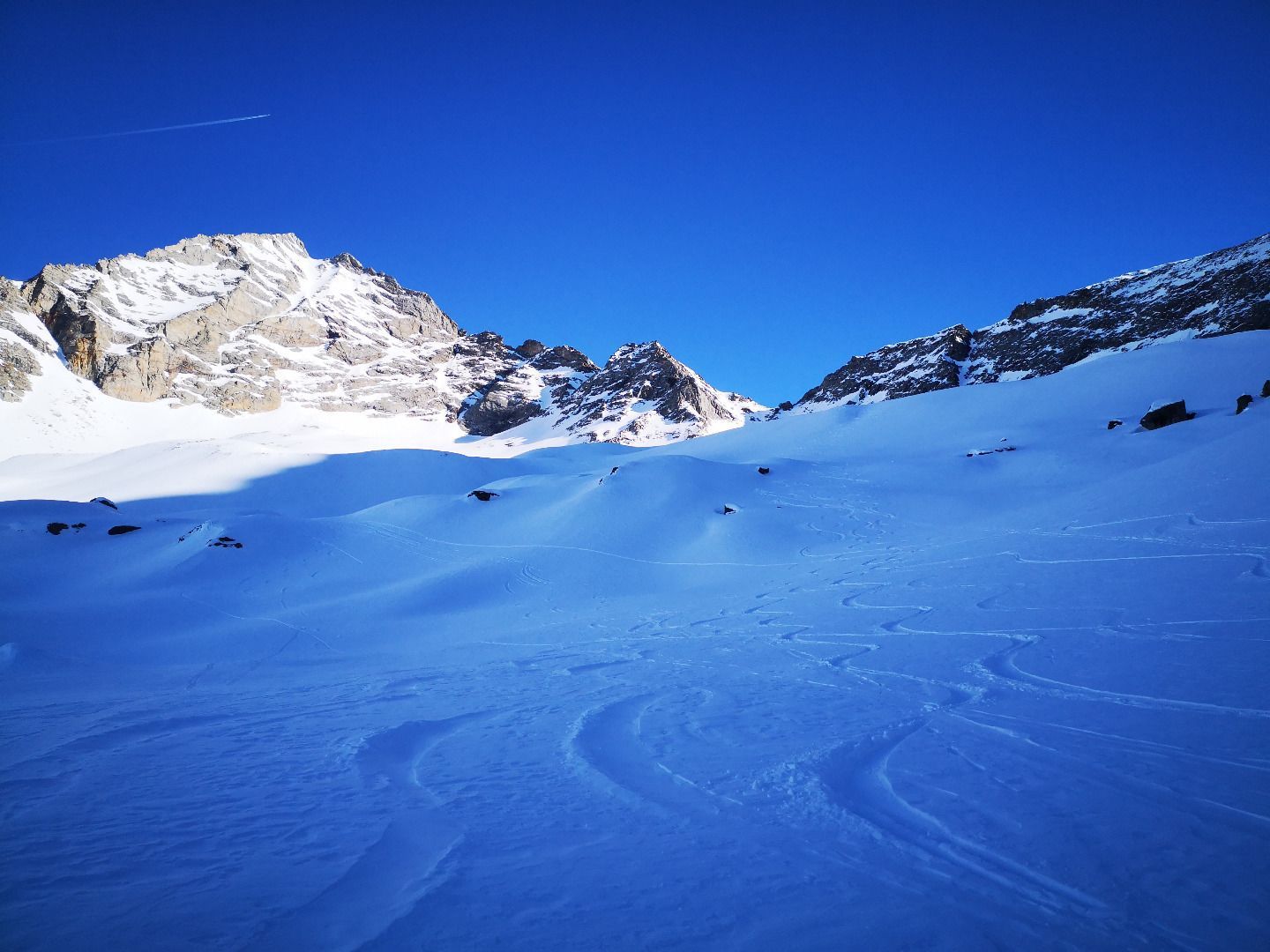
From the Nocker Alm, you first walk through alder forests into the Alterertal valley to the alpine pasture of the same name. The terrain starts to get steeper here and along deep snow-covered ditches you finally reach the first hilltop. Surrounded by the magnificent backdrop of Fußstein, Schrammacher and Sagwand, the trail continues between moraines and cirques to the former molybdenum mine at the foot of the Scharte. The last few metres up to the saddle are a bit steeper, but in slushy conditions it is often more pleasant to take off the skis and walk up. At the Scharte, a magnificent view of the highest peaks of the Zillertal Alps with Hochfeiler and Großer Möseler awaits, with the Hohe Tauern also smiling from the distance. But the most beautiful part of the tour, the descent over endless wide slopes with mostly great snow, is still to come.
ROUTE DESCRIPTION
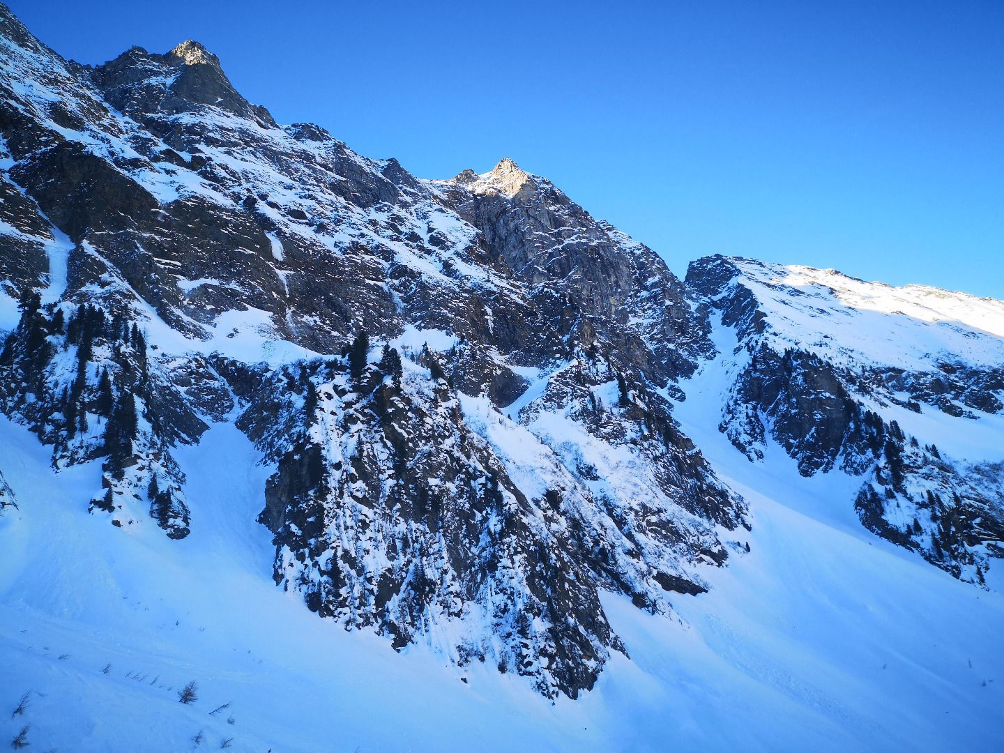
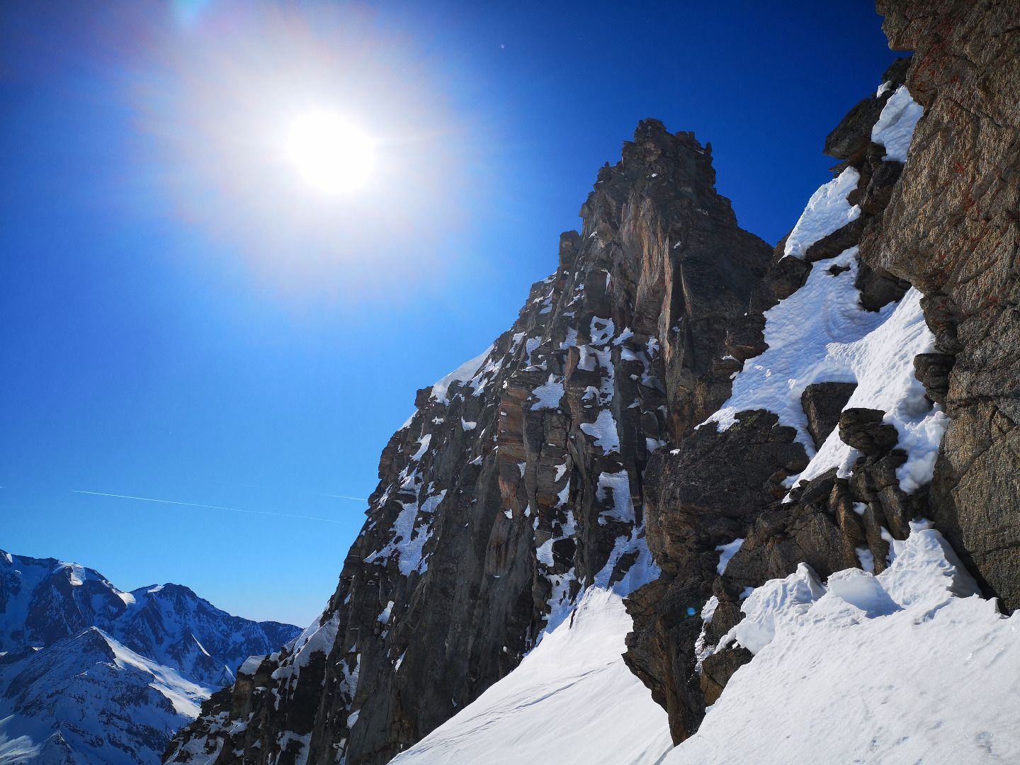
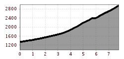
From the car park at the Nocker Almen, follow the road out of the valley over the bridge and then cross a field to the other side of the valley and the Hagers Kaser snack station (closed in winter). From there, follow the forest road in an easterly direction to the Altereralm. Alternatively, you can cross the alder forest directly from the car park in a north-easterly direction to the forest path, but this requires some local knowledge. In the area of the last alpine hut of the Altereralm, turn slightly right from the forest road into the middle of the valley and follow one of the numerous ditches back to a first steep step. Here again, bordered by ditches in the middle of the valley, a broad ridge stretches upwards, which is best followed in wide hairpin bends. Once you have reached the crest, the terrain becomes much flatter again. At first you follow a wide depression in a constant south-easterly direction, then after passing a small rock formation you turn 90° to the left - now in a north-easterly direction, you climb from ground to ground below the long marginal moraine of the former Alpei glacier to the scaffolding of the former molybdenum mine at 2750m. From here you have a good view of the last cirque below the Alpeiner Scharte to the east. The last slope is then also a bit tricky, both in high winter from an avalanche point of view and in hard, harsh conditions. It is best to stay on the left side here and conquer the last metres of altitude in narrow hairpin bends. If the ground is hard, it may sometimes be necessary to take off your skis completely and trudge up on foot - you should never slip here.
SAFETY ADVICE
The tour to the Alpeiner Scharte can only be undertaken when the avalanche situation is very good - both the steep adjacent southern flanks on the way to the Altereralm and steep slopes on the ascent pose a risk and should not be underestimated. In late winter, pay particular attention to wet snow avalanches on and off the path from the Alterertal, as numerous avalanche cones testify every year (depart early enough!). The last slope below the Scharte requires perfect hairpin turns and safe climbing, a fall here can have dire consequences.
TIP OF THE AUTHOR
The rear Vals Valley is of untouched beauty and always worth a visit. As an alternative to ski tours, cross-country skiing and tobogganing are also wonderful here.