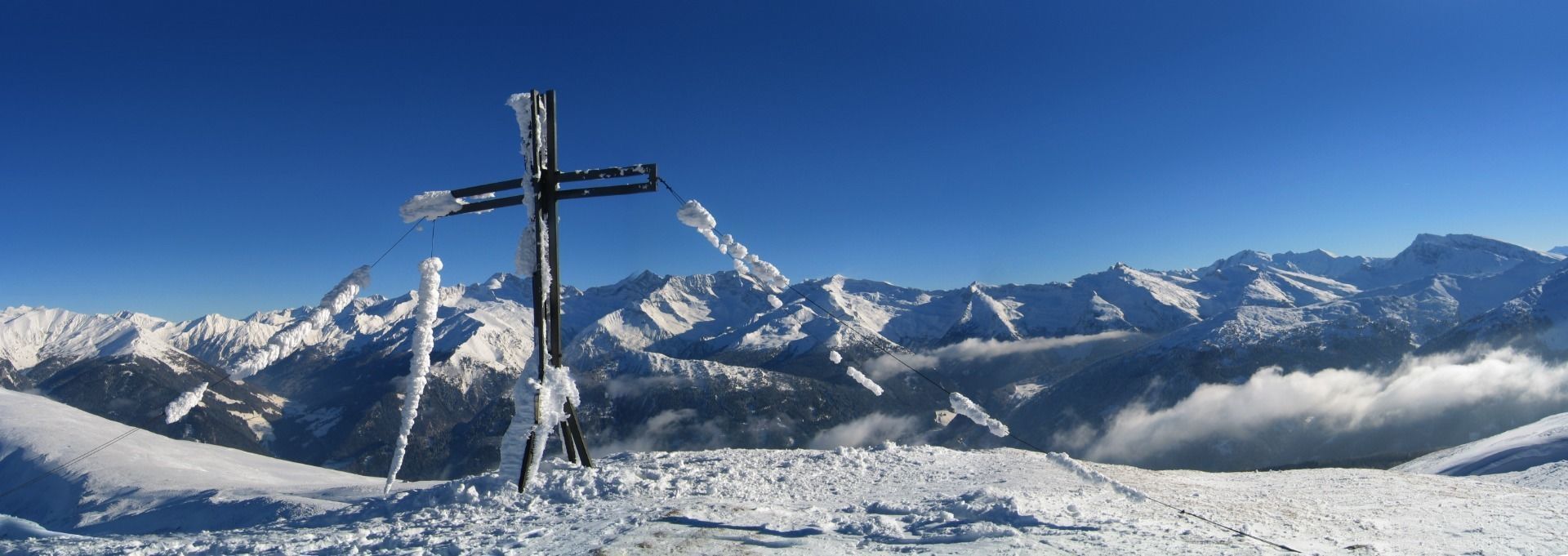
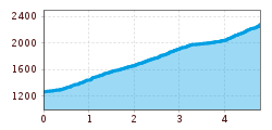
Eggerberg (2,280 m)

Route length: 4.7 km
Duration: 3:00 h

A gently ascending tour always through a larch forest. Very snow-sure, a highlight for lovers of forest descents especially when there is fresh snow!

Tour information

  • Length: 4.7 km
  • Duration: 3:00 h
  • Elevation uphill:1,011 hm
  • Elevation downhill:21 hm
Highest point2,280 m

Starting point

Parking spaces Vinaders

Finishing point

Eggerberg

Equipment

Ski touring equipment with shovel, search probe, avalanche transceiver, tea, drinks, snacks
Source: TVB Wipptal

Description

From the parking spaces, start in the direction of the valley and walk to a farm on the other side of the stream (bridge). Then the trail leads straight upwards across meadows to the edge of the forest. After the short stretch of forest, cross another meadow and keep a little to the left towards the Paulerhof farm with chapel. Pass the farm on the left and continue until you reach a path on the left edge of the meadow. Cross this and continue up through the forest until you meet the same path again. Pass a small cross and head northwest through the sparse larch forest up to fairly level terrain. Walk above the forest line in the direction of Eggerjoch (2,132 m), but turn right before it and walk across a hollow through two ridges to the summit with iron cross at 2,280 m.

Getting here

  • Arrival by public transport

    Take the train (S3, S4) to Steinach am Brenner and continue with the 4145 bus in the direction of Obernberg a. Br. to the bus stop at the Vinaders Inn. Start the ascent on the opposite side of the stream. Exact timetables can be found at www.vvt.at. Free use of the bus with the Wipptal Guest Card!

  • Parking

    Some parking spaces are available at the church and next to the road.

More tours in the surrounding area

  • Breiteggspitze

    Difficulty:easy
    Length:3.4 kmDuration:2:00 hElevation uphill:700 m
  • Bichalm

    Difficulty:easy
    Length:2.4 kmDuration:1:30 hElevation uphill:450 m
  • Mutterer Alm

    Difficulty:medium
    Length:3.1 kmDuration:2:00 hElevation uphill:581 m
  • Hoadl-Haus

    Difficulty:easy
    Length:7.6 kmDuration:2:25 hElevation uphill:778 m
  • Patscherkofel Schutzhaus

    Difficulty:medium
    Length:13.3 kmDuration:2:30 hElevation uphill:1,000 m
  • Eichenhof

    Difficulty:medium
    Length:4.7 kmDuration:2:50 hElevation uphill:898 m
  • Seefelder Joch

    Difficulty:medium
    Length:5.8 kmDuration:2:30 hElevation uphill:866 m
Newsletter

The mountain is calling? So does our newsletter!

In our monthly newsletter we reveal the best holiday tips for Tyrol.