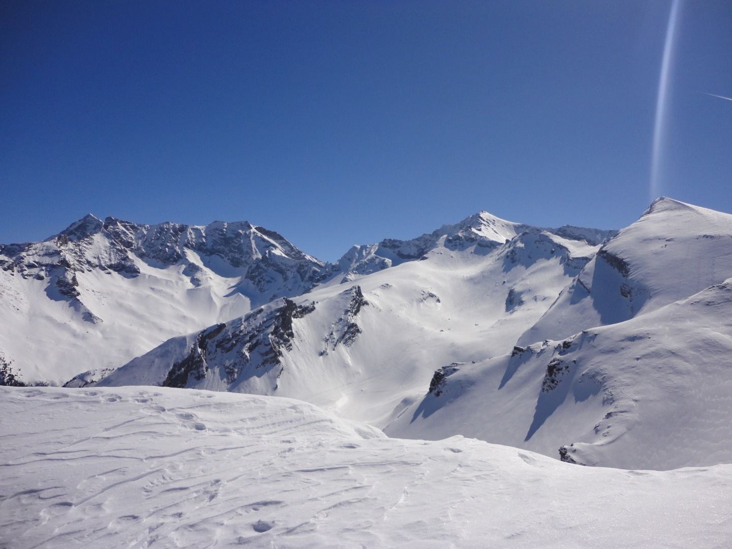
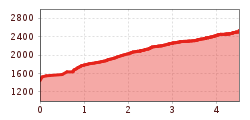
Gammerspitze (2,537 m)

Route length: 4.5 km
Duration: 3:30 h

Beautiful ski tour over a panoramic ridge with a view of the Olperer mountain.

Tour information

  • Length: 4.5 km
  • Duration: 3:30 h
  • Elevation uphill:1,100 hm
  • Elevation downhill:0 hm
Highest point2,537 m

Starting point

Parking area Muchnersiedlung

Finishing point

summit Gammerspitze

Equipment

Ski touring equipment with shovel, probe, avalanche transceiver, tea, drinks, snack, sun protection.
Source: TVB Wipptal

Description

First walk across a field in the direction of a farm, then by a large tree through a gap in the fence and along the forest aisle diagonally uphill to the left until you reach a hollow at 1,920m. Continue diagonally upwards to the left until you reach the forest line directly below the Ottenspitze. Continue up to the left to a small hut and over the ridge towards the east on the Windbühel. After a short descent to a saddle, continue up the broad ridge of the Gammerspitze to the summit with cross.

Descent as ascent.

Getting here

  • Arrival by public transport

    By train to Steinach am Brenner, from there with bus line 4144 to Schmirn to the Schmirn Lorleswald stop. Start directly at the bus stop. Exact timetables can be found at www.vvt.at. Free use of the bus with the Wipptal Guest Card!

  • Parking

    Sufficient parking facilities at the Muchnersiedlung parking area

More tours in the surrounding area

  • Breiteggspitze

    Difficulty:easy
    Length:3.4 kmDuration:2:00 hElevation uphill:700 m
  • Bichalm

    Difficulty:easy
    Length:2.4 kmDuration:1:30 hElevation uphill:450 m
  • Mutterer Alm

    Difficulty:medium
    Length:3.1 kmDuration:2:00 hElevation uphill:581 m
  • Hoadl-Haus

    Difficulty:easy
    Length:7.6 kmDuration:2:25 hElevation uphill:778 m
  • Patscherkofel Schutzhaus

    Difficulty:medium
    Length:13.3 kmDuration:2:30 hElevation uphill:1,000 m
  • Eichenhof

    Difficulty:medium
    Length:4.7 kmDuration:2:50 hElevation uphill:898 m
  • Seefelder Joch

    Difficulty:medium
    Length:5.8 kmDuration:2:30 hElevation uphill:866 m
Newsletter

The mountain is calling? So does our newsletter!

In our monthly newsletter we reveal the best holiday tips for Tyrol.