Gröbner Hals (1,654m)

Achenkirch am Achensee / Karwendel
Route length: 6.5 km
Duration: 2:30 h

Leisurely tour through the Unterautal valley in Achenkirch.

Tour information

  • Length: 6.5 km
  • Duration: 2:30 h
  • Elevation uphill:700 hm
  • Elevation downhill:0 hm
Highest point1,654 m

Starting point

Achenkirch, car park Unterautal

Finishing point

Achenkirch, Gröbner Hals (1,654 m)

Best time of year

  • January
  • February
  • March
  • April
  • May
  • June
  • July
  • August
  • September
  • October
  • November
  • December

Equipment

Snacks and drinks, helmet, avalanche safety gear (transceiver, shovel and probe), first aid kit, bivvy bag, and mobile phone. Avalanche airbags improve your chance of survival.
Source: Achensee Tourismus

Description

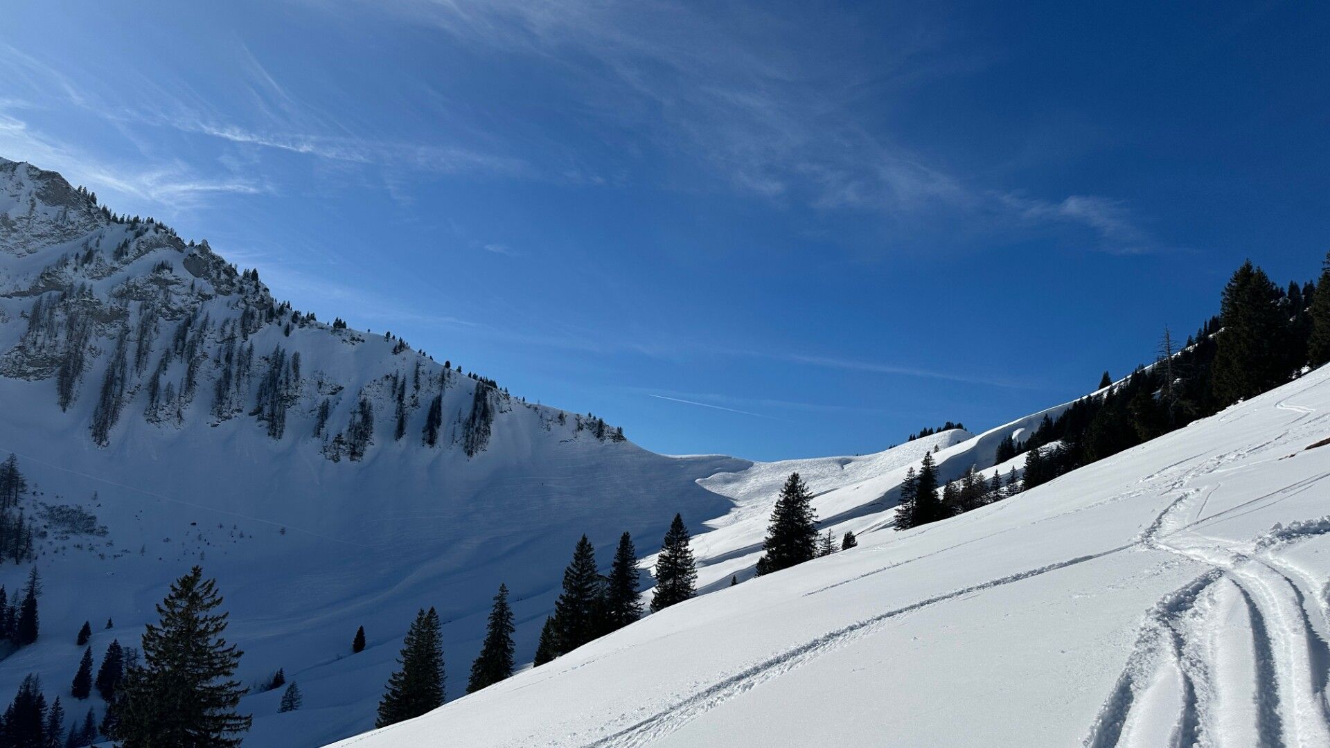
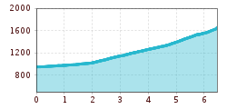
The ascent starts at the avalanche beacon checkpoint Unterautal and follows the winter hiking path to the Hochstegenalm (1,159m) and continues to the Gröbenalm (1,540m) and to the saddle of the Gröbner Hals.
The descent follows the ascent route.

Nearby huts and mountain restaurants

Getting here

  • Arrival by public transport

    Take the regional bus (lines 4080 or 390) to Achenkirch and get off the bus at "Achenkirch Christlumlifte" stop.

  • Parking

    Car park Unterautal or car park Unterautal Valley entrance in Achenkirch (both chargeable).

Newsletter

The mountain is calling? So does our newsletter!

In our monthly newsletter we reveal the best holiday tips for Tyrol.