Grubenkopf (2.339 m)

Route length: 5.7 km
Duration: 3:00 h

Scenic ski tour past Lake Obernberg - also suitable for beginners!

Tour information

  • Length: 5.7 km
  • Duration: 3:00 h
  • Elevation uphill:885 hm
  • Elevation downhill:11 hm
Highest point2,339 m

Starting point

Parking lot Waldesruh at the end of the village

Finishing point

Gipfel Grubenkopf
Source: TVB Wipptal

Description

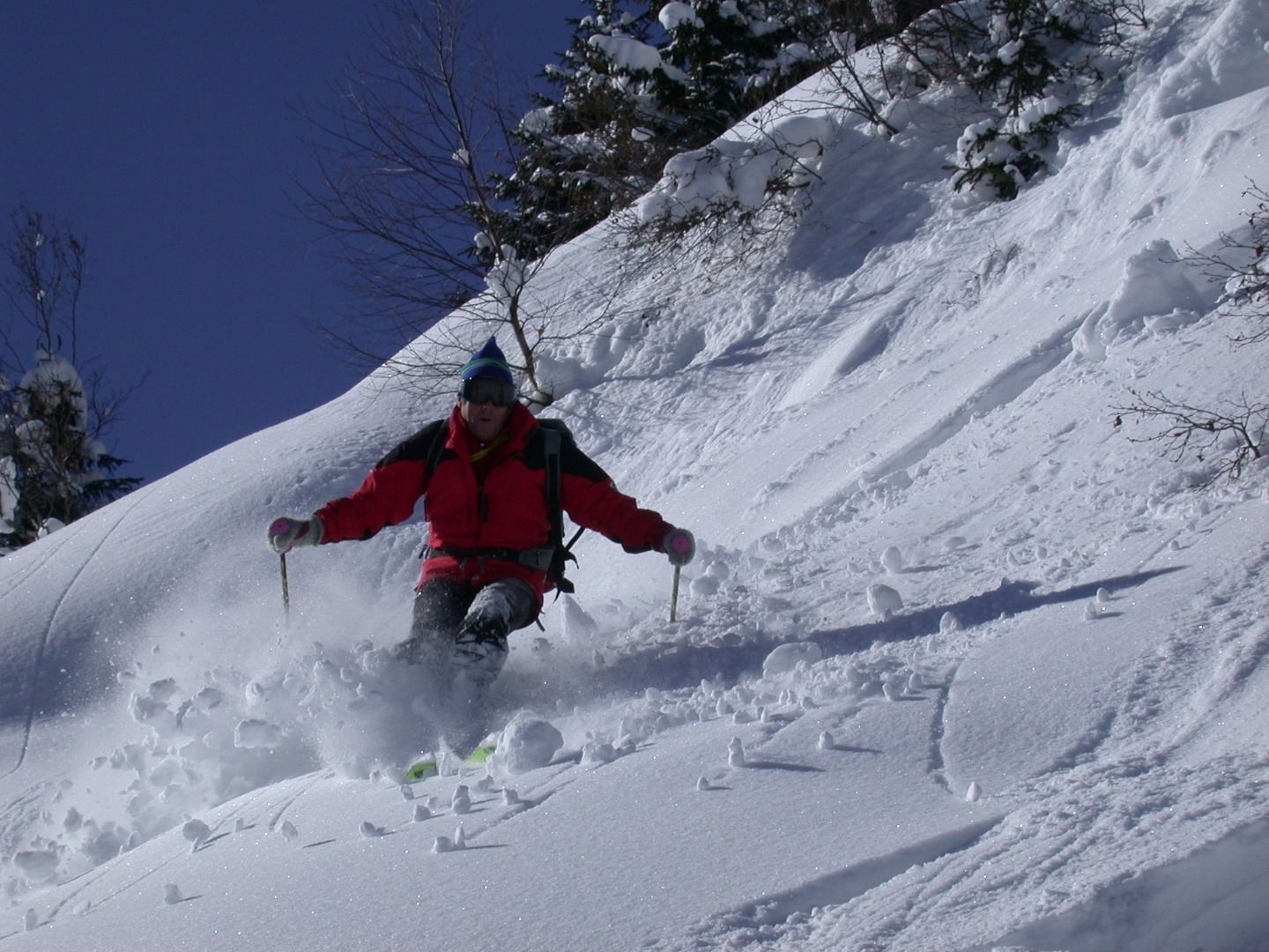
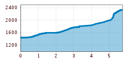
Walk along the path to the Obernberger See lake and then along the left shore of the lake to a bridge where there is a small chapel on the right. From there, follow the marked path to the Sandjoch until you reach a signpost at about 1700m. Then turn left over a flat area and a ridge. Continue to the right past a hill and into a hollow, which you follow to the Grubenjoch. On the Joch turn right over the ridge to the Grubenkopf.

Descent as ascent.

Getting here

  • Arrival by public transport

    By train (S4) to Steinach a. Brenner and from there by bus 4145 to Obernberg until the end of the valley, where you will find the starting point at the Waldesruh parking lot.

  • Parking

    Waldesruh parking lot

More tours in the surrounding area

  • Breiteggspitze

    Difficulty:easy
    Length:3.4 kmDuration:2:00 hElevation uphill:700 m
  • Bichalm

    Difficulty:easy
    Length:2.4 kmDuration:1:30 hElevation uphill:450 m
  • Mutterer Alm

    Difficulty:medium
    Length:3.1 kmDuration:2:00 hElevation uphill:581 m
  • Hoadl-Haus

    Difficulty:easy
    Length:7.6 kmDuration:2:25 hElevation uphill:778 m
  • Patscherkofel Schutzhaus

    Difficulty:medium
    Length:13.3 kmDuration:2:30 hElevation uphill:1,000 m
  • Eichenhof

    Difficulty:medium
    Length:4.7 kmDuration:2:50 hElevation uphill:898 m
  • Seefelder Joch

    Difficulty:medium
    Length:5.8 kmDuration:2:30 hElevation uphill:866 m
Newsletter

The mountain is calling? So does our newsletter!

In our monthly newsletter we reveal the best holiday tips for Tyrol.