Grünbergspitze

Route length: 6.5 km
Duration: 3:30 h

Great, medium-distance tour in the rear Navistal valley past alpine pastures and wide valley basins. Through varied terrain exposed to the south, you climb here mostly in the sunshine against a wonderful backdrop.

Tour information

  • Length: 6.5 km
  • Duration: 3:30 h
  • Elevation uphill:1,310 hm
  • Elevation downhill:0 hm
Highest point2,790 m

Starting point

Parking lot Grün

Finishing point

Grünbergspitz/Parking lot Grün

Equipment

Follow the Brenner federal road to Matrei am Brenner, then turn off at the motorway exit (A13) into the Navistal valley. Follow the Navistal Landesstraße to the end of the valley. At the primary schools turn left and after approx. 500m turn left again. Here you go up the left side of the valley, past numerous farms, always further into the valley until you reach the hamlet of "Grün". Pay attention to the signposts, they give you information about the right way. At the end of the road there are two parking spaces.
Source: TVB Wipptal

Description

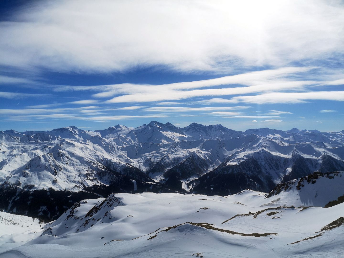
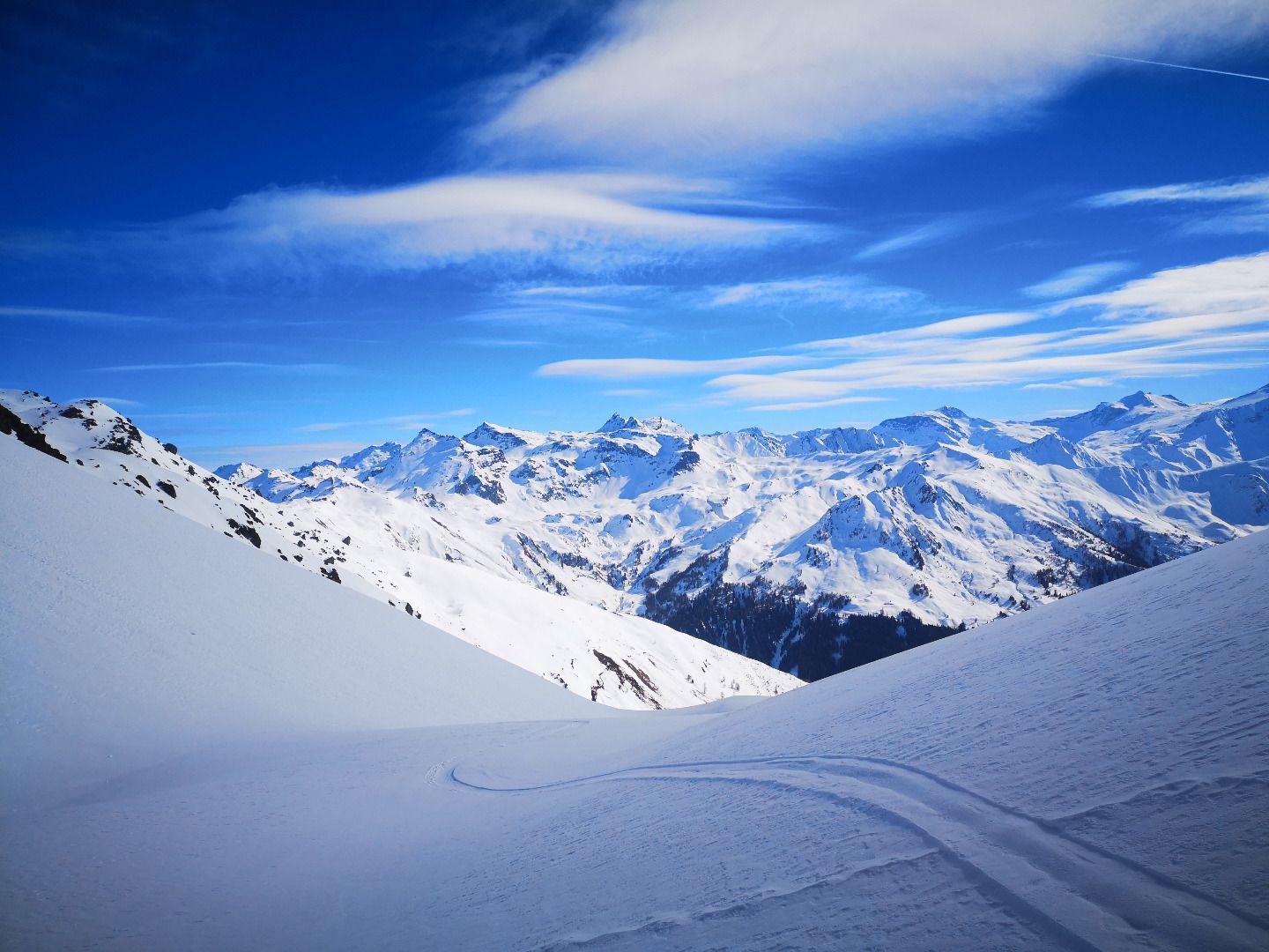
From the hamlet of Grün, you first follow a forest path until just before the managed Peeralm. Continue through a denser forest and you finally reach a wide basin, the so-called Grünbergalm. Along beautiful south-facing slopes, you now climb from floor to floor and over many a great slope to the saddle below the Grünbergspitze. From here it is not far to the summit via the ridge. As the Grünbergspitze is quite dominant in terms of its surroundings, you have a wonderful all-round view, starting from the Inntal and the Karwendel over the Hintertux glacier to the Stubai peaks. The descent along the beautifully sloping terrain from crest to crest is also a real pleasure.

ROUTE DESCRIPTION
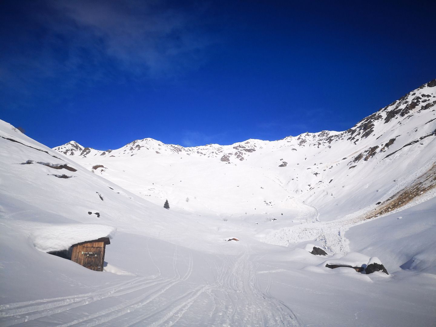
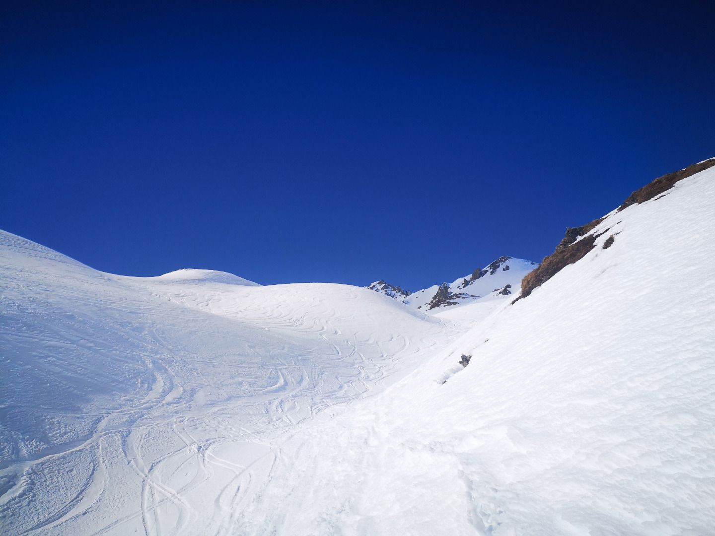
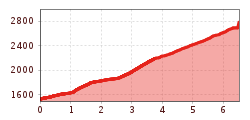
From the Grün car park (for which a fee is charged), follow the forest path in a north-easterly direction to the Peeralm at the start of the tour. Shortly before a large ditch, turn left and continue along the forest road. After a few minutes you reach a signpost marking a trail that turns right - here you have the option of either staying on the forest trail or taking the somewhat steeper shortcut. Finally, you reach a bend in the thinning forest, again with a signpost. Here you stay on the forest road in a constant northerly direction and reach a wide valley basin. From here, the trail climbs over a first steep step in hairpin bends to the Vögeleralm, beautifully situated on a hilltop. There you turn off over another hilltop into the high valley on the right, to the north. With a little care in the choice of the ascent track (some steeper slopes), you follow the course of the valley and finally reach the hermitage below the summit with a bend in a north-easterly direction. Several steeper slopes that have to be climbed on the way to the Einsattelung can often be very hard, especially in late winter in the early morning hours; it is worth using crampons here. On the right side of the saddle is the Grafmartspitze, on the left it goes along the ridge in a now westerly direction up the last 100 metres of altitude to the summit.

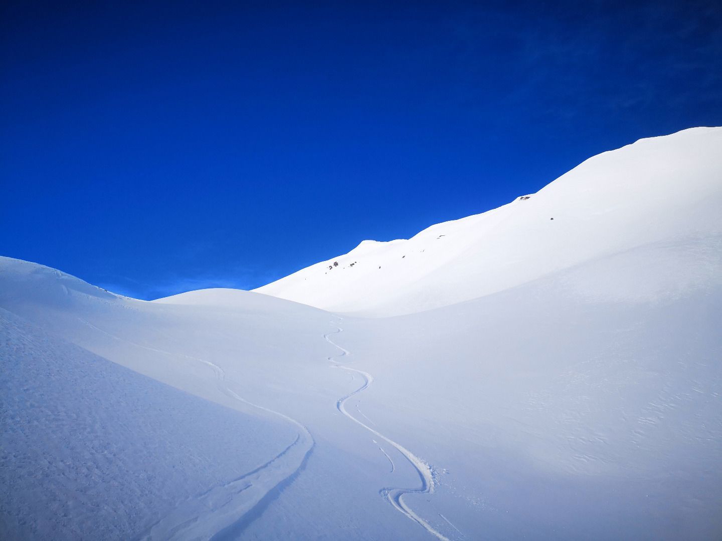
Descent along the wide basin close to the ascent track. The steep slopes in the upper area are to be enjoyed with caution in high winter.

TIP OF THE AUTHOR
A stop on the sun terrace rounds off the tour experience perfectly with delicious homemade dumplings.

Getting here

  • Arrival by public transport

    By train to Matrei am Brenner, from there with bus line 8365 to Navis-Dorf. From here, however, you have to walk to the start of the tour at the "Grün" car park. Information on the timetable at vvt.at. Alternatively, there is a Regiotax in Navis, which only travels to destinations on the Oberweg and thus also to the hamlet of "Grün" if required. To use this service, however, you have to call in advance and book a ride. (Further information under Regiotax Navis).

  • Parking

    Paarking lot Grün - parking -fees!

More tours in the surrounding area

  • Breiteggspitze

    Difficulty:easy
    Length:3.4 kmDuration:2:00 hElevation uphill:700 m
  • Bichalm

    Difficulty:easy
    Length:2.4 kmDuration:1:30 hElevation uphill:450 m
  • Mutterer Alm

    Difficulty:medium
    Length:3.1 kmDuration:2:00 hElevation uphill:581 m
  • Hoadl-Haus

    Difficulty:easy
    Length:7.6 kmDuration:2:25 hElevation uphill:778 m
  • Patscherkofel Schutzhaus

    Difficulty:medium
    Length:13.3 kmDuration:2:30 hElevation uphill:1,000 m
  • Eichenhof

    Difficulty:medium
    Length:4.7 kmDuration:2:50 hElevation uphill:898 m
  • Seefelder Joch

    Difficulty:medium
    Length:5.8 kmDuration:2:30 hElevation uphill:866 m
Newsletter

The mountain is calling? So does our newsletter!

In our monthly newsletter we reveal the best holiday tips for Tyrol.