Arrival by public transport
By train to Steinach am Brenner, from there take bus line 4145 to Schmirn-Lorleswald. Information on the timetable at www.vvt.at
Easy, scenic tour through forest aisles, alpine pastures and sparse larch forests to the gentle elevation of the Leiten.
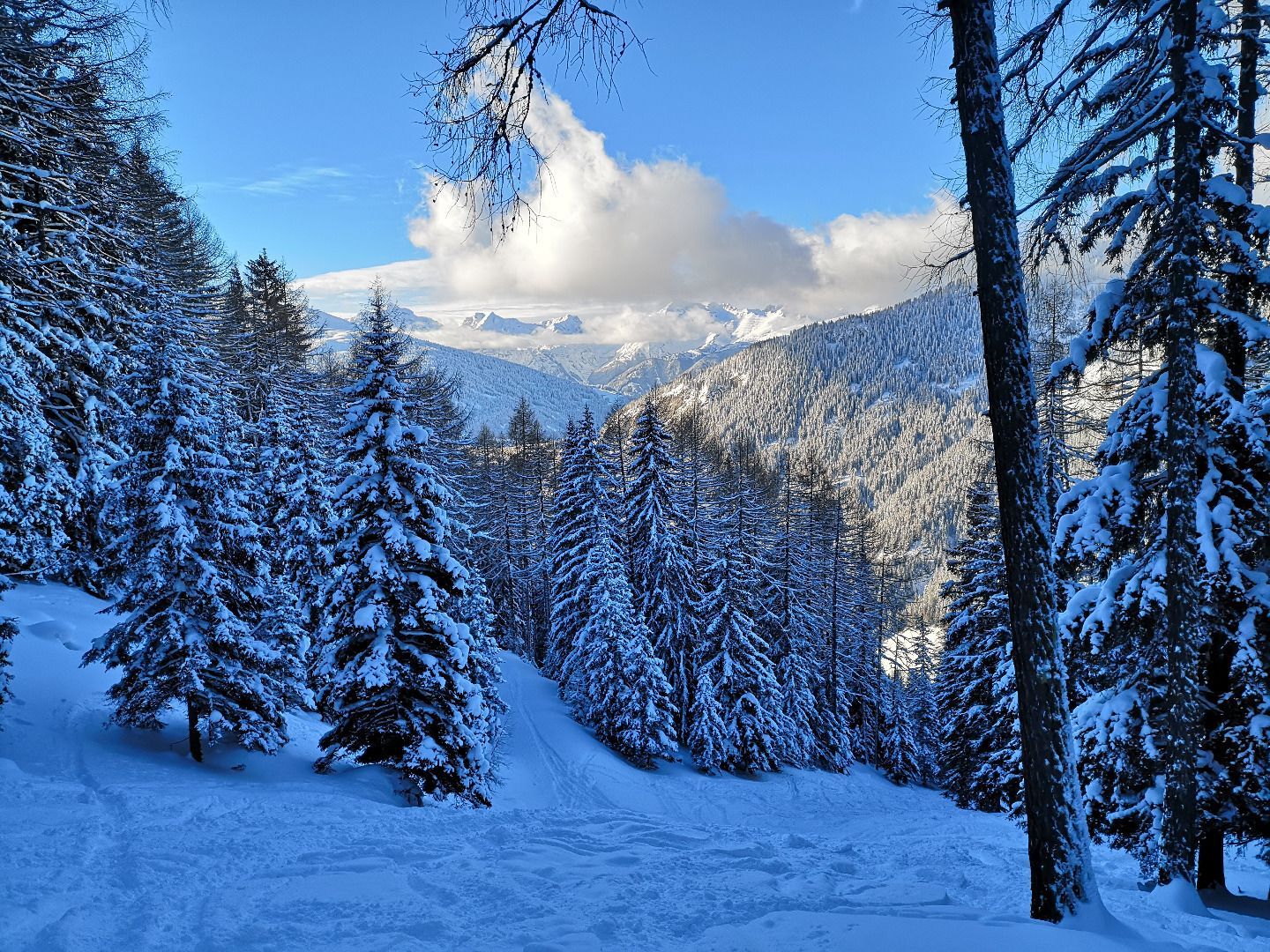
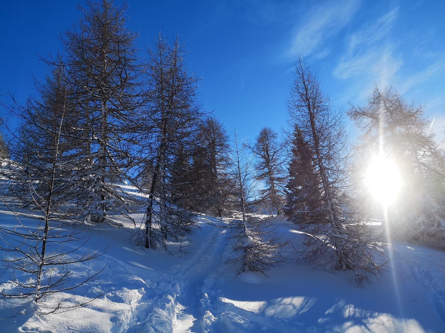
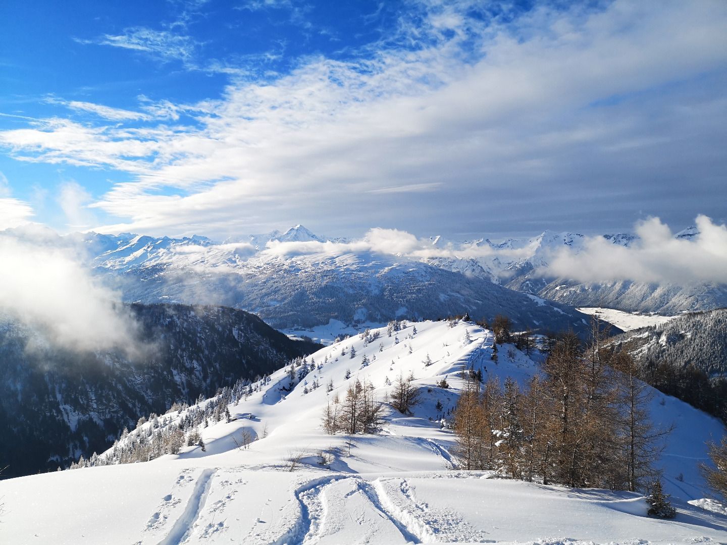
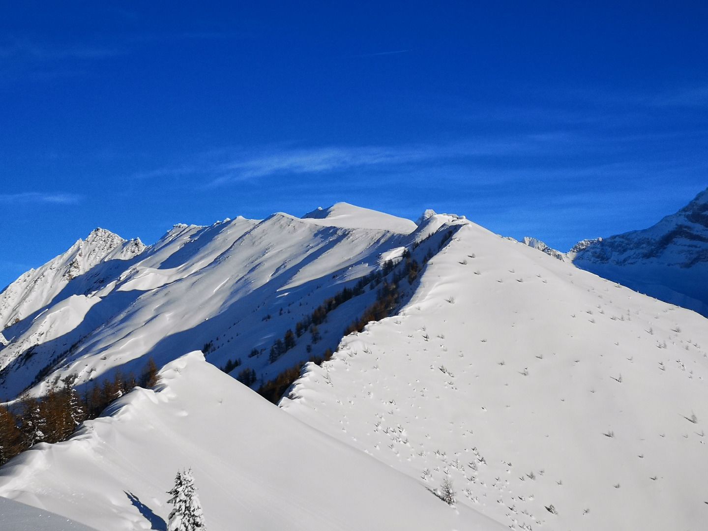
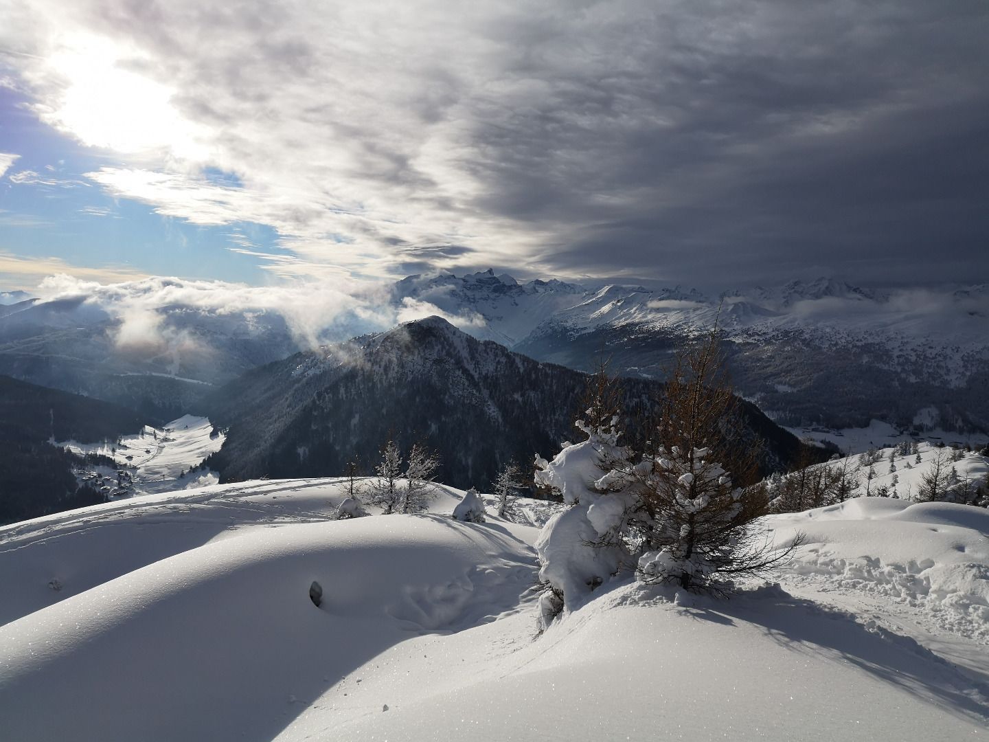
From the starting point, you first reach a forest aisle via a short stretch of field, which leads up a pleasant incline to an open alpine pasture. Continuing upwards through beautiful, increasingly sparse larch forests, you finally reach the timberline and with it the summit region. Here, a wonderful view of the Wipptal valley, the distant Stubai peaks and the steep walls of the Vals valley end awaits you. You can also look forward to a few warming rays of sunshine.
ROUTE DESCRIPTION
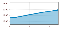
The tour begins directly at the car park with the ascent across a meadow up to a large, free stone pine tree. Here you leave the field through a gap in the fence and head for the forest aisle that begins on the left. The trail then climbs upwards in a pleasant gradient, crossing a forest road 3-4 times. At approx. 1900 m you finally reach an alpine pasture (Tschachn). At this point the paths separate - in an easterly direction you continue to Otten- and Gammaspitz, straight up through the forest, however, the ascent track leads up to Leiten. The last 200 metres in altitude are the most beautiful of the tour. With the right track, they are a real pleasure. The only thing to remember here is not to go too far to the left, but also not too far to the right. Once you have reached the ridge, all you have to do is climb over the fence (usually a gap is kept free), and then you are at the highest point of the tour.
TIP OF THE AUTHOR
Right at the beginning of the tour is the cosy Schmirnerstadl inn. Here you can enjoy food and drink after the efforts of the tour.
By train to Steinach am Brenner, from there take bus line 4145 to Schmirn-Lorleswald. Information on the timetable at www.vvt.at


