Naviser Kreuzjöchl (2,536 m)

Route length: 4.7 km
Duration: 3:00 h

Adventurous ascent over the broad ridge ridge. Wonderful descents attract tourers to this mountain. When it snows, you have to get up early to make your first tracks here. A stop at the Naviser Hütte or the Stöcklalm is well worth it!

Tour information

  • Length: 4.7 km
  • Duration: 3:00 h
  • Elevation uphill:1,100 hm
  • Elevation downhill:0 hm
Highest point2,536 m

Starting point

parking area Schranzberg (chargeable)

Finishing point

Naviser Kreuzjöchl

Equipment

Ski touring equipment with shovel, search probe, avalanche transceiver, tea, drinks, snacks, money
Source: TVB Wipptal

Description

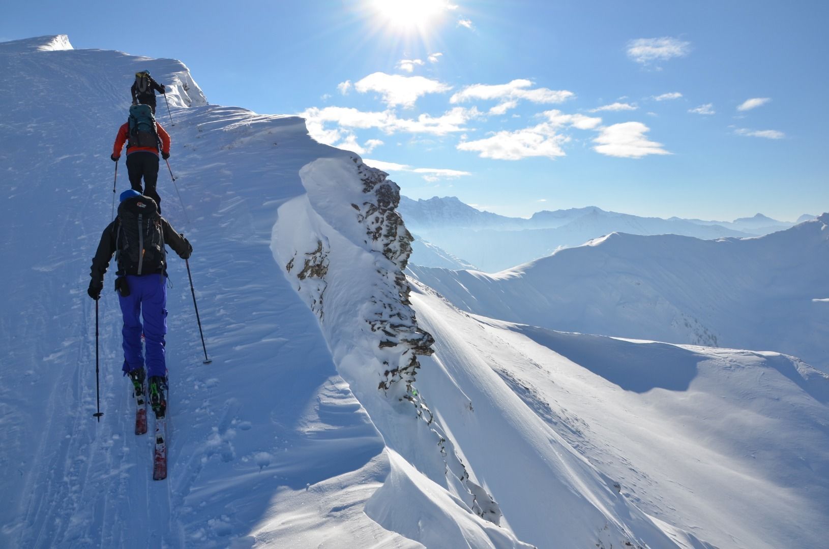
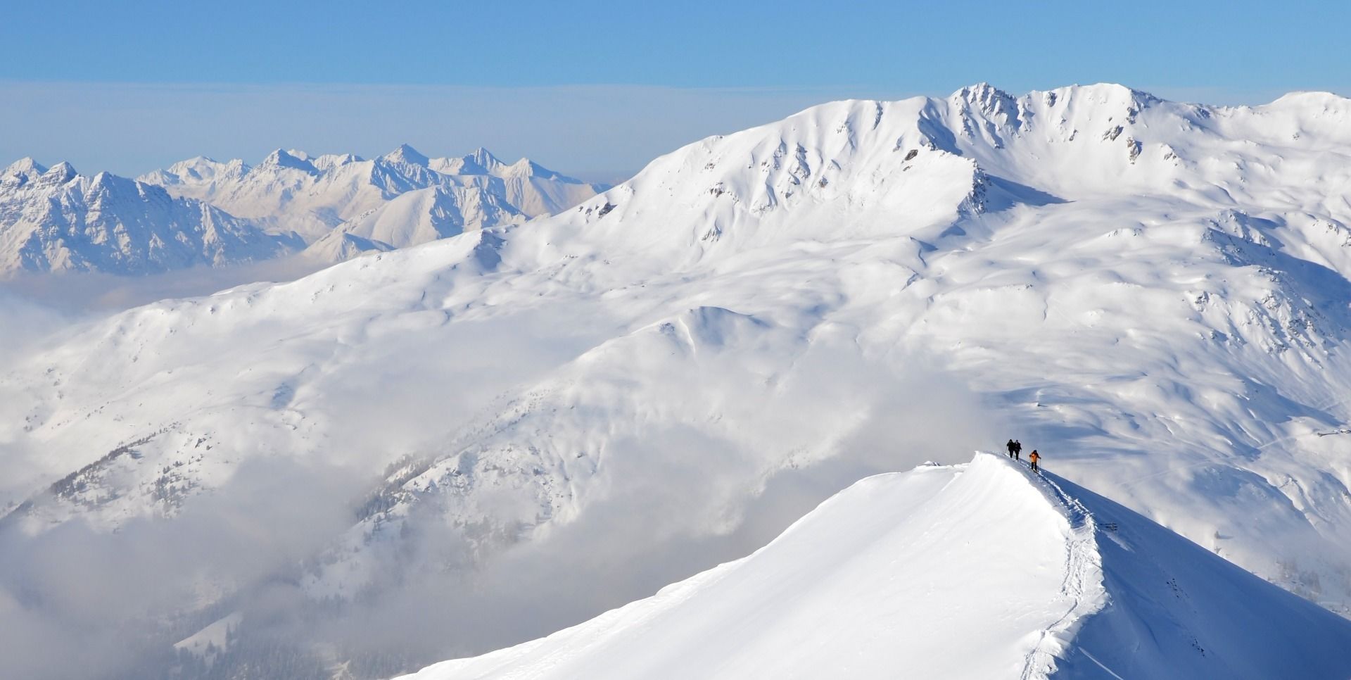
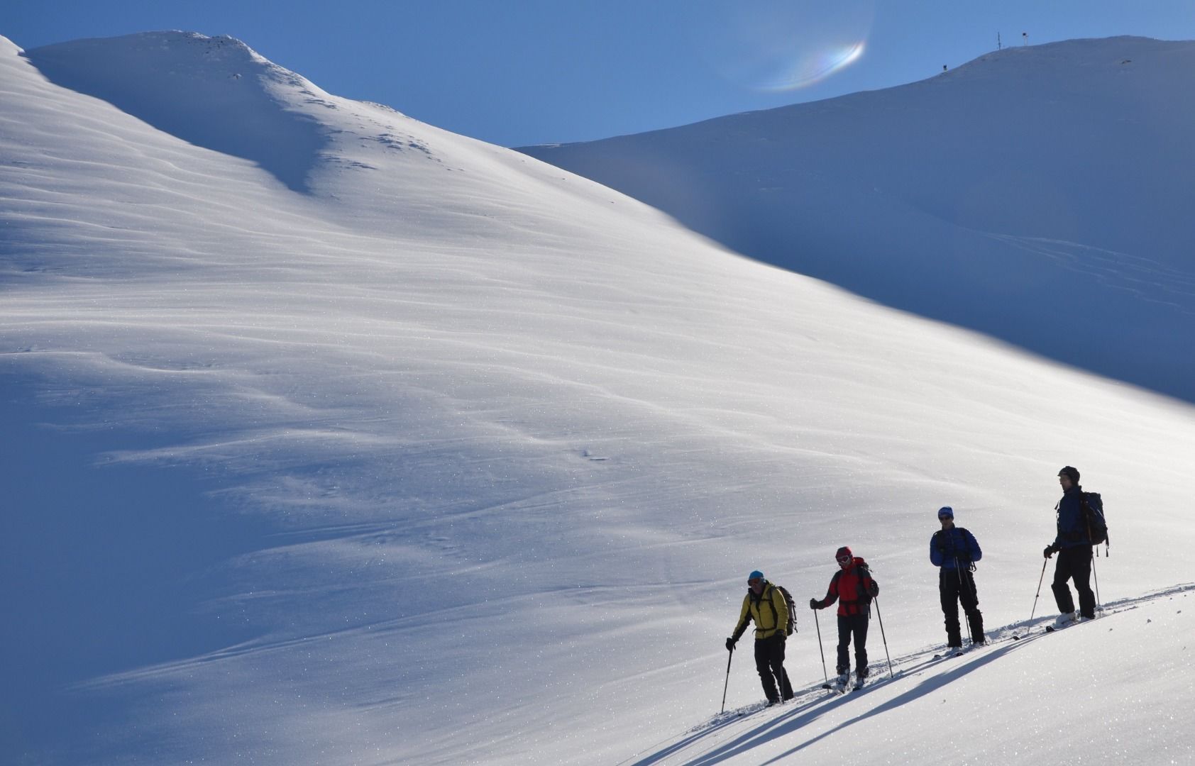
The starting point is the Schranzberg parking area (chargeable), from where you can either ascend via the toboggan run or a shorter route via the marked summer trail to the Naviser Hütte. Continue along the path to the Stöcklalm, from there it is a fairly straight ascent, then further up turn right in the direction of Weirichtseck. Once there, climb along a ridge until you reach a crest on the left (cross) and then turn right over another ridge. At the top, continue along the ridge to the pre-peak, here descend a few metres and then over the last ridge to the summit cross.

Descend as you did on the ascent.

Nearby huts and mountain restaurants

  • Naviser Hut

    Opening hours:open
    Place:Navis
    :Alpine pasture / hut / mountain restaurant

Getting here

  • Parking

    Parking area Schranzberg (chargeable) in Navis

More tours in the surrounding area

  • Breiteggspitze

    Difficulty:easy
    Length:3.4 kmDuration:2:00 hElevation uphill:700 m
  • Seefelder Joch

    Difficulty:medium
    Length:5.8 kmDuration:2:30 hElevation uphill:866 m
  • Mutterer Alm

    Difficulty:medium
    Length:3.1 kmDuration:2:00 hElevation uphill:581 m
  • Bichalm

    Difficulty:easy
    Length:2.4 kmDuration:1:30 hElevation uphill:450 m
  • Hoadl-Haus

    Difficulty:easy
    Length:7.6 kmDuration:2:25 hElevation uphill:778 m
  • Patscherkofel Schutzhaus

    Difficulty:medium
    Length:13.3 kmDuration:2:30 hElevation uphill:1,000 m
  • Eichenhof

    Difficulty:medium
    Length:4.7 kmDuration:2:50 hElevation uphill:898 m
Newsletter

The mountain is calling? So does our newsletter!

In our monthly newsletter we reveal the best holiday tips for Tyrol.