Description
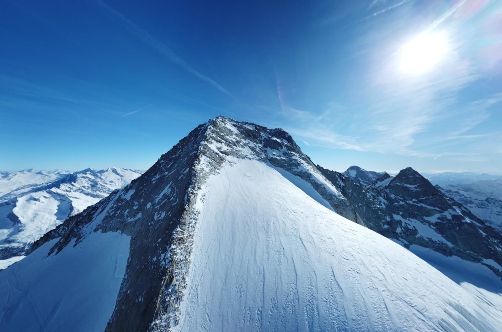
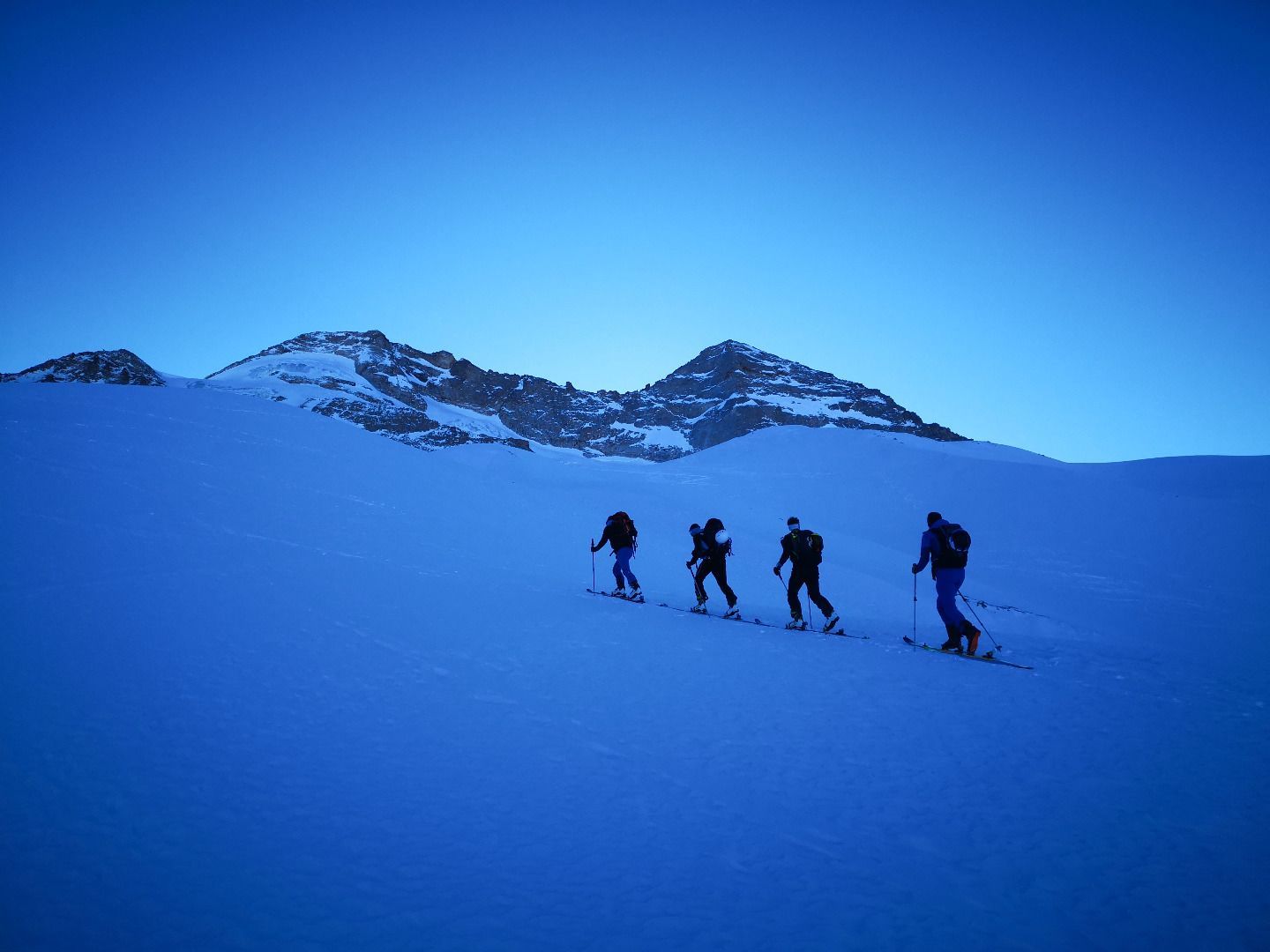
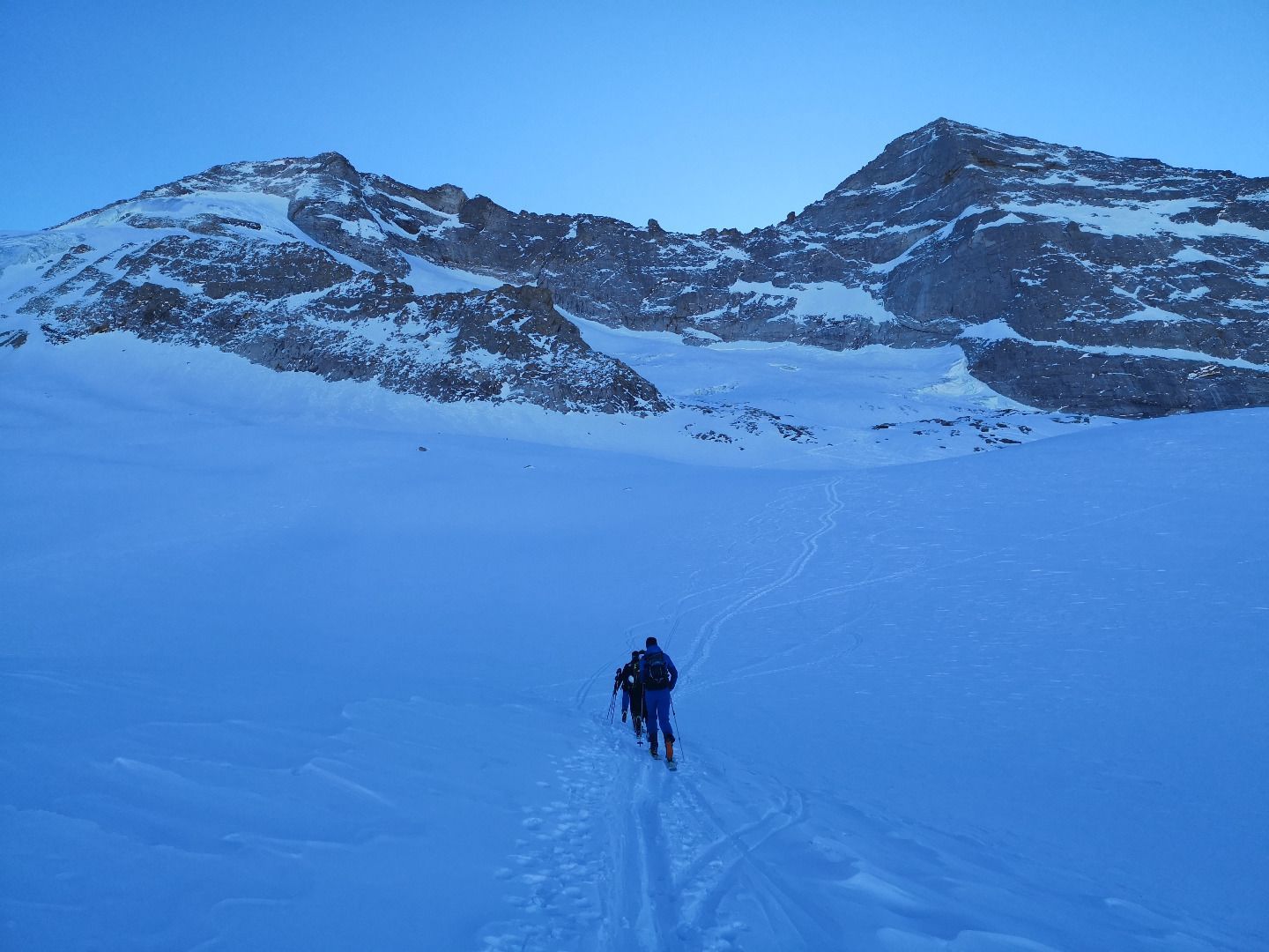
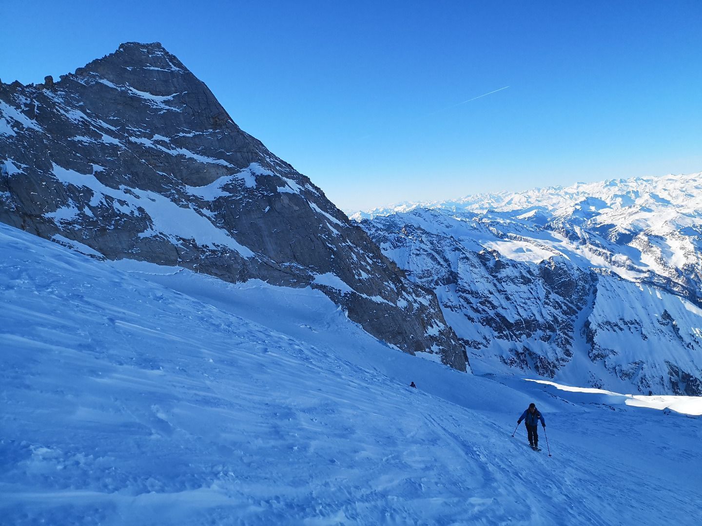
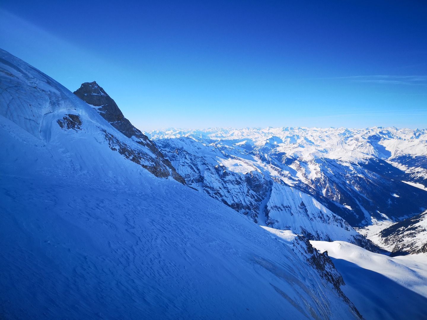
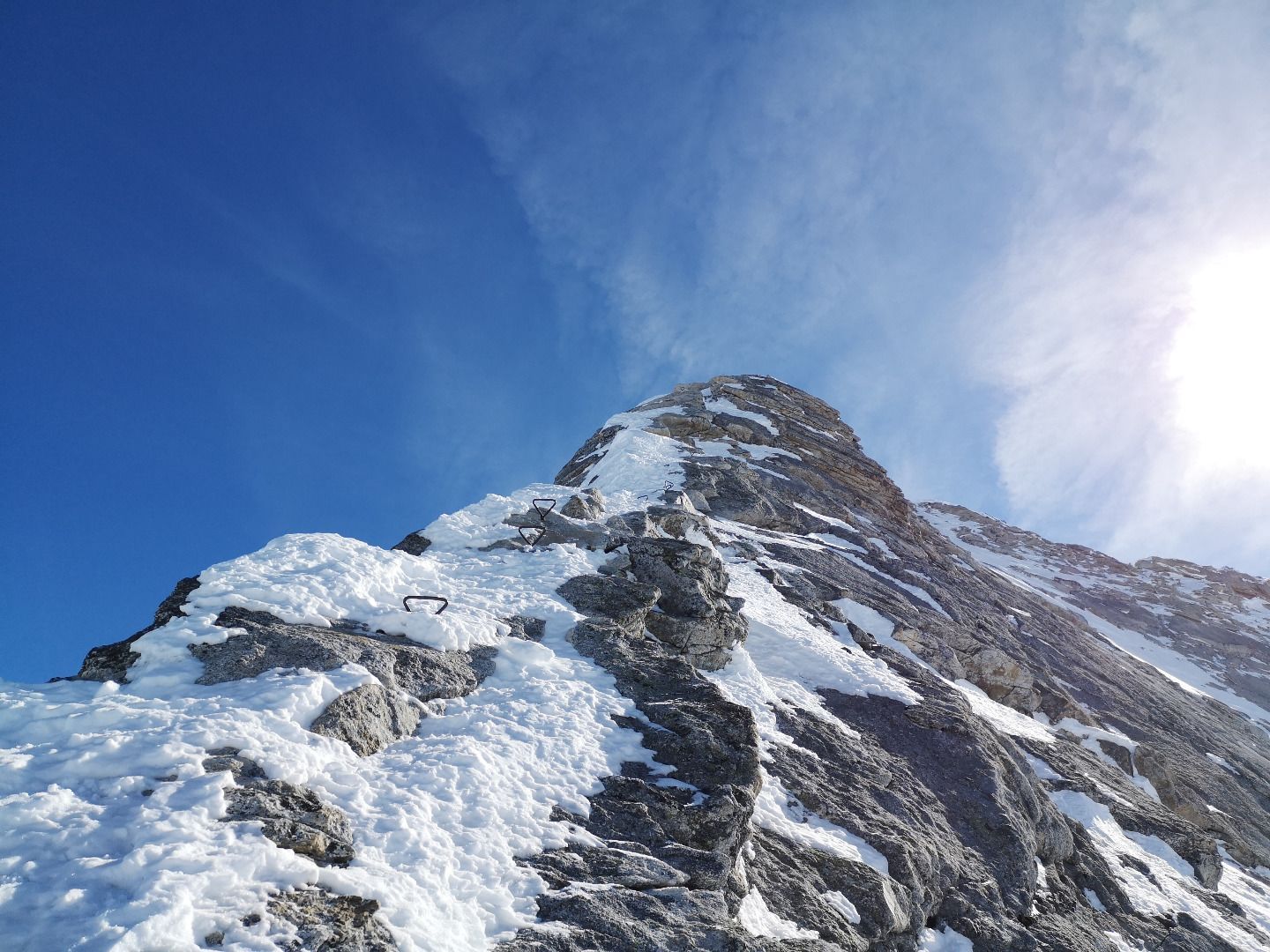
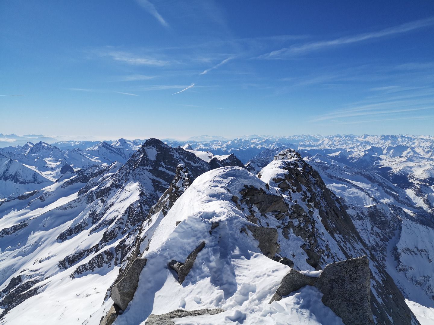
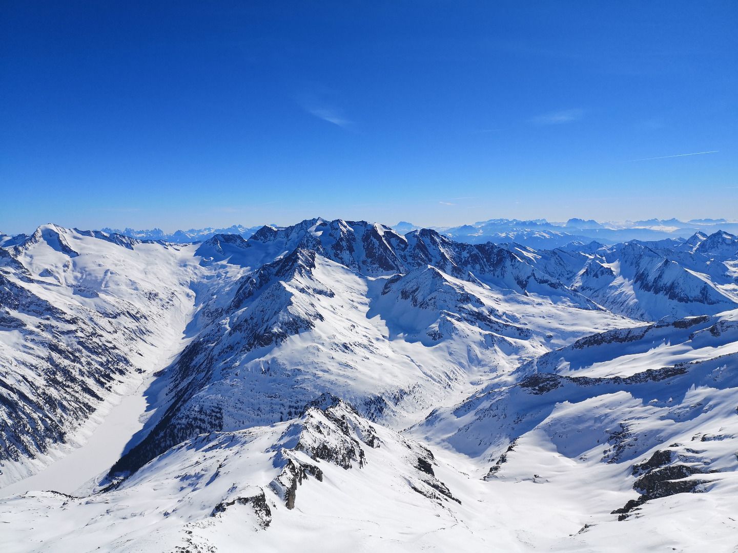
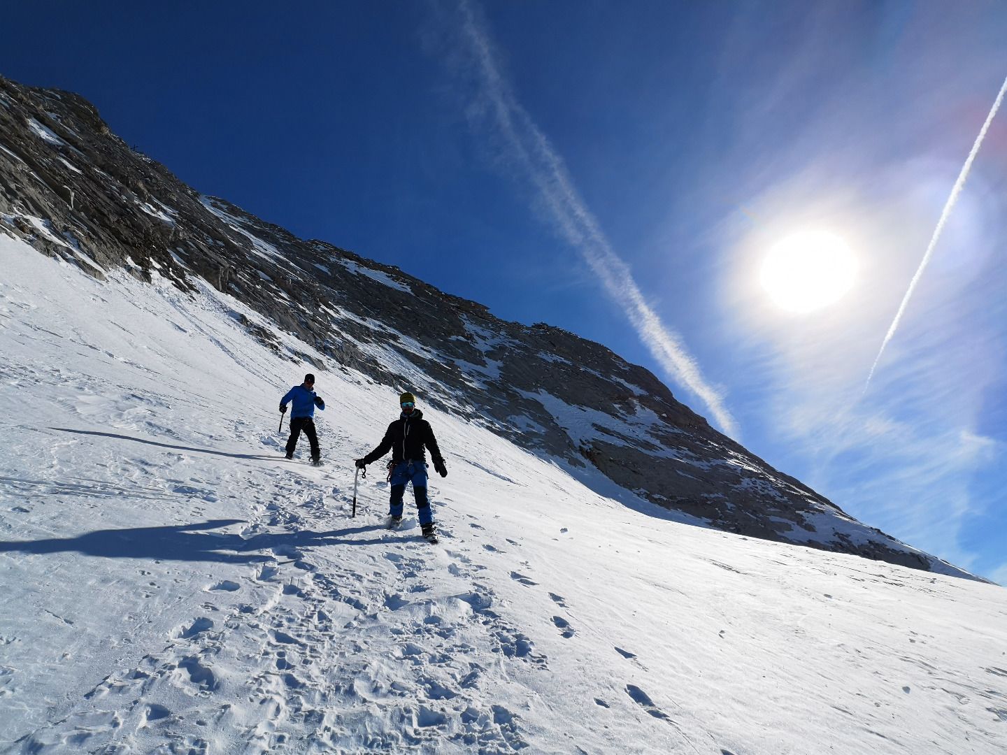
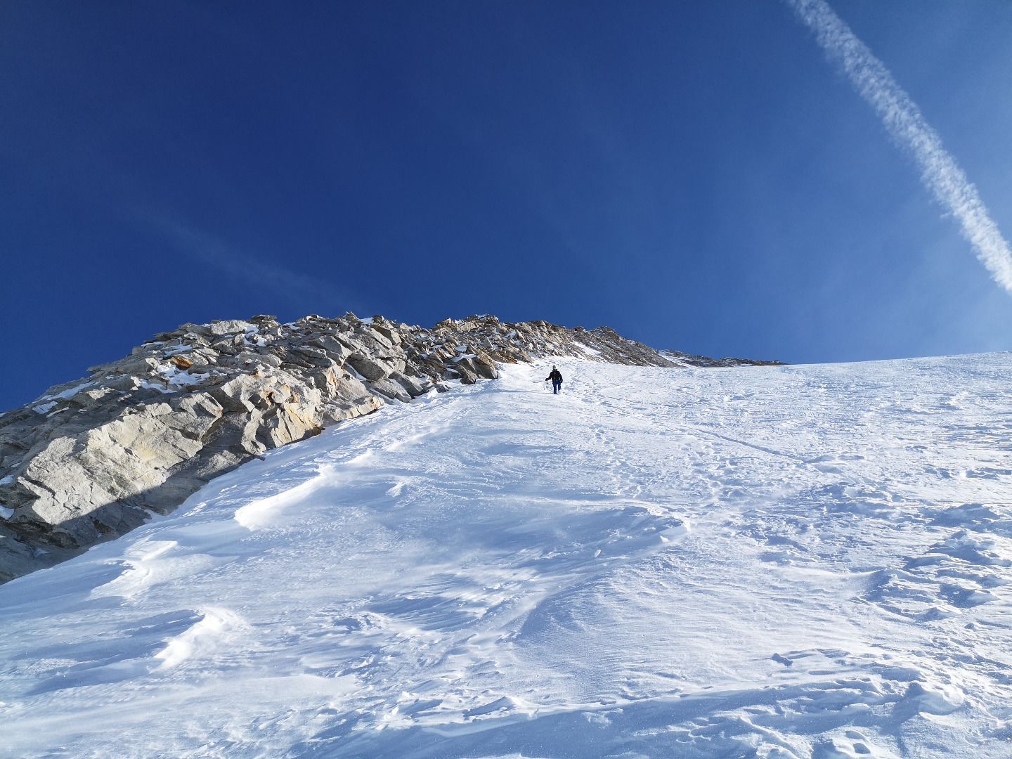
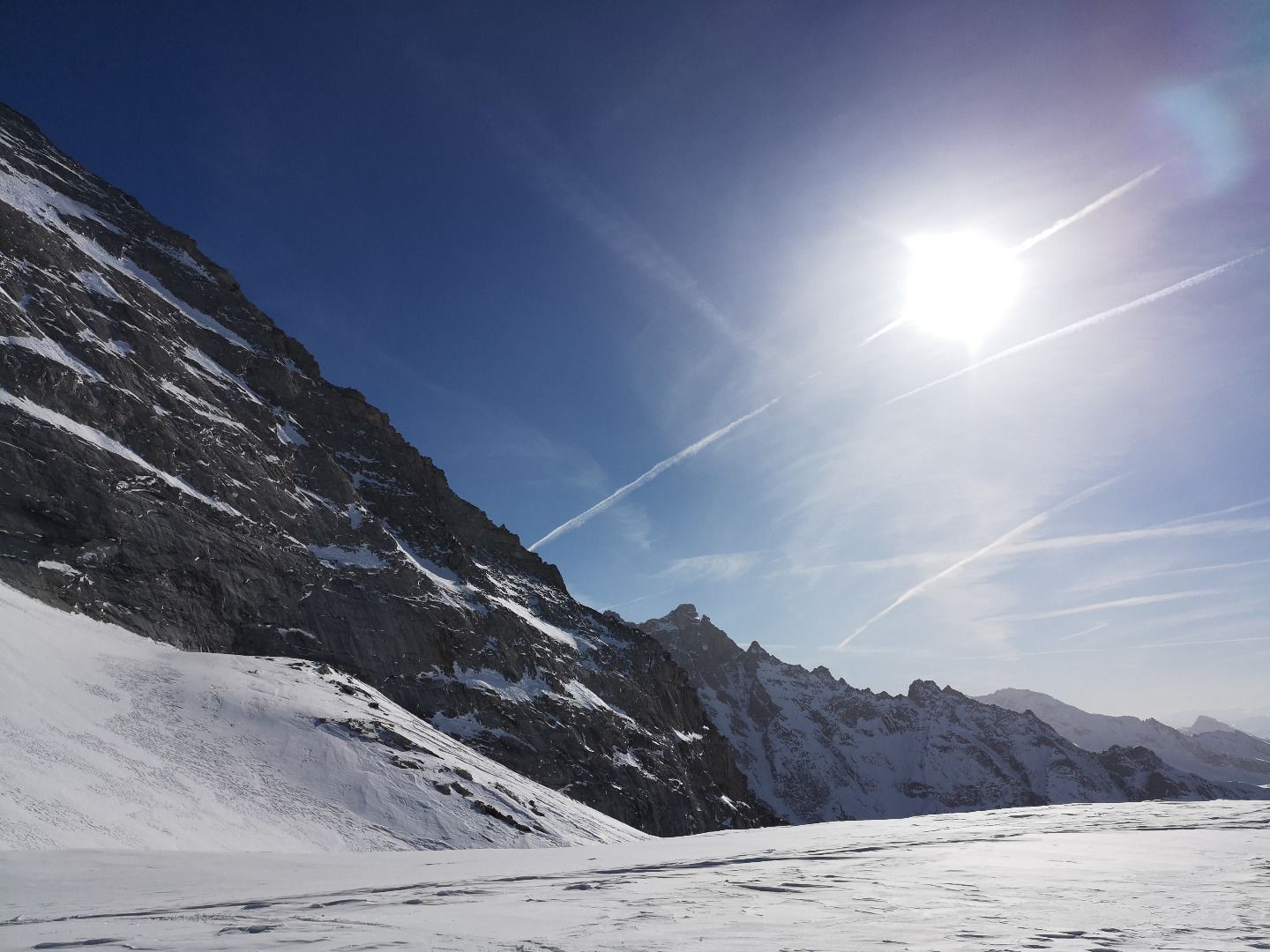
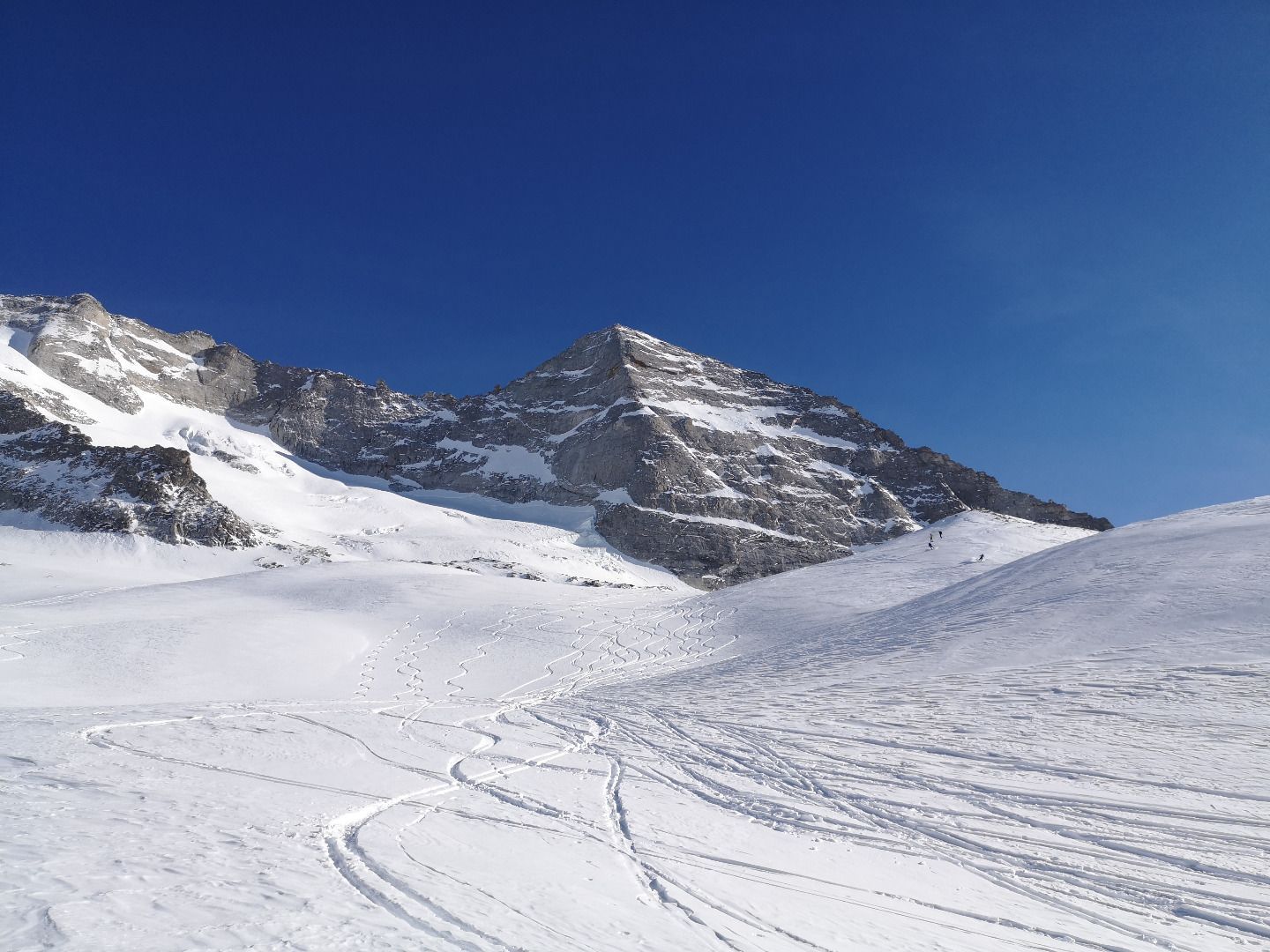
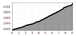
From the starting point at the beginning of the Wildlahnertal valley, the route is initially quite flat until you reach the Issealm. In the face of the magnificent backdrop of Fussstein and Olperer, you then continue to follow the course of the valley along old Mörans to a rugged rocky ridge at the beginning of the glacier, an ideal place for a first major rest stop. Now follows what is probably the most strenuous, coldest but also most beautiful part of the tour, the path up to the Wildlahnerscharte. Directly below the magnificent north walls of the massif, jagged glacier fractures and a mighty ice wall, we climb to over 3200m. Arriving at the Wildlahnerscharte, however, is a bit of a shock, despite the warming rays of sunshine that await you here. Crowds of people milling about in the vastness of the Hintertux glacier ski area interrupt the hitherto quiet solitude of the ascent - nevertheless, the view is breathtaking. Once you have recovered in the sun from the hardships of the previous ascent, the crowning glory of the tour awaits: the summit ridge of the Olperer. It looks steep, dangerous and forbidding from below, and it is indeed a certain challenge. With or without skis, depending on the snow conditions, you first climb up the steep summit flank. As high up as possible, you finally cross to the left onto the ridge. Here you can climb the last 200 m to the summit with crampons, ice axe and rope protection.
SAFETY ADVICE
The tour to the Olperer is a high alpine challenge and should therefore only be undertaken with appropriate experience or professional guidance. Through the Wildlahnertal but also in the upper area below the summit there are some steep slopes to cross and climb, the snow conditions must be correspondingly safe for this. The summit ridge is very exposed and, as a mixed climb in winter with few belay options, a particular challenge.
ROUTE DESCRIPTION
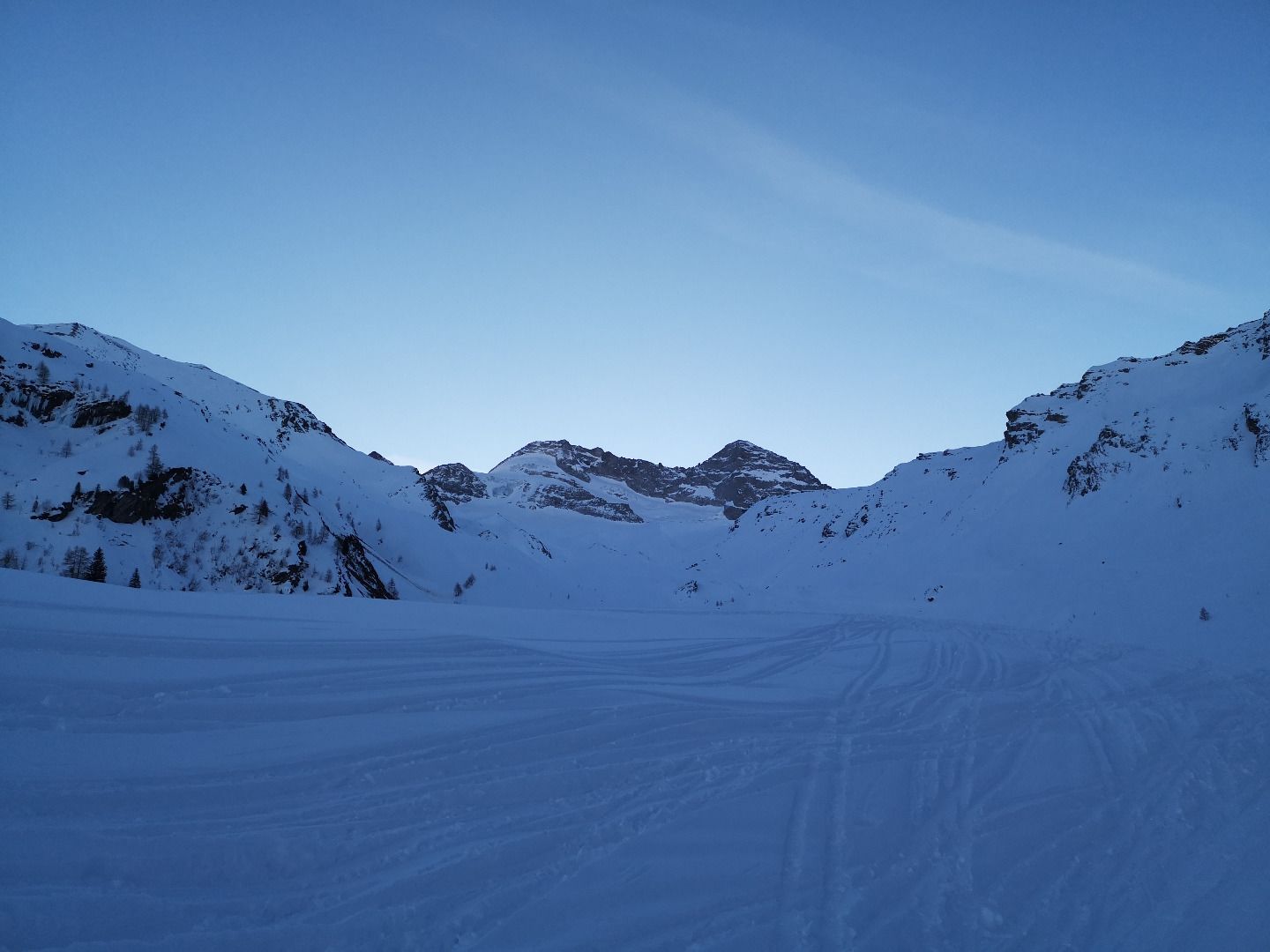
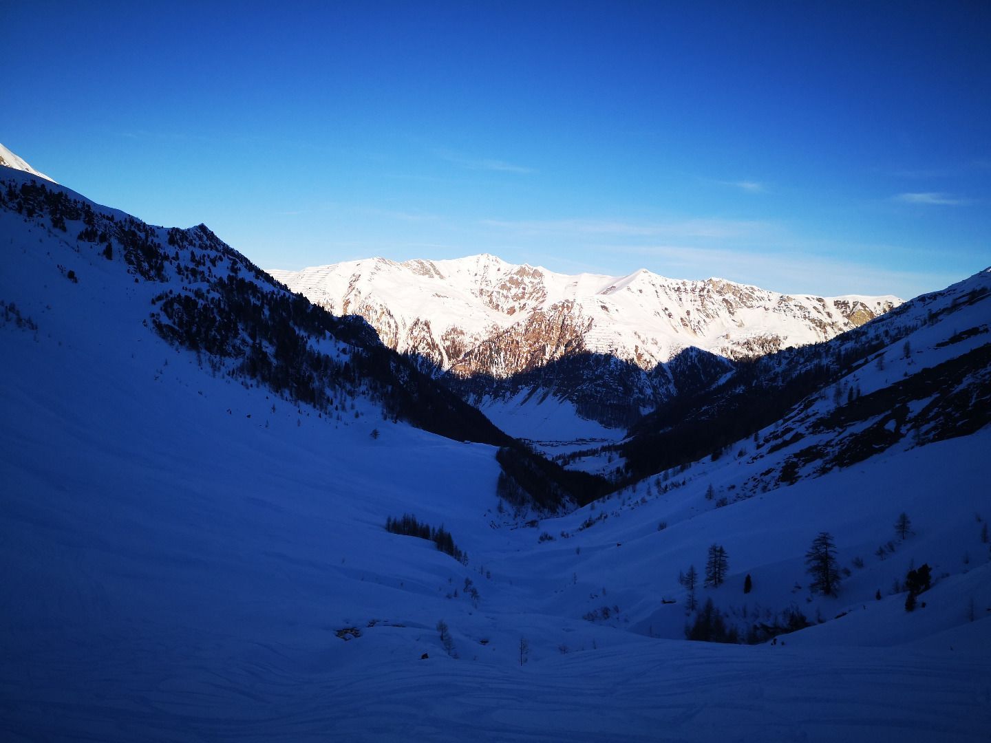
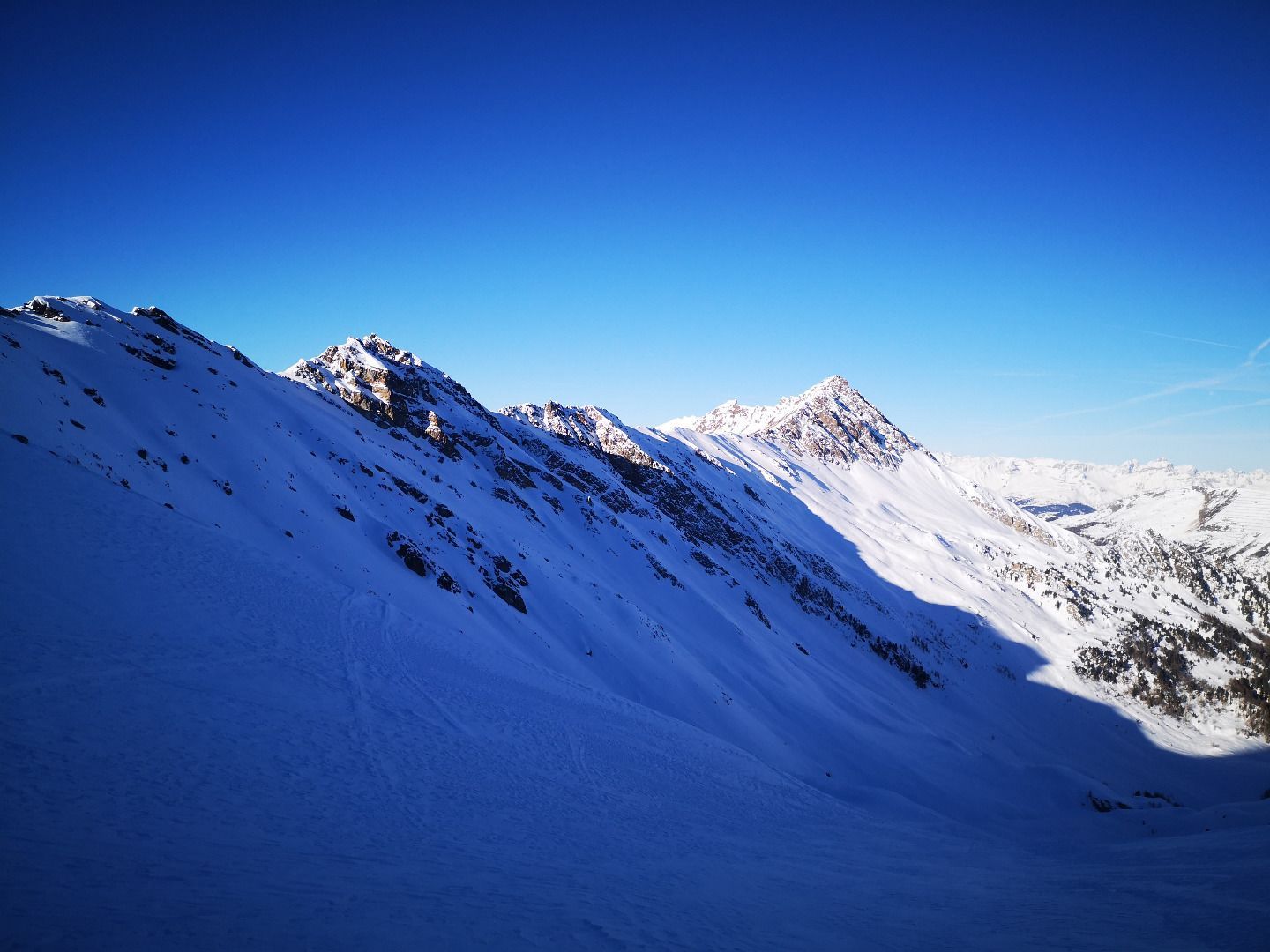
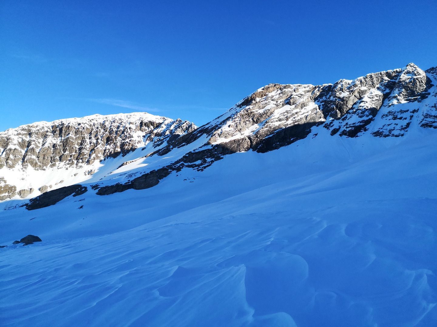
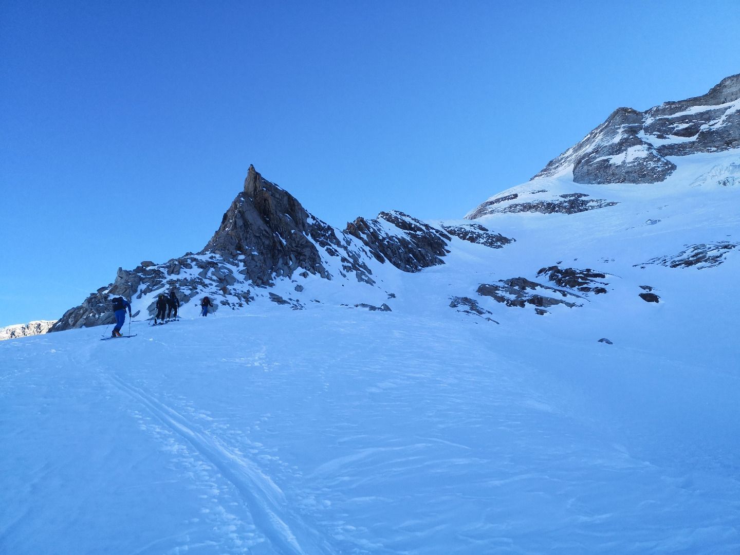
From the car park, first follow the forest road to the Issealm in a south-easterly direction. After about an hour of flat ascent, you will reach the alpine pasture when you leave the tree line and reach a small floor. Continue in a long curve on the right side of the valley to a small knoll. Behind the crest, the terrain flattens out again. Depending on the track you choose, you may have to descend a few metres to avoid crossing the adjacent steep northern slope. Then follows a narrow ditch that leads up to another crest. The Wetterkreuz is not far away and shortly before it the tracks separate - the left one leads up to the Höllscharte, straight ahead or to the right to the Wildlahnerscharte. In the further course of the ascent, the track leads upwards through wide former glacier trenches and moorings following the course of the valley until you finally reach a wide rocky ridge. The southern end of the ridge is bypassed and you reach the beginning of the snow-covered Olpererferner glacier. After a short break for supplies, you walk parallel to the rocky ridge on the left in an easterly direction upwards along the glacier to below the so-called Eisbuckel, a massive ice wall. The higher you get, the steeper the terrain becomes, and it may be advisable to use crampons here. Shortly below the ice wall, you finally cross to the left and walk back below it in now flatter terrain to the Wildlahnerscharte. Now the last section of the tour remains to be done, the walk to the summit. To do this, you first have to climb the steep north slope of the Olperer. If the snow conditions are favourable, this can be done on skis with the help of hairpin bends, otherwise you just trudge upwards in the snow near the rocky crest. As high up as possible, you then cross to the left onto the summit ridge. This is usually a mixture of snow, ice and rock, so appropriate equipment of crampons, ice axe and rope belay is a prerequisite. Iron stirrups can always be used as belay points, and there are also The climbing on the ridge is not particularly difficult (2-3), but should not be underestimated due to the mixed conditions of snow and rock and the exposure. After a good 30 minutes and 200 m on the ridge, however, this last challenge is also overcome and you stand at the goal of the tour, the summit of the Olperer.
TIP OF THE AUTHOR
A stop at the Alpengasthof Olpererblick after the efforts of the tour is a special treat.
For those who find the summit ridge too demanding, it is worth completing the tour with the Wildlahnerscharte or aks a guide to take you to the summit.