
Opening hours:Open today
Place:Ochsengarten
:Restaurant
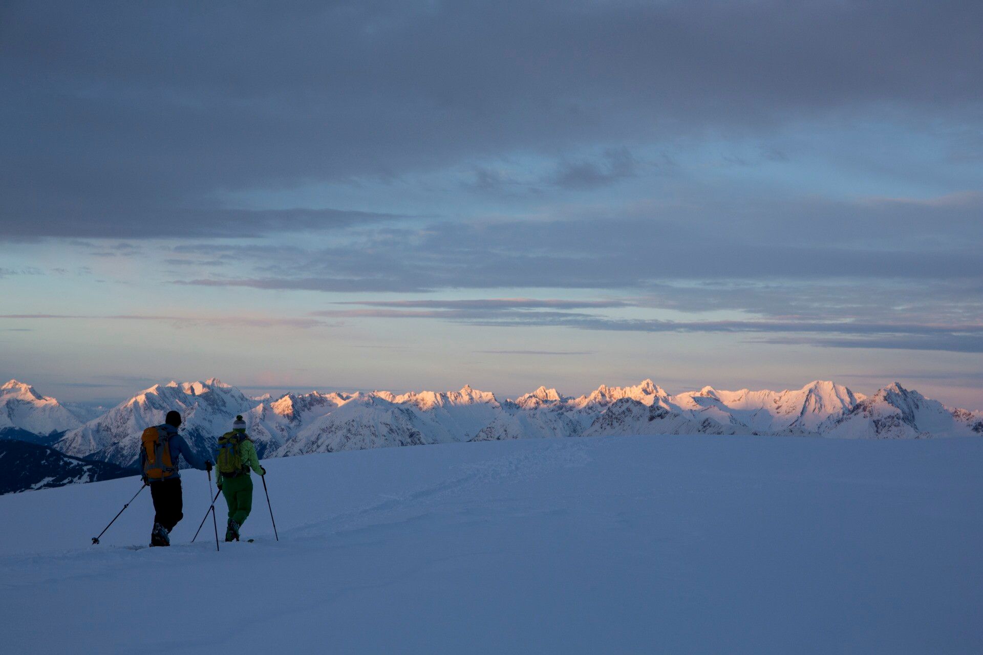
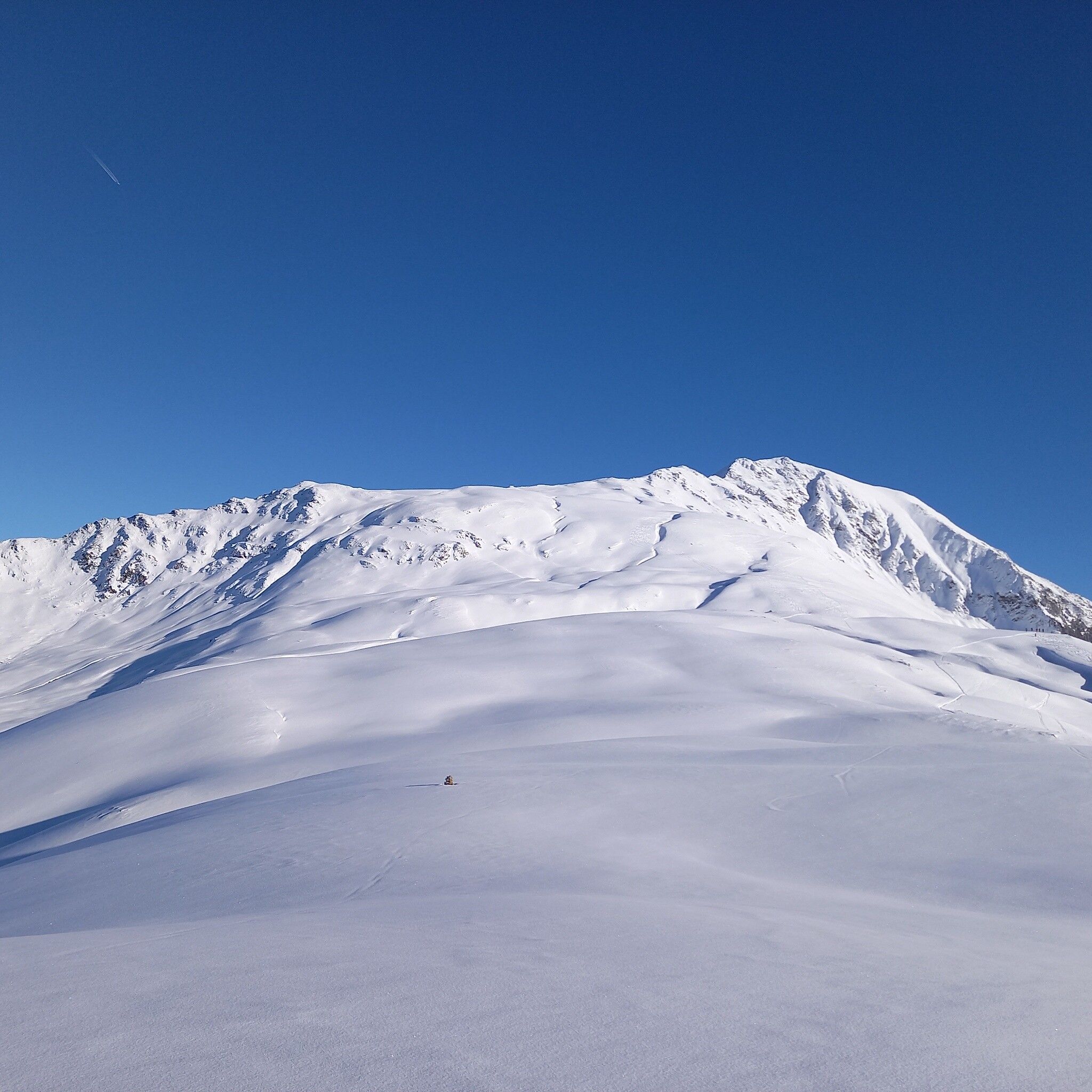
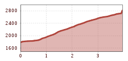
MARLSTEIN - fifth hairpin bend - Steinmandl - Schafjoch - north flank Pirchkogel - PIRCHKOGEL
Avalanche Danger Scale
1 (LOW)
An avalanche release is only possible with heavy additional load on very few, extreme steep slopes. Spontaneous avalanches (so-called sluffs) are not expected. Generally safe conditions.
2 (MODERATE)
An avalanche release is likely with heavy additional load mainly on the specified steep slopes. Larger avalanches are not expected. The snow cover is generally well consolidated except on some steep slopes. Careful route choice on the specified steep slopes and slope exposures.
3 (CONSIDERABLE)
An avalanche release is likely even with light additional load mainly on the specified steep slopes. Occasionally some medium and sporadically large avalanches are possible spontaneously. The snow cover is only moderately to weakly consolidated on many steep slopes. Experience in avalanche assessment is necessary. Avoid specified steep slopes and slope exposures as much as possible.
4 (HIGH)
An avalanche release is possible even with light additional load mainly on the specified steep slopes. Many medium, and repeatedly also large avalanches can occur occasionally. On many steep slopes the snow cover is only weakly consolidated. Route choice should be restricted to moderately steep terrain and avalanche runout zones should be observed. Much experience in avalanche assessment is necessary.
5 (VERY HIGH)
Numerous large avalanches, including in moderately steep terrain, are expected spontaneously. At this warning level, safe operation in ski areas is no longer possible. The snow cover is generally weakly consolidated and unstable. Avoid tours is recommended.
See also at lawine.tirol.gv.at
Recommended Ski Touring Equipment
The "normal ski touring equipment" consists of touring skis with touring bindings, telescopic poles, climbing skins, crampons, digital avalanche transceiver, avalanche shovel, avalanche probe, first aid kit, and a mobile phone. A "complete glacier equipment" consists of a harness, two prusik loops or ascenders of different lengths, two HMS carabiners, ice axe, crampons, and a rope. A backpack with appropriate contents should be carried, including spare clothing, sun protection, cold protection, provisions, and enough to drink! Do not forget to take hygiene articles and a hut sleeping bag for overnight stays in huts!
DIFFICULTY RATING
From Marlstein along the prepared winter hiking trail towards Grünwaslekreuz to the first left hairpin bend. Straight ahead east until a wide clearing is reached. Along this, on the left side about halfway uphill and then turning left through sparse forest northwards to the tree line. On a clearly distinct and undulating ridge uphill northeastwards to the main ridge. Now always eastwards, uphill over a short steep section, past a stone cairn to Schafjoch where the broad ridge narrows to a crest. Continue along the narrow crest into a saddle northwest of the summit structure and cross a short steep slope north of the summit (key point). Around the summit structure and through the upper part of the Schneetal coming from the east into the saddle between the two summit peaks. Turn left, easy ascent to the highest point without summit mark and then briefly back to the summit cross on the second summit peak.
Travel comfortably and safely by train to the Ötztal train station. The final stop or exit point is ÖTZTAL station. Afterwards, travel conveniently and quickly with public transport or local taxi companies through the entire valley to your desired destination! The current bus timetable is available at: http://fahrplan.vvt.at
Parking lot at the Berghotel Marlstein


