
Opening hours:Open today
Place:Winklern
:Alpine pasture / hut / mountain restaurant
A gentle beginners' tour with panoramic views over the Hohe Tauern, the Lienz Dolomites and into neighboring South Tyrol.
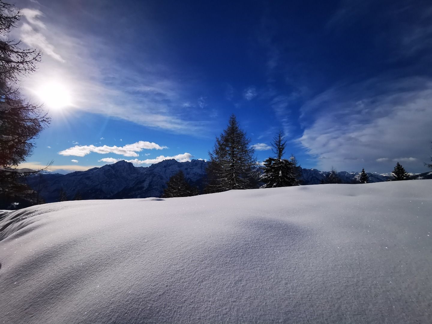
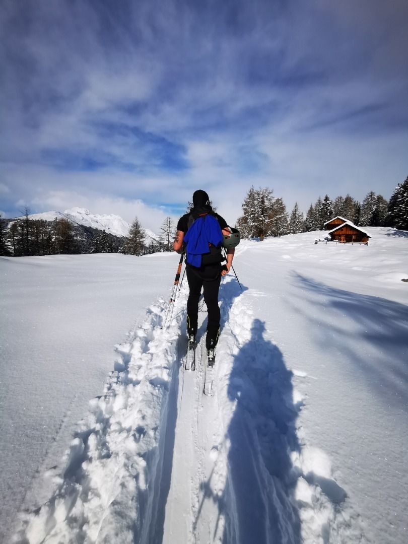
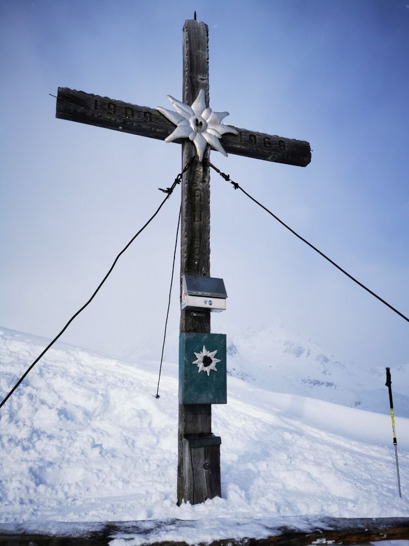
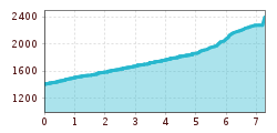
The Strassboden, mostly known as the Strasskopf, is a popular ski tour on the eastern foothills of the Schober group. The summits which provide plenty of views dominate the Winklerner and Roaner Alm, whose gentle slopes also present a perfect destination for beginners and those getting back into the swing of things. At the half-way point is the ÖAV Winklerner Hütte (1843 m). It is open for business at weekends. A refreshment stop on the way down is your reward for any exertions. Starting point for our ski tour is the little church of St. Benedikt (1375 m) and its interesting onion-domed tower, located in the parish of Penzelberg. We get here via a narrow road, which we approach at the Iselsbergpass, fifty metres after Defreggerhof coming from Lienz and which takes us to the sunny side (follow the signposts for Winklerner Alm). At the church (a few car parking spaces available) we follow a forest trail, which we do however leave after 100 metres on the right-hand side. The ski track swings upwards via lovely glades and disappears for the time being into a bit of woodland. We cross a goods road several times; this is used as a shuttle route to the inn. After 1 ½ hours we get to Winklerner Alm and the Strasskopf is already within touching distance. The rest of the ascent is on a distinct ridge which proceeds in moderately steep pasture terrain. After 1 – 1 ½ hours we get to the flat summit which has a cross (3 – 3 ½ hours by car). Descent along the ascent track and later via the forest trail to the Penzelberg.
Additional ski tour tips can be obtained in the ski tour guides by Thomas Mariacher. These are available here: https://www.tyroliaverlag.at/item/Skitouren_in_Osttirol_und_Oberkaernten/Thomas_Mariacher/43058387


