Arrival by public transport
By train to Steinach am Brenner, from there take bus line 4144 to Schmirn-Aue. From there, however, you have to walk to the hamlet. Information on the timetable at www.vvt.at
Unique, sunny tour across meadows, forests and mowing fields to the Sumpfkopf at the beginning of the Schmirntal valley. Facing purely south, the terrain is particularly suitable as a firn tour if there is enough snow.
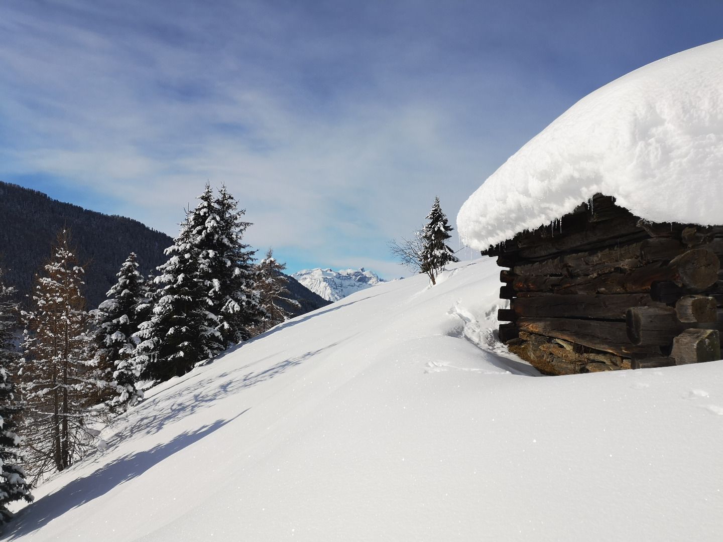
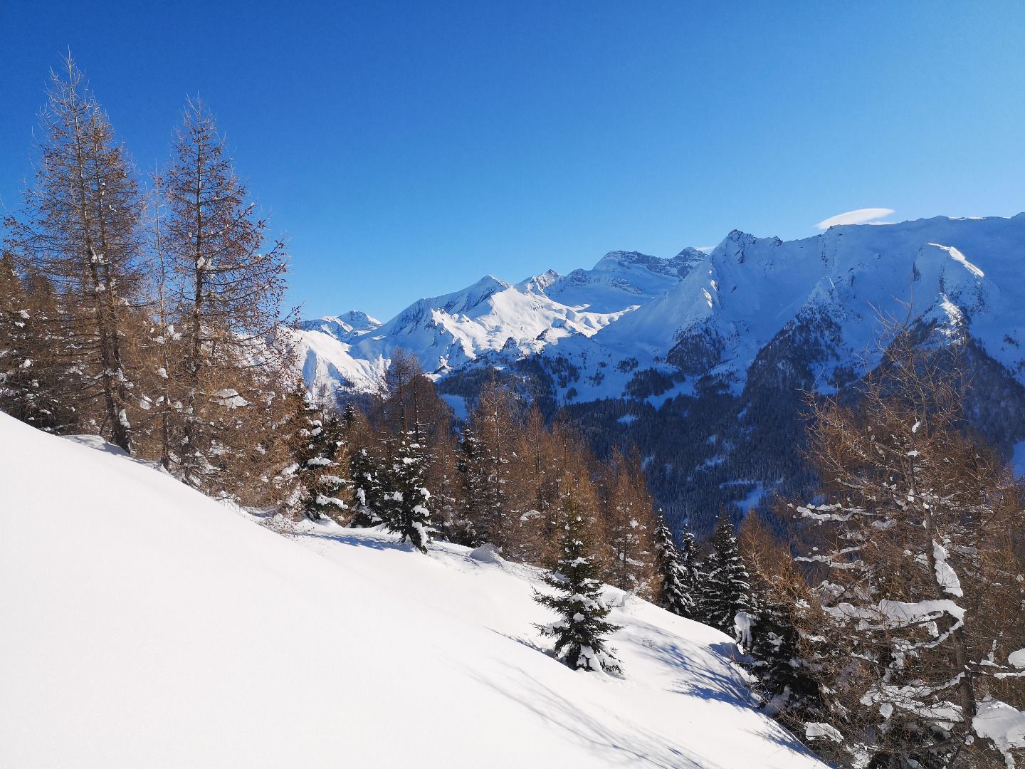
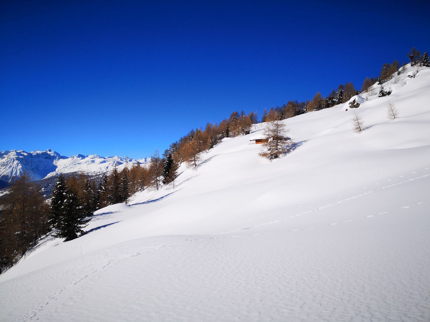
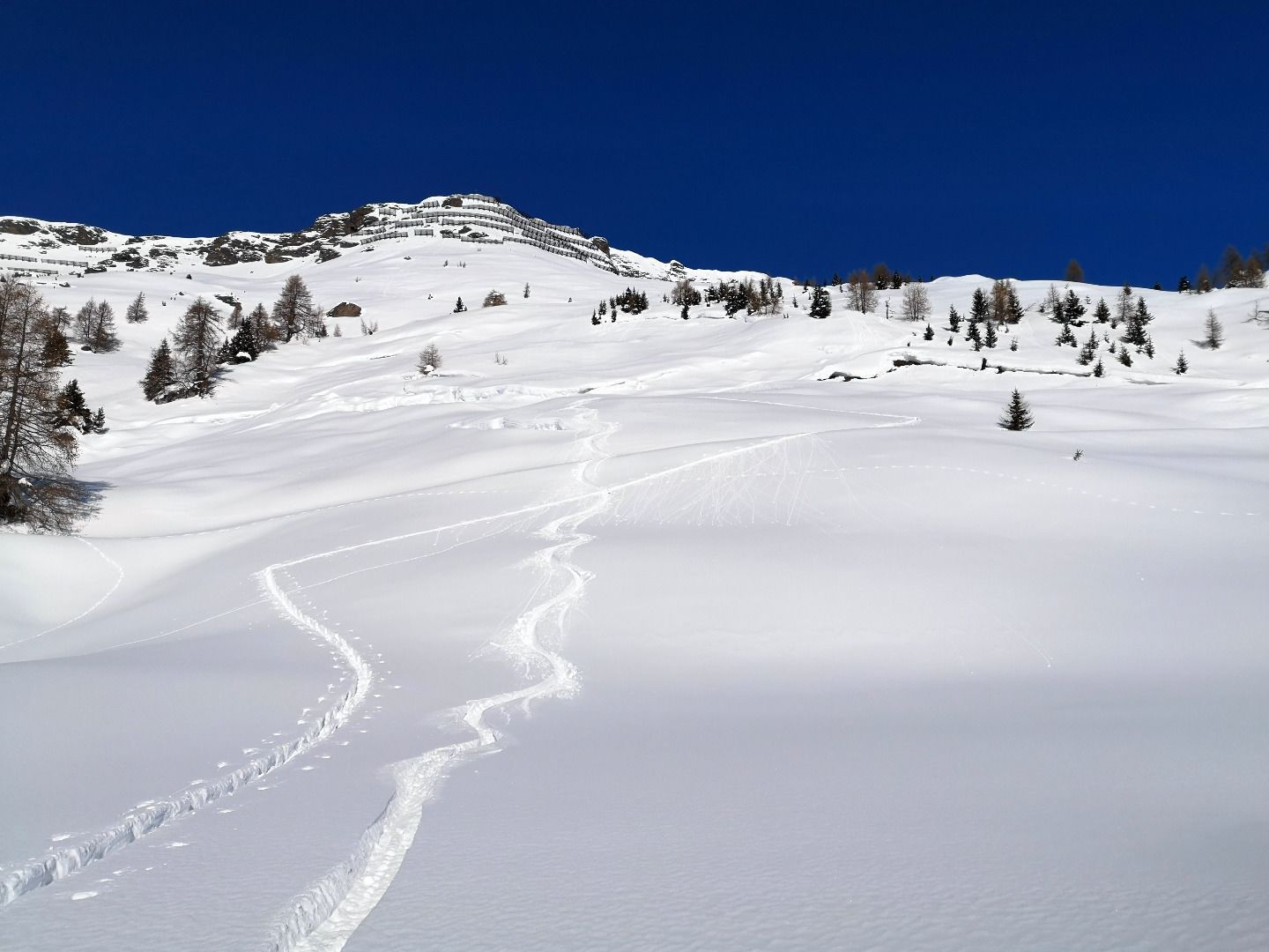
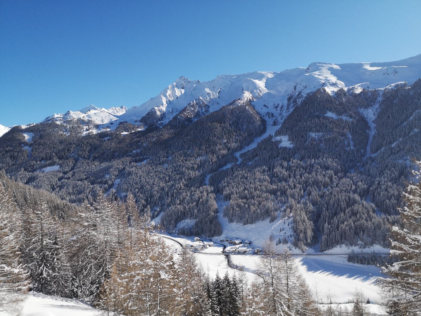
From the high hamlet around the former Edelrauth hut on the sunny side of Schmirn, you first climb up through meadows, forests and meadows to the crossing to Padaster. In front of the magnificent backdrop of Olperer and Fußstein, you then continue close to the ridge to the summit cross. Surrounded on both sides by steep slopes, it stands exposed as the first higher peak at the beginning of the Schmirntal valley - the view over the Wipptal valley and the neighbouring Stubai Alps is correspondingly beautiful and wide. The normal descent over great slopes and forests close to the ascent track can be extended almost to St.Jodok via the upper and lower Leite if the snow conditions are right. Alternatively, it is possible to ski directly from the summit along the very steep south side (via "Knoten") to Rohrach - excellent conditions are a prerequisite for this.
ROUTE DESCRIPTION
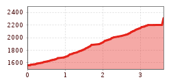
From the parking area just before the start of the high pier, you first walk along the road for a few metres before climbing up a meadow on the right in a northerly direction. Once you have reached the upper end of the meadow, you take a long right turn into the adjoining forest and a little later you reach a forest path in a north-easterly direction. Continue along this path until you reach a bend - a few metres later you reach a barn. Above the barn, the forest gives way to sparse mountain meadows. You then climb through these with a slight turn to the west until you reach the ridge and the crossing into the Padastertal. Here you need to be careful when choosing your track, so as not to cross the one or other steeper passage. From the hermitage, you then follow the striking west ridge for the last 300 metres to the summit cross. It is best to stay close to the ridge, as it is better not to venture too far into the north-west flank, which is often blown off.
SAFETY ADVICE
Due to the pure southern exposure, this tour is suitable as a pure firn tour in the early morning hours if the conditions are right immediately after a snowfall or in the later winter months. Caution is advised along the sometimes over-swept west ridge, as well as in the upper descent area on some somewhat steeper slopes.
TIP OF THE AUTHOR
Take enough to drink! Especially in the sunnier winter months, it can quickly get very warm on the ascent.
By train to Steinach am Brenner, from there take bus line 4144 to Schmirn-Aue. From there, however, you have to walk to the hamlet. Information on the timetable at www.vvt.at


