Anreise mit den Öffis
By train to Steinach am Brenner, from there take bus line 4144 to Vals-Joggler. Information on the timetable at www.vvt.at
Great ski tour in the rear Valsertal valley through scenically beautiful and untouched terrain to the 2,666m high Sumpfschartl, a passage to the Venntal valley.

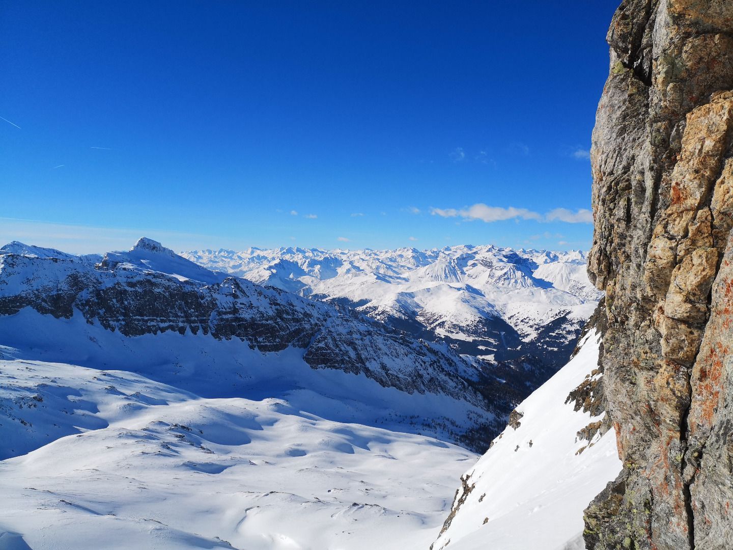
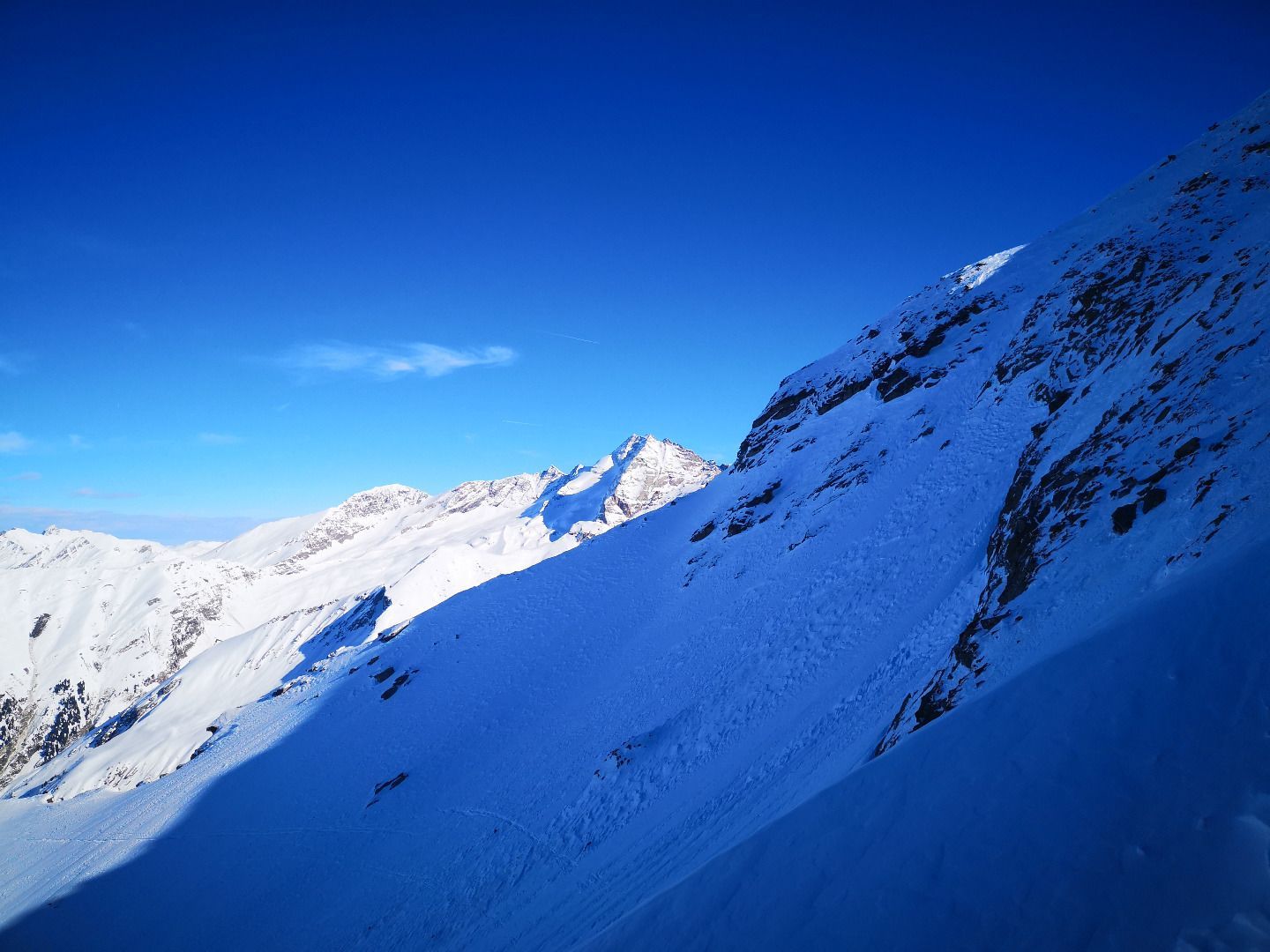
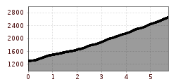
From the "Eben" at the bottom of the valley, the trail first leads through forest and alpine pastures to the beautifully situated Bloaderalm with its centuries-old caserns. From there, the tour continues through somewhat steeper terrain and past a waterfall through sparse larch forests to the timberline. Here the previously narrow valley opens up into a wide basin, bordered to the south and west by the rugged, mighty rock faces of the Saxalmwand and the Geierschnabel. Following the south-eastern course of the valley, which extends to the Kraxentrager, the route then climbs upwards in a pleasant gradient through beautiful skiing terrain. At an altitude of approx. 2,500 metres, you finally reach a larger base - depending on the snow and avalanche situation, this is the end, and only in very good conditions is the last very steep ascent to Sumpfschartl recommended. You are rewarded for the effort of the ascent with a magnificent panoramic view of Hohe Wand, Fussstein and Olperer.
ROUTE DESCRIPTION
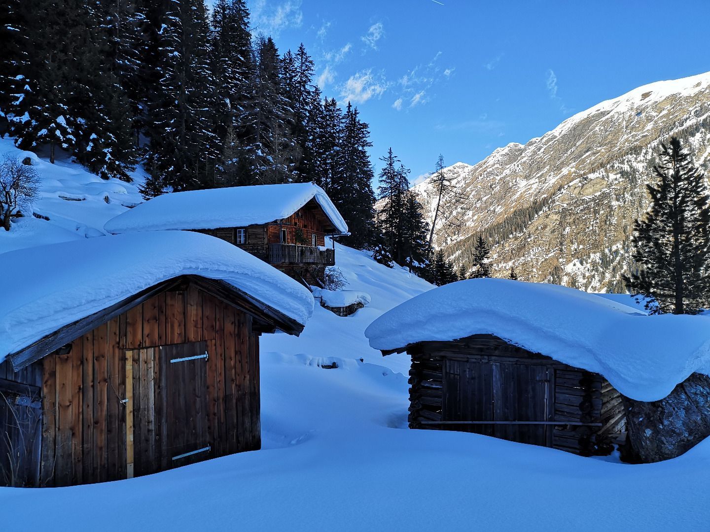
From the starting point in Eben, you first have to cross the stream over one of the bridges. Then head for a high, tree-free alpine pasture, which you first climb up a few hairpin bends. As soon as the terrain becomes steeper, it is best to change to the forest on the right edge and climb up through it until you reach a forest road. Continue eastwards along this path for a few minutes until you reach the Bloaderalm. Once you have passed the rustic alpine huts there, follow the path backwards until you reach a small ground in front of a frozen waterfall. Here you turn left and reach a more demanding section through a larch forest to another floor. Following the course of this one crosses the valley and then climbs on the right side over a wide ditch up to the timberline, where the terrain opens up into a wide basin. On the left side, in a south-easterly direction, the destination of the tour lies in front of the massif of the Kraxentrager. Accordingly, turn left and climb about 600 hm over gentle terrain to a level. The last very steep slope leading up to the Scharte is exposed purely on the north side and often blown in - accordingly, it should only be tackled in excellent conditions.
TIP OF THE AUTHOR
A short rest in the sun at one of the rustic barns in front of the spectacular Vals valley end will lift your heart and soul.
By train to Steinach am Brenner, from there take bus line 4144 to Vals-Joggler. Information on the timetable at www.vvt.at


