
Öffnungszeiten:Heute geöffnet
Ort:Schnalstal
:Alpine pasture / hut / mountain restaurant
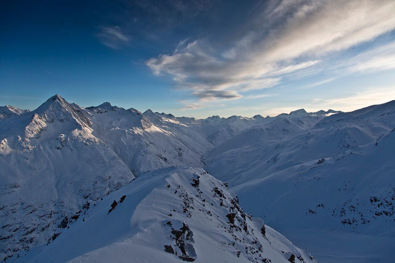
WEISSKUGEL -> HOCHJOCH HOSPIZ
Avalanche Danger Scale
1 (LOW)Avalanche release is only possible with a large additional load on very few, extreme steep slopes. No spontaneous avalanches (so-called slides) are expected. Generally safe conditions.
2 (MODERATE)Avalanche release is likely with a large additional load especially on the specified steep slopes. Larger avalanches are not expected. The snow cover is generally well consolidated except at some steep slopes. Careful route selection on the specified steep slopes and exposures.
3 (CONSIDERABLE)Avalanche release is already likely with little additional load especially on the specified steep slopes. Occasionally some medium, sporadically large avalanches are possible spontaneously. The snow cover on many steep slopes is only moderately to weakly consolidated. Experience in avalanche assessment necessary. Avoid specified steep slopes and exposures as much as possible.
4 (HIGH)Avalanche release is already possible with little additional load especially on the specified steep slopes. Occasionally many medium, often also large avalanches occur. On many steep slopes, the snow cover is only weakly consolidated. Route choice limited to moderately steep terrain and attention to avalanche run-out zones. Much experience in avalanche assessment needed.
5 (VERY HIGH)Numerous large avalanches, even in moderately steep terrain, expected spontaneously. Safe operation in ski areas is no longer possible at this warning level. The snow cover is generally weakly consolidated and unstable. Avoid tours.
See also at lawine.tirol.gv.at
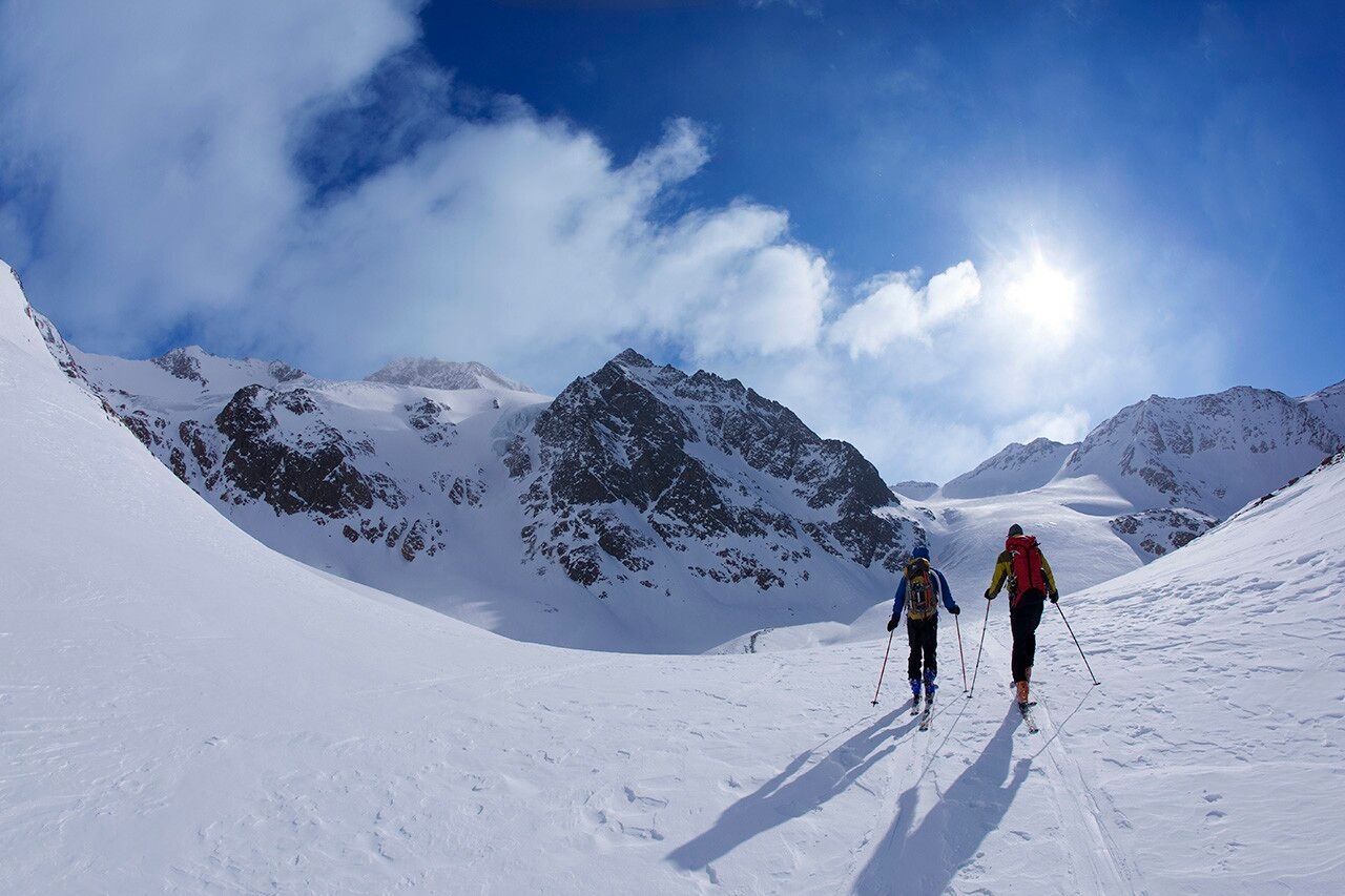
Recommended ski tour equipment
The "normal ski touring equipment" consists of touring skis with touring bindings, telescopic poles, climbing skins, crampons, digital avalanche transceiver, avalanche shovel, avalanche probe, first aid kit and a mobile phone. A "complete glacier equipment" consists of a harness, two prusik slings or ascenders of different lengths, two HMS carabiners, ice axe, crampons and a rope. A backpack with appropriate contents should be carried, including spare clothing, sun protection, cold protection, provisions and enough to drink! For hut overnight stays, do not forget to bring hygiene articles and a hut sleeping bag!
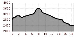
DIFFICULTY RATING
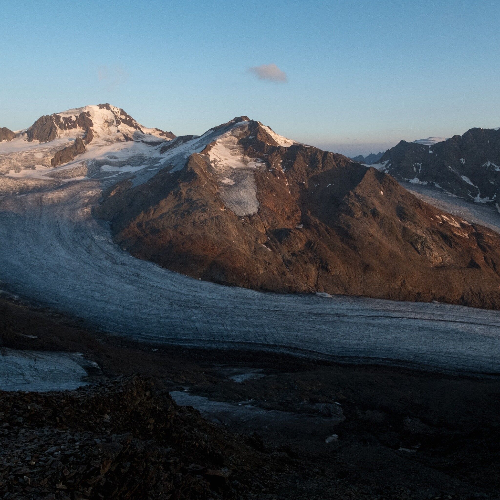
Ascent over the saddle in the rear ice (3,270 m) and Egg (3,219 m) –> descent Hintereisferner –> ascent over the Hintereisferner to the Hintereisjoch (3,460 m, 4 - 4.5 h) –> across the south ridge to the Weißkugel (3,739 m, 1 h) –> descent Hintereisferner to Hochjoch Hospiz (2,413 m, 2 h);
Travel comfortably and safely by train to the Ötztal station. The final station or drop-off point is the ÖTZTAL station. Afterwards, travel conveniently and quickly by public transport or local taxi companies through the whole valley to your desired destination! The current bus schedule is available at: http://fahrplan.vvt.at
In the mountaineering village Vent, the following parking options are available to you.
- In summer in front of the village (parking meter, coins or EC card only) and at the valley station of the chairlift (at the ticket counter of the cable cars)
- In winter only at the valley station of the chairlift.
Cost: € 5.00 per day/car


