Westliche Schöberspitze (2,580 m)

Streckenlänge: 3.6 km
Dauer: 3:00 h

A panoramic ski tour with the imposing Olperer mountain in the background.

Toureninformation

  • Länge: 3.6 km
  • Dauer: 3:00 h
  • Höhenmeter Bergauf:1,080 hm
  • Höhenmeter Bergab:0 hm
Höchster Punkt2,580 m

Ausgangspunkt

Parking area Wildlahnertal

Endpunkt

summit Schöbernspitze

Ausrüstung

Ski touring equipment with shovel, search probe, avalanche transceiver, tea, drinks, snacks, sun protection
Quelle: TVB Wipptal

Beschreibung

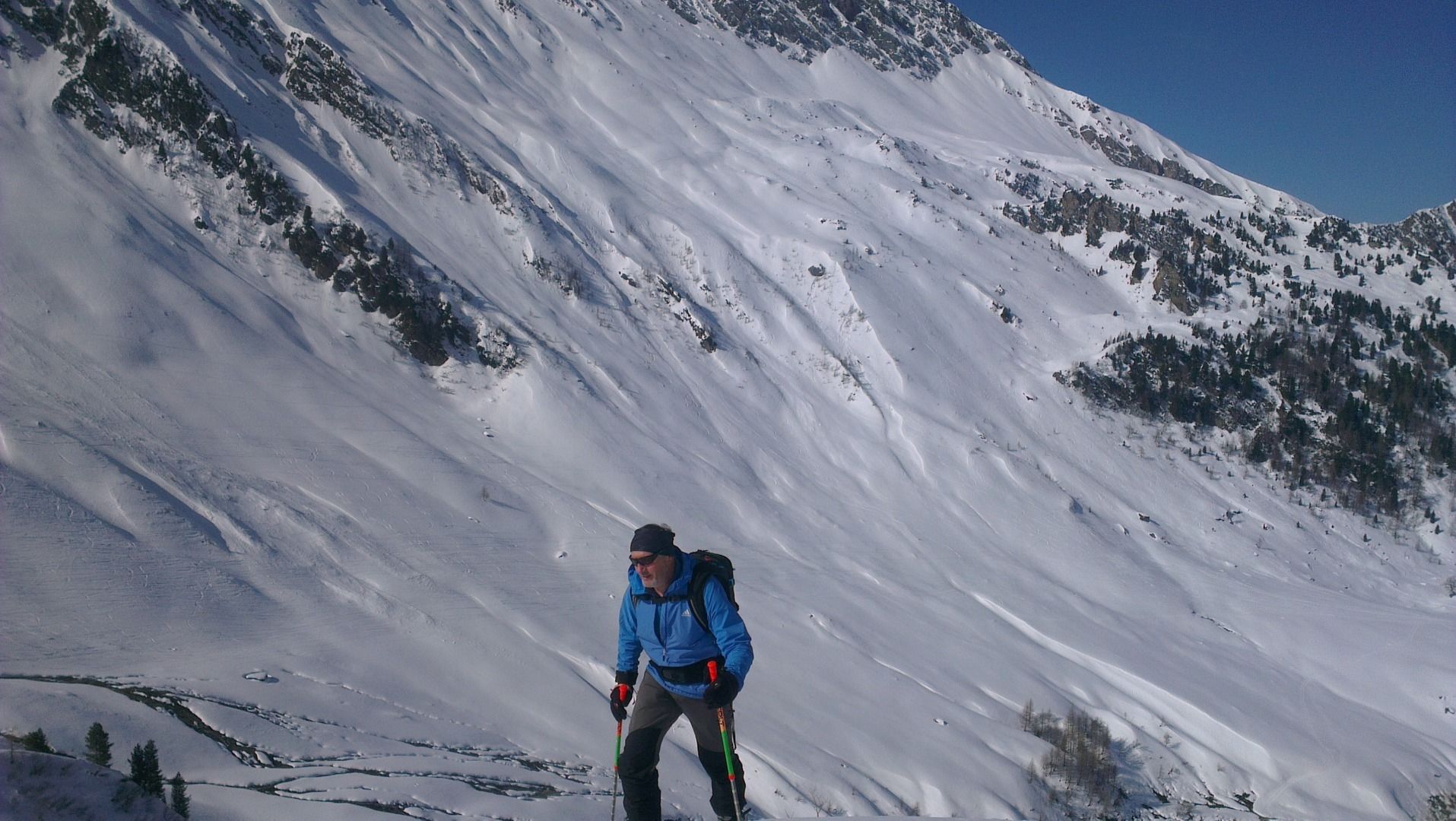
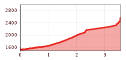
From the car park, immediately turn left across a meadow next to the stream to a large avalanche ditch on the left, climb this along the summer trail. After a sparse section of forest, at the corner where the path leads out of the forest, leave the path and go diagonally right across the steep southern slopes of the Schönlahnspitze (up to 2,120m). After a stretch you reach flatter terrain, from there keep going to the right over a saddle. On the north side through a hollow and then right into a saddle (2,540m) between the western and eastern Schöberspitze. There is the ski depot. Again along the summer path, now diagonally upwards to the left to the ridge and then right to the summit with cross.

Descent via the ascent path.

Anreise

  • Anreise mit den Öffis

    By train to Steinach am Brenner, from there with bus line 4144 to Schmirn to the stop Schmirn Toldern. Approx. 15 min hike in the direction of Wildlahnertal and Olperer to the starting point.exact timetables can be found at www.vvt.at. Free use of the bus with the Wipptal Guest Card!

  • Parken

    Parking area Wildlahnertal

Weitere Touren in der Umgebung

  • Seefelder Joch

    Schwierigkeit:medium
    Länge:5.8 kmDauer:2:30 hHöhenmeter bergauf:866 m
  • Breiteggspitze

    Schwierigkeit:easy
    Länge:3.4 kmDauer:2:00 hHöhenmeter bergauf:700 m
  • Mutterer Alm

    Schwierigkeit:medium
    Länge:3.1 kmDauer:2:00 hHöhenmeter bergauf:581 m
  • Hoadl-Haus

    Schwierigkeit:easy
    Länge:7.6 kmDauer:2:25 hHöhenmeter bergauf:778 m
  • Bichalm

    Schwierigkeit:easy
    Länge:2.4 kmDauer:1:30 hHöhenmeter bergauf:450 m
  • Eichenhof

    Schwierigkeit:medium
    Länge:4.7 kmDauer:2:50 hHöhenmeter bergauf:898 m
  • Patscherkofel Schutzhaus

    Schwierigkeit:medium
    Länge:13.3 kmDauer:2:30 hHöhenmeter bergauf:1,000 m
Tirol Newsletter

The mountain is calling? So does our newsletter!

In our monthly newsletter we reveal the best holiday tips for Tyrol.