
Öffnungszeiten:Heute geöffnet
Ort:Längenfeld
:Restaurant
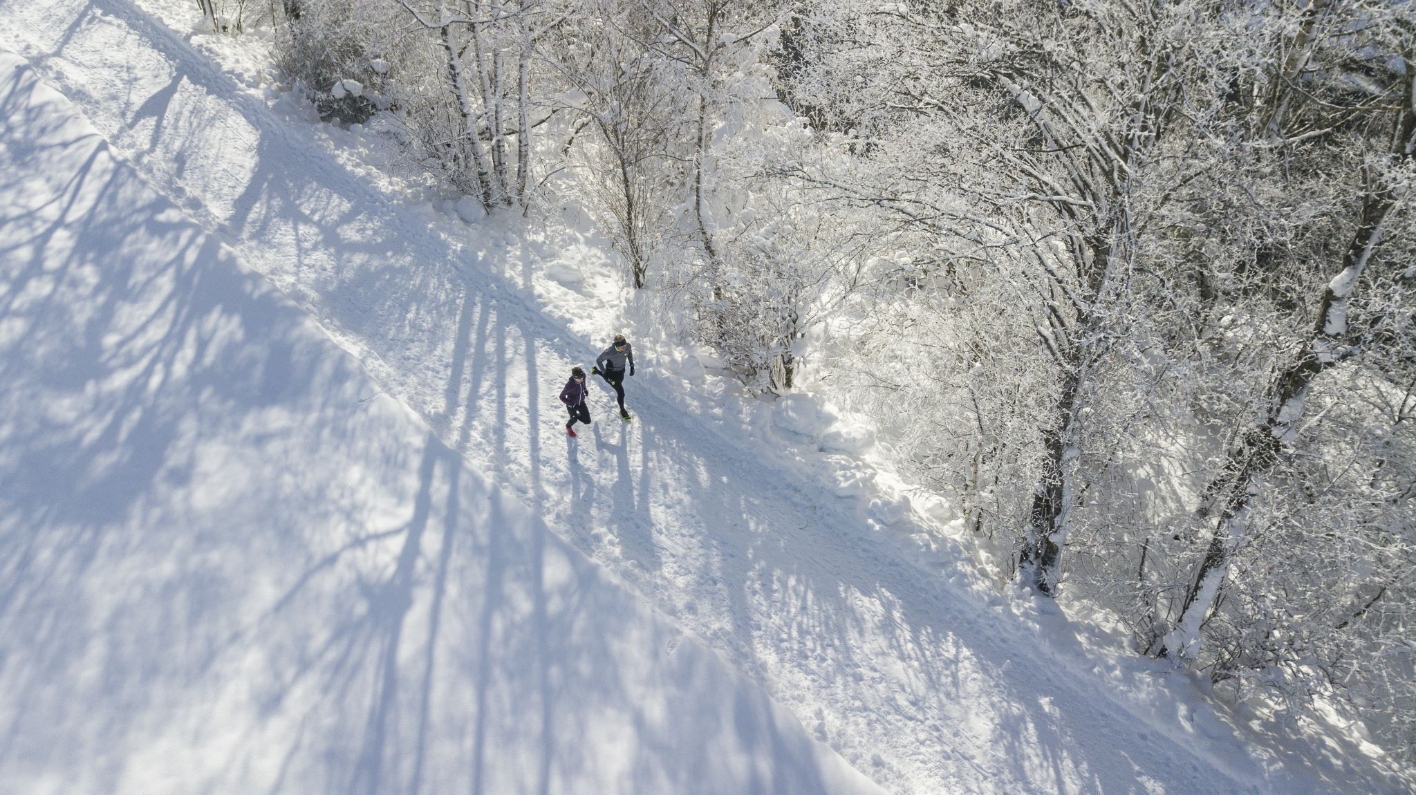
LÄNGENFELD -> Camping Ötztal -> Dorfer-Au -> Au -> Winklen -> Lehner-Au -> LÄNGENFELD

Please note the current snow and avalanche report for the coming days: www.oetztal.com/de/ & https://lawinen.report/bulletin/latest
The Ötztal Tourism team will be happy to inform you personally about the condition of the winter hiking trails.
Ötztal Tourism T +43 5 72 00 300 - info@laengenfeld.com
Appropriate equipment such as breathable and weather-appropriate outdoor clothing is required for all hikes and routes.
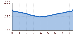
On this hike, you initially follow the Ötztaler Ache downstream and later upstream. The starting point can vary depending on mood and preference. However, we start in Längenfeld at the sports center. In front of the campsite, a path leads right between the ice rink and a small stream to a bridge. After crossing, stay on this path until you reach the road to Oberried. Now cross the road and follow the Ache to the hamlet of Au. Here, cross the bridge again and take the return route on the other side of the river back to Längenfeld. Along the entire route, you will enjoy the tranquility and a magnificent view of the Ötztal mountain world.


