Strass - Schlitters - Bruck - Strass
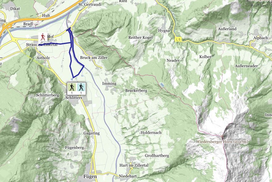
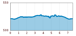
This trail leads from the municipal office past the church, through the village and up to the Ziller promenade. The hike follows the cycle track and footpath into the valley all the way through to Schlitterer See lake. Turn left between the Seecafe and the playground, then head straight on to return to the Ziller river. After crossing the
pedestrian bridge in the direction of Bruck, you should keep left. Hike along the bank of the Ziller until the end of the village, then cross the bridge to reach the other side of the river. At the cycle track and footpath, keep right and head back into the valley towards Strass.
Stop off possibilities: restaurants in the village, Seecafe Schlitters
