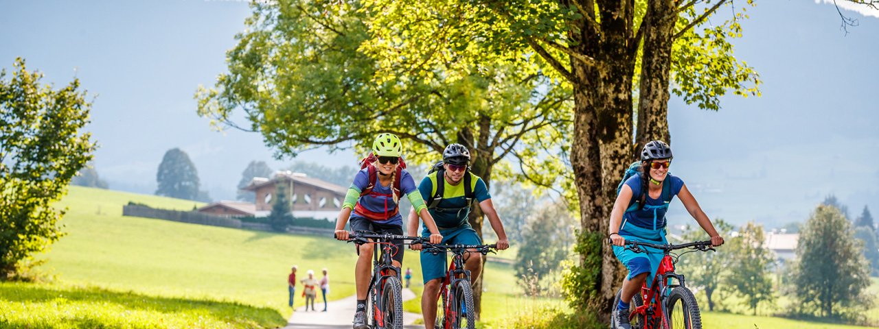
The KAT Bike trail in the Kitzbühel Alps is the perfect trail for multi-day adventures in spring, summer or autumn. At 180km it is divided into four stages. Each stage can be ridden individually as well as in conjunction with the others. The local tourism board in Kitzbühel offers a series of KAT Bike packages with luggage transport. Riders stay the night in Mariastein, Hopfgarten, Brixen im Thale, Oberndorf in Tirol and Fieberbrunn. This ride is also recommended for e-bikes.

Multi-Day Ride
Starting point
Mariastein
Finishing point
Fieberbrunn
Mountain chain
Kitzbühel Alps
Length
147 km
Duration
3 day(s)
Features
- Circular route
- Handicap-accessible
- Route with e-bike charging station
Difficulty rating
difficult
Altitude
1,931m 598m
Elevation uphill 5,300m
Vertical metres downhill 5,130m
Fitness level
Technique
Best time of year
Jan
Feb
Mar
Apr
May
Jun
Jul
Aug
Sep
Oct
Nov
Dec
* These are approximate values and recommendations. Please take your personal fitness level, technical ability and the current weather conditions into account. Tirol Werbung cannot guarantee that the information provided is correct and accepts no liability.
Trail description
Day 1: Mariastein - Hopfgarten
Distance: 25 kilometres, elevation gain/loss in vertical metres: 700/700, difficulty: easy (blue)
The KAT Bike trail begins in the small pilgrimage location of Mariastein in the east of Tirol. After admiring the Wallfahrtskirche Mariastein church, riders set off on what is a relatively gentle first stage leading past old farmhouses and points of historical interest. The route leads up over the Angerberg mountain down to the Inn river and on to the town of Wörgl. Once the first real climb of the day has been completed, riders reach the Möslalm hut at 964 metres above sea level offering fine views of the Inn Valley. The route then continues along the forest road and down to the hamlet of Pinnersdorf. Once down in the valley, the trail takes riders as far as Bruckhäusl and along the Brixental Cycle Path to Hopfgarten. Hopfgarten is a charming village with baroque architecture which is well worth exploring.
Day 2: Hopfgarten - Brixen im Thale
Distance: 46 kilometres, elevation gain/loss in vertical metres: 1650/1650, difficulty: intermediate (red)
The second stage leads from Hopfgarten along a back road up onto the sunny Penningberg plateau and in towards the end of the valley. It is here that the climb to the Haag-Alm hut at 1350m begins. After a fun descent to Kelchsau, riders head to the bottom cable car station in Kelchsau and follow a meadow trail to the Toifhof with its fabulous views. There is a short section below the Glantererkogel mountain where riders must push their bikes, before the riding continues past the Angerla Alm hut as far as the Kinzling Alm hut. The descent into the Windautal Valley begins with a short climb. The final few kilometres lead down to Westendorf and via the Brixental Cycle Path to the village of Brixen im Thale.
An easy version of this stage is also available. For details please visit: www.kitzbueheler-alpen.com
Day 3: Brixen im Thale - Oberndorf in Tirol
Distance: 53 kilometres, elevation gain/loss in vertical metres: 2000/2532, difficulty: difficult (black)
Riders who have taken part in the KitzAlpBike Marathon will be familiar with this third stage of the KAT Bike trail. It leads through beautiful lush meadows and twisting trails starting from Brixen. The first section takes riders via the Brixenbachgraben up to the Wiegalm hut (1525m). This is the highest point of the saddle and marks the start of the section to the Harlassanger Alm and eventually the easy Wiegalm Trail leading all the way to the Aschau Cycle Path. After turning left to the Oberer Grund, riders pass the Kloo Alm hut and meet the Aschau High Trail with its spectacular views of the Spertental Valley out towards Kirchberg. From the Krunaalm hut the route heads right and uphill to the Pengelstein mountain (1938m) and on to the Ehrenbachhöhe. The trail turns left to the Fleckalm Trail (difficulty level S2) which ends at the car park of the Fleckalmbahn cable car in Kirchberg. The Brixental Cycle Path then takes riders past the Schwarzsee Lake towards Kitzbühel. In Oberndorf in Tirol the third day of riding comes to an end.
An easy version of this stage is also available. For details please visit: www.kitzbueheler-alpen.com
An intermediate version of this stage is also available. For details please visit: www.kitzbueheler-alpen.com
Day 4: Oberndorf in Tirol - Fieberbrunn
Distance: 54 kilometres, elevation gain/loss in vertical metres: 1900/1750, difficulty: difficult (black)
At 54 kilometres in length with two long climbs and around 1900 vertical metres of elevation gain, the final stage if not to be underestimated. It starts in Oberndorf in Tirol and leads up to the Harschbichlalm hut at 1604 metres above sea level, where riders should take a moment to drink in the marvellous views of the Kitzbüheler Horn mountain. From here the route heads downhill to St. Johann. From the mid-way station of the cable car there is the option of taking the twiting singletrack or staying on the Harschbichl I trail (leading to the Harschbichl II trail). Fine views await those riders who opt to take the Harschbichl III trail. From the centre of St. Johann in Tirol the route continues towards Kirchdorf and enters the settlement of Habach. From there, riders take first a narrow tarmac road and later a beautiful wide forest track heading uphill. It is here that they can enjoy fine views of the Wilder Kaiser Mountains and the Kitzbüheler Horn peak. Continue uphill, past the Adlerspoint Alm hut all the way to the Gerstbergalm hut. Riders must then shoulder their bikes for a short section before re-mounting and riding past the Winterstelleralm hut along a gravel road down to St. Ulrich am Pillersee. The final section leads along the cycle path via St. Jakob in Haus to Fieberbrunn, before riders take the train back to the starting point in Mariastein (if they have chosen to park their car there).
An easy version of this stage is also available. For details please visit: www.kitzbueheler-alpen.com
An intermediate version of this stage is also available. For details please visit: www.kitzbueheler-alpen.com


