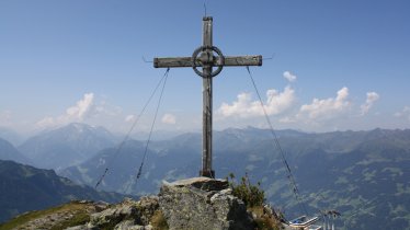
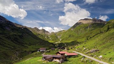
This challenging two-day hike begins in the village of Ginzling. From the rock climbing area, hikers cross lush alpine pastures to the Berliner Hütte hut, a protected building. Day one offers spectacular views of the Zillertal Alps Nature Park. Highlights include the fine views of the Grawandhütte hut and the nearby waterfalls from the Schönbichler Kar and the deep canyon carved into the rock by the rushing Zemmbach river. Things get even tougher on day two. After staying the night at the Berliner Hütte hut, the day begins with a tricky ascent up to the Schönbichler Horn (3,134 metres), the highest point of the trek. Some sections here have a steel rope anchored into the rock for safety. Hikers require not only good overall fitness but also must be sure-footed and have a good head for heights. The reward for all that hard work is a majestic panorama of the Main Alpine Ridge, including many glaciers. As you descend down the western flank, you are likely to encounter patches of snow even in early summer. Continue via the Furtschaglhaus lodge to the Schlegeisspeichersee reservoir.

Starting point
Ginzling
Hike to
Berliner Hütte, Schlegeisspeicher
Finishing point
Schlegeisspeicher reservoir
Mountain chain
Zillertal Alps
Length
32.4 km
Duration
2 day(s)
Features
- Wheelchair-accessible Hiking Route
- Circular hike
Difficulty rating
difficult (black trails)
Altitude
Elevation uphill 2,300m
Vertical metres downhill 1,510m
Fitness level
Technique
Best time of year
* These are approximate values and recommendations. Please take your personal fitness level, technical ability and the current weather conditions into account. Tirol Werbung cannot guarantee that the information provided is correct and accepts no liability.
Public transport
- Accessible using public transport
Parking
Car park in Ginzling
Places serving food & drink
- Stage 1: Alpengasthof Breitlahner (May until September), Klausenalm (May until October), Grawandhütte (early May until early October), Alpenrose-Hütte (early June until early October), Berliner Hütte (early June until late September)
- Stage 2: Furtschaglhaus (mid-June until mid-September), Zamser Eck/Bergrestaurant Schlegeis (mid-May until late September), Gasthaus Dominikushütte (mid-May until late October), various locations in Ginzling
Downloads
Trail description
Stage 1: Ginzling – Berliner Hütte
Uphill/downhill: 1,076/25 vertical metres, walking time: 5 hours 50 minutes, distance: 16 kilometres, highest point: 2,040 metres, difficulty level: intermediate (red trails)
Starting at the church in Ginzling, stay on the left bank of the Zemmbach river as you walk through the village into the Zemmtal Valley. It is a gentle ascent on the old valley road that takes you along meadows and through groves. Always remember to stay on the left bank of the river, following it downstream. Having passed the Gasthof Roßhag inn, the trail merges onto the valley road. Continue without changing direction. Then, take the left fork towards the Alpengasthof Breitlahner inn right before reaching the start of the Schlegeis toll road (as an option you can catch a bus from Ginzling to Breitlahner). Here, follows the signs for “Berliner Hütte”. Cross the river and follow the dirt road towards the Klausenalm hut. There is a turnoff right before the hut, where you continue on the right bank of the Zemmbach river. From there, the trail follows an even path within wide open terrain along Zemmgrund. You will soon reach the area of Schwemmalm. Stay on the left side of the slope and follow the steep climb to the Grawandhütte hut, which is followed by various switchbacks leading up to the wide open alpine pastures. As the valley narrows, take the steep singletrack trail winding up to the Alpenrosenhütte hut and directly to the refuge (do not cross the river towards Waxeggalm). Having passed the Alpenrosenhütte hut, continue on the footpath to your left that takes you gently up to the Berliner Hütte hut.
Tip! The multipurpose village hall in Ginzling hosts regular exhibitions about the Zillertal Alps Nature Park as well as other regional topics.
Stage 2: Berliner Hütte – Schönbichler Horn – Schlegeisspeicher
Uphill/downhill: 1,225/1,485 vertical metres, walking time: 9 hours, distance: 16.4 kilometres, highest point: 3,134 metres, difficulty level: difficult (black trails)
Leave the Berliner Hütte hut southward, cross the small ravine of Zemmbach river and follow the way-marked track to “Schönbichler Horn, Furtschaglhaus” (the first part of this section takes you gently downhill). Having crossed the stream that runs down the Hornkees glacier, continue to the first lateral moraine of the Waxeggkees glacier. From there, the route along the footpath has some ups and downs. Cross the brook rushing down from the Waxeggkees glacier and follow the path up to the second lateral moraine. Continue on the old path along the moraine before climbing a trail along the meadows. The next section has fixed ropes to safely navigate. Turn right and continue your ascent along the ridge, which takes you through rugged terrain with boulders and talus. Follow the wide ridge up to the Schönbichlerscharte notch, which is situated just a few metres below the summit of the Schönbichler Horn. This steep section is assisted by a fixed anchoring system of cables. From the summit cross, continue in a westward direction towards the lateral moraine of the Furtschaglkees glacier and climb up to the Furtschaglkar cirque. From the cirque, it’s a gentle downhill stroll along the meadows to the southwest and you will soon reach Furtschaglhaus lodge. Keep to the west and follow the footpath that steeply zigzags its way down to Furtschaglboden. Keep to the right bank of Schlegeisbach river and continue on the forest road that leads out of the valley. Not long before you reach Schlegeis reservoir, change to the left bank of the river along a tiny dam. Follow the broad trail along the western shore of the lake. This level trail will finally take you to the dam (in the very last section the trail turns onto a dirt road).


