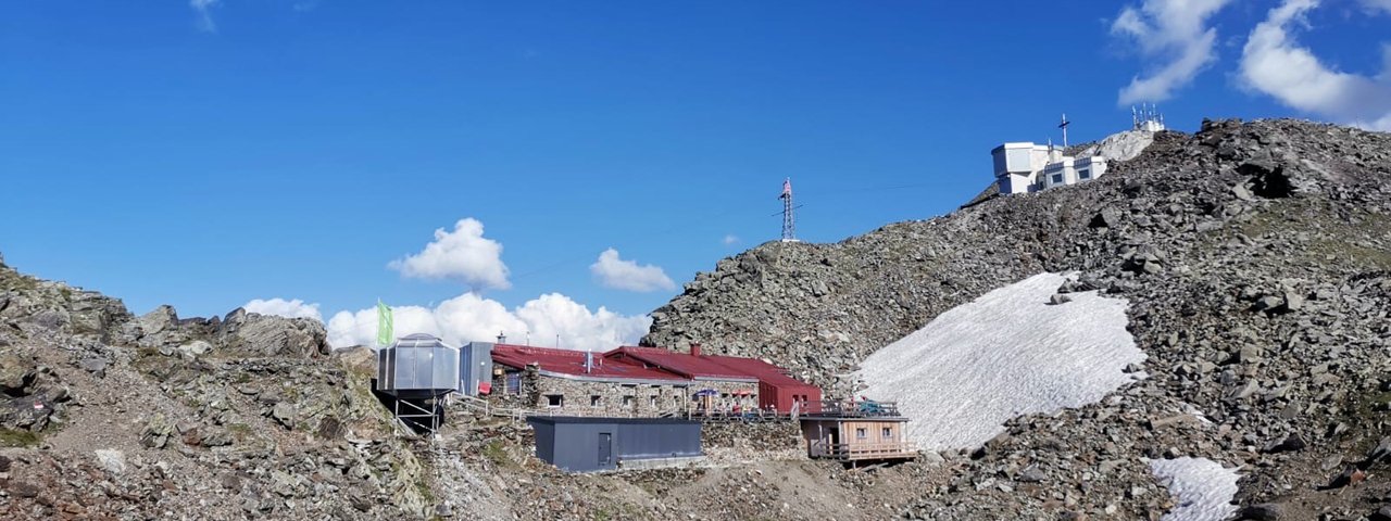
The Glungezerhütte (2,610 metres) is a popular hut for day trips and ski touring day excursions at Glungezer in the Tux Alps, Tirol.
Mountain hut popular with walkers, hikers and skiers
Austrian Alpine Club, Hall in Tirol Division
The Glungezerhütte is the highest Austrian Alpine Club ski touring hut in Tirol. The summit of the Glungezer mountain is accessible in around an hour in winter using the Glungezer lifts. However, this magnificent mountain dwelling designed by renowned architect, Theo Prachensky, is also a much visited destination in summer. Nestled on the ridge between the Glungezer and Sonnenspitze peaks, it offers an incredible mountain panorama of around 500 summits, crests and peaks. The hut itself is in great condition and has been awarded with some coveted “Alpine Oscars”, the “Tirolean Mountain Trail Seal of Quality” and “Culinary Creations of the Highest Level”. Because mountain climbers often like to eat healthily, vegetarian and vegan cuisine is also offered. Due to the great choice offered and appropriate equipment available, the Glungezer hut is often used for alpine courses.
How to get to the Glungezer hut
From Hall in 5.5 hours, from Schartenkogel/top of ski lift in 1 hour, Glungezer hiking route from Tulfes in 4 hours (including use of cable cars)
Walks and hikes in the area (walking time to summit)
Glungezer (2,677 metres), 15 minutes, intermediate
Kreuzspitze (2,746 metres), 2.75 hours, difficult
Patscherkofel (2,247 metres), 3 hours, intermediate
Naviser Jöchl (2,479 metres), 5 hours, difficult
Further huts in the area, long-distance hiking trails
Lizumer Hütte, 9 hours
Patscherkofelhaus, 2.75 hours
Meißner Haus, 2.5 hours
The Glungezerhütte is on the Inn Valley High Trail (Stage1/2) and the Munich-Venice Dream Path (Stage 8). It is also connected to the Eagle Walk (Stage 13).
Mountain hut popular with walkers, hikers and skiers Austrian Alpine Club, Hall in Tirol Division The Glungezerhütte is the highest Austrian…


