
Opening hours:Open today
Place:Leutasch
:Alpine pasture / hut / mountain restaurant
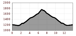
Route No. 540 - Bike tour with the most beautiful view
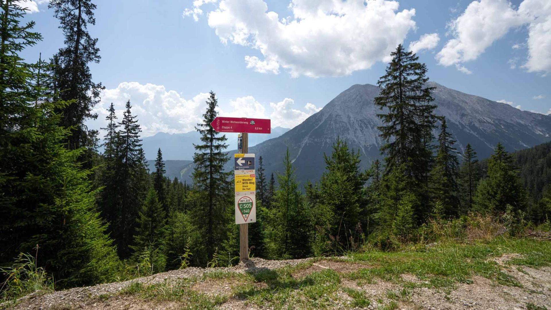
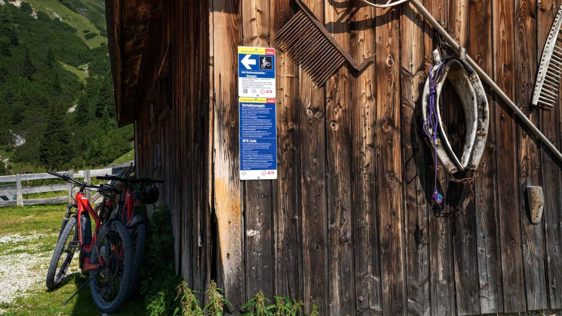
Gravel - Good riding skills (especially downhill) required. Steep, partly rough forest road.
You can find all the latest information on the road closures in the Seefeld region here.
Have you discovered a spot that we should rework or repair? Fill in the 'Report hazard' form and let us know where work is needed in the region.
Good physical condition & technique required. Off-road bike (mountain bike, gravel bike, etc.), helmet, gloves
Suitable equipment is also available in the bike stores in the region.
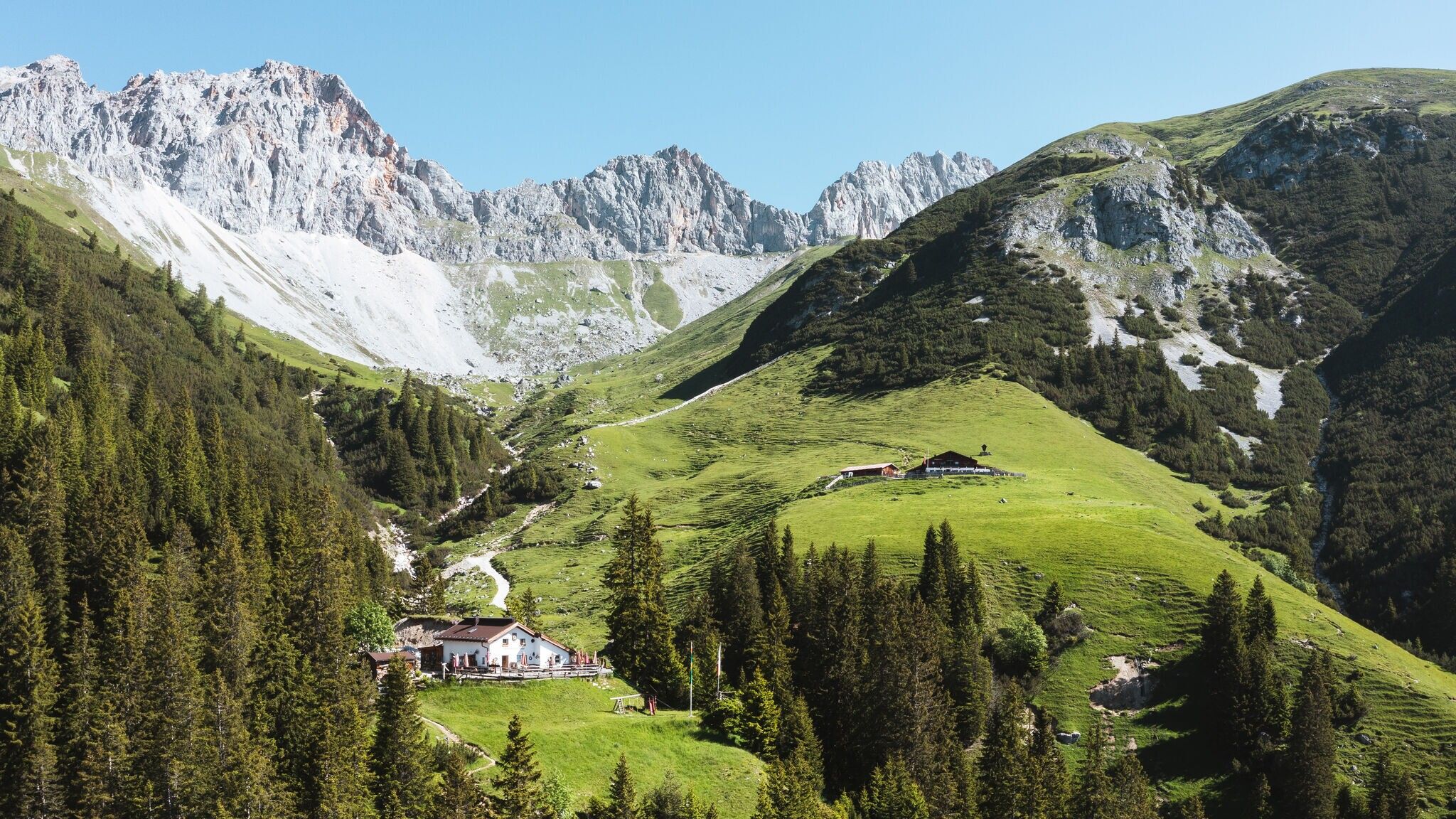
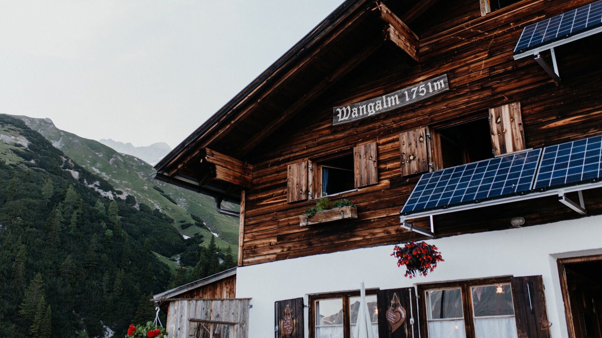
Note: The Wettersteinhütte is currently closed.
Gaistal in Summer – Hiking & Biking in Region Seefeld
The starting point is the Salzbach parking area (P3, P4, P5) in the western part of Leutasch. From there, you do not head into the valley initially, but follow the paved road back toward the Klamm district. At the “Fiakerstüberl”, the route turns north and continues along local roads until reaching the forest road entrance.
From this point, the actual ascent begins: a consistently moderately steep, rideable gravel road through dense forest, with many shaded sections and occasional rest spots. The route has been newly constructed in recent years and climbs in switchbacks as well as longer, gentler stretches.
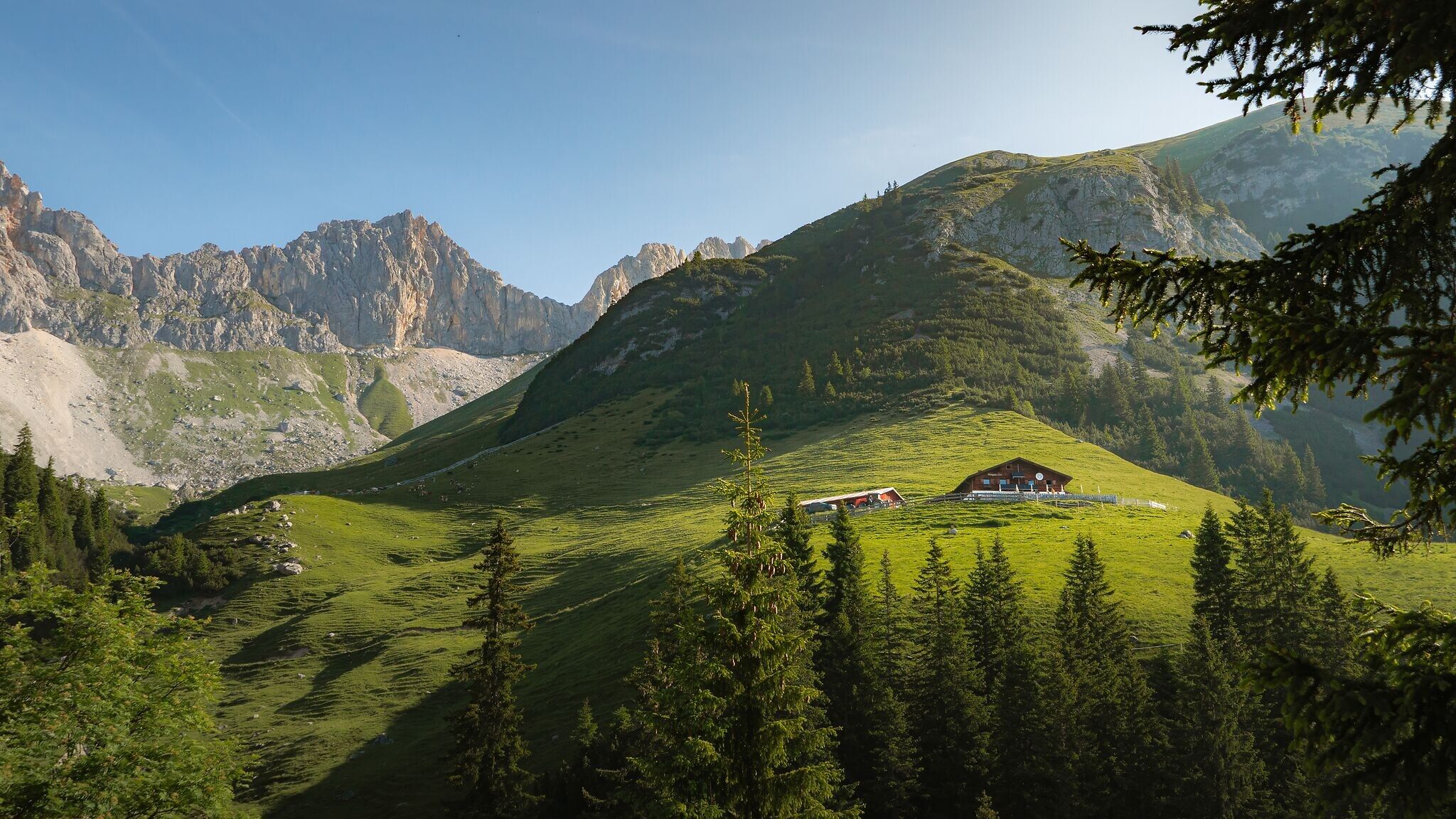
Above the tree line, at the junction about 100 meters below the Wettersteinhütte (not serviced) and the Wangalm, the tour becomes significantly more alpine.
Here:
Take the bus to Leutasch and get off at the 'Gaistal/Salzbach' bus stop.
All real-time connections can be found in the route planner.
You can find all information about bicycle transportation on the bus here.
Guest Card = Travel Card: The guest card is valid during your stay as a ticket for all public bus connections in the region (up to Telfs and Mittenwald). In addition, the train ride between Seefeld and Scharnitz and the Wildmoosbus are also included. However, a separate ticket for bicycle transportation on the train must be purchased at the ticket counter of the Seefeld information & mobility center or online.
Parking lots P3, P4, and P5 'Salzbach' in Gaistal - Leutasch.
You can find all other car parks in Leutasch here.


