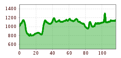
Open interactive mapOpen this POI on the interactive mapElevation profileGrenzenLoser Radspaß Bad Hindelang Tannheimer Tal.gpx
Das Falzthurntal wirkt aufgrund der bunten Blumenwiesen und der markanten Bergwelt sanft und schroff zugleich. © Achensee Tourismus Handbike ride Pertisau - FalzthurnalmDifficulty:difficultLength:3.3 kmDuration:1:00 hElevation uphill:105 mGo to biketourGo to biketour: Handbike ride Pertisau - Falzthurnalm
Tux - Höllensteinhütte-Grieralm-RundeDifficulty:mediumLength:12.5 kmDuration:2:30 hElevation uphill:565 mGo to biketourGo to biketour: Tux - Höllensteinhütte-Grieralm-Runde
Lakata Trail © bikeboard/Roland Kachelhauser Alban Lakata Trail No. 142Difficulty:mediumLength:2.0 kmDuration:0:20 hElevation uphill:10 mGo to biketourGo to biketour: Alban Lakata Trail No. 142
Lienz, Peter Sagan Trail crop (1) © Tirol Werbung | Sebastian Schels Peter Sagan Trail No. 141Difficulty:mediumLength:5.0 kmDuration:0:30 hElevation uphill:90 mGo to biketourGo to biketour: Peter Sagan Trail No. 141
On the Lech Cycle Path ⒸRobert Eder, Reutte Nature Park Region © Naturparkregion Reutte | Robert Eder LechradwegLength:244.6 kmDuration:18:00 hElevation uphill:1,702 mGo to biketourGo to biketour: Lechradweg
der Weg am Ufer des Achensees ist ein tolles Handbiker Areal © Achensee Tourismus Handbike ride Maurach - AchenkirchDifficulty:mediumLength:9.0 kmDuration:1:00 hElevation uphill:35 mGo to biketourGo to biketour: Handbike ride Maurach - Achenkirch
am Gipfel des Feilkopfes © Achensee Tourismus 435 FeilkopfDifficulty:mediumLength:8.3 kmDuration:2:00 hElevation uphill:580 mGo to biketourGo to biketour: 435 Feilkopf
Mountainbiken - am Beginn der Karwendeltäler in Pertisau © Achensee Tourismus Buchau - GramaialmDifficulty:easyLength:32.9 kmDuration:3:00 hElevation uphill:540 mGo to biketourGo to biketour: Buchau - Gramaialm
Rad Bike MTB E-Bike Radfahren © Mathäus Gartner Kaiserweis pure culinary cycle routeDifficulty:mediumLength:71.9 kmElevation uphill:540 mGo to biketourGo to biketour: Kaiserweis pure culinary cycle route
BergkasteltrailOpening hours:openDifficulty:mediumLength:5.5 kmGo to biketourGo to biketour: Bergkasteltrail
Lakata Trail © bikeboard/Roland Kachelhauser Flow Family Trail Nr. 155Difficulty:easyLength:4.0 kmDuration:0:30 hElevation uphill:60 mGo to biketourGo to biketour: Flow Family Trail Nr. 155
TVB Bike 204.jpg © Nikola Radovic - NKLRDVC photo Wetterstein trail red - Fifty/FiftyOpening hours:openDifficulty:mediumLength:1.2 kmGo to biketourGo to biketour: Wetterstein trail red - Fifty/Fifty
Rennrad Bike Rad © Erwin Haiden Chiemgau circuitDifficulty:mediumLength:176.1 kmElevation uphill:723 mGo to biketourGo to biketour: Chiemgau circuit
Region-Hohe-Salve-Gravel-Bike-07-2025-Fotograf-Stefan-Ringler-Web-09.jpg © Stefan Ringler SalvenaradrundeDifficulty:mediumLength:62.7 kmDuration:3:30 hElevation uphill:648 mGo to biketourGo to biketour: Salvenaradrunde
Region-Hohe-Salve-Gravel-Bike-07-2025-Fotograf-Stefan-Ringler.jpg © Region Hohe Salve - Stefan Ringler Brixental cycling tour Nr. 21Difficulty:easyLength:46.7 kmDuration:3:30 hElevation uphill:450 mGo to biketourGo to biketour: Brixental cycling tour Nr. 21
Käsealm Straubing © Ferienregion Hohe Salve Käsealm Straubing past WindauDifficulty:mediumLength:19.8 kmDuration:2:30 hElevation uphill:270 mGo to biketourGo to biketour: Käsealm Straubing past Windau
biken102_klammljoch_2019_(c)Erwin Haiden, bikeboard.at.jpg © Erwin Haiden, bikeboard.at Klammljoch - Defereggental No. 102Difficulty:mediumLength:22.0 kmDuration:3:30 hElevation uphill:946 mGo to biketourGo to biketour: Klammljoch - Defereggental No. 102
Komperdell Tour © © Serfaus-Fiss-Ladis Marketing GmbH Komperdell Tour 761Opening hours:openDifficulty:mediumLength:17.4 kmDuration:1:30 hElevation uphill:650 mGo to biketourGo to biketour: Komperdell Tour 761
Adlertrail © bikeboard/Roland Kachelhauser Adlertrail No. 138Difficulty:mediumLength:3.7 kmDuration:0:20 hGo to biketourGo to biketour: Adlertrail No. 138
Singletrail Höhenweg 880Opening hours:openDifficulty:mediumLength:2.0 kmDuration:0:15 hElevation uphill:15 mGo to biketourGo to biketour: Singletrail Höhenweg 880
BannwaldseerundeDifficulty:mediumLength:95.4 kmDuration:3:45 hElevation uphill:591 mGo to biketourGo to biketour: Bannwaldseerunde
kulinarische radtour. durch die region_img_614426181 © Tourismusverband Region Hall-Wattens Culinary bike route. Through the regionDifficulty:mediumLength:26.4 kmDuration:2:00 hElevation uphill:322 mGo to biketourGo to biketour: Culinary bike route. Through the region
Bayreuther Hütte & BergalmDifficulty:difficultLength:9.1 kmDuration:3:00 hElevation uphill:1,050 mGo to biketourGo to biketour: Bayreuther Hütte & Bergalm
2031 | Sonnenrast TrailDifficulty:easyLength:1.7 kmGo to biketourGo to biketour: 2031 | Sonnenrast Trail
Give feedback for a chance to win a special holiday experience!Click here for the surveyClick here for the survey

-min.jpg")

")


")


.jpg")


Erwin Haiden, bikeboard.at.jpg")


")

